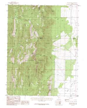
Williams Peak Topo Map Utah
To zoom in, hover over the map of Williams Peak
USGS Topo Quad 39112c2 - 1:24,000 scale
| Topo Map Name: | Williams Peak |
| USGS Topo Quad ID: | 39112c2 |
| Print Size: | ca. 21 1/4" wide x 27" high |
| Southeast Coordinates: | 39.25° N latitude / 112.125° W longitude |
| Map Center Coordinates: | 39.3125° N latitude / 112.1875° W longitude |
| U.S. State: | UT |
| Filename: | o39112c2.jpg |
| Download Map JPG Image: | Williams Peak topo map 1:24,000 scale |
| Map Type: | Topographic |
| Topo Series: | 7.5´ |
| Map Scale: | 1:24,000 |
| Source of Map Images: | United States Geological Survey (USGS) |
| Alternate Map Versions: |
Williams Peak UT 1985, updated 1985 Download PDF Buy paper map Williams Peak UT 2001, updated 2003 Download PDF Buy paper map Williams Peak UT 2011 Download PDF Buy paper map Williams Peak UT 2014 Download PDF Buy paper map |
| FStopo: | US Forest Service topo Williams Peak is available: Download FStopo PDF Download FStopo TIF |
1:24,000 Topo Quads surrounding Williams Peak
> Back to 39112a1 at 1:100,000 scale
> Back to 39112a1 at 1:250,000 scale
> Back to U.S. Topo Maps home
Williams Peak topo map: Gazetteer
Williams Peak: Springs
Fishers Spring elevation 1753m 5751′Quarry Spring elevation 2040m 6692′
Williams Peak: Streams
Little Creek elevation 1962m 6437′Little Oak Creek elevation 1663m 5456′
Williams Peak: Summits
Partridge Mountain elevation 2661m 8730′Williams Peak elevation 2778m 9114′
Williams Peak: Valleys
Bear Hollow elevation 2334m 7657′Bowens Canyon elevation 2053m 6735′
Devil Canyon elevation 2004m 6574′
Hardscrabble Canyon elevation 1963m 6440′
John Williams Canyon elevation 1957m 6420′
Knoll Hollow elevation 2055m 6742′
Little Long Canyon elevation 1842m 6043′
Little Oak Canyon elevation 1862m 6108′
Lyman Canyon elevation 2120m 6955′
North Walker Canyon elevation 1975m 6479′
Ox Hollow elevation 2279m 7477′
Prouse Canyon elevation 2297m 7536′
Radford Canyon elevation 2108m 6916′
Rattlesnake Canyon elevation 2210m 7250′
Rogers Canyon elevation 2171m 7122′
Rough Hollow elevation 2322m 7618′
South Walker Canyon elevation 2018m 6620′
Upper Quaking Asp Canyon elevation 2194m 7198′
Weetches Canyon elevation 1990m 6528′
Yance Canyon elevation 1967m 6453′
Williams Peak digital topo map on disk
Buy this Williams Peak topo map showing relief, roads, GPS coordinates and other geographical features, as a high-resolution digital map file on DVD:


