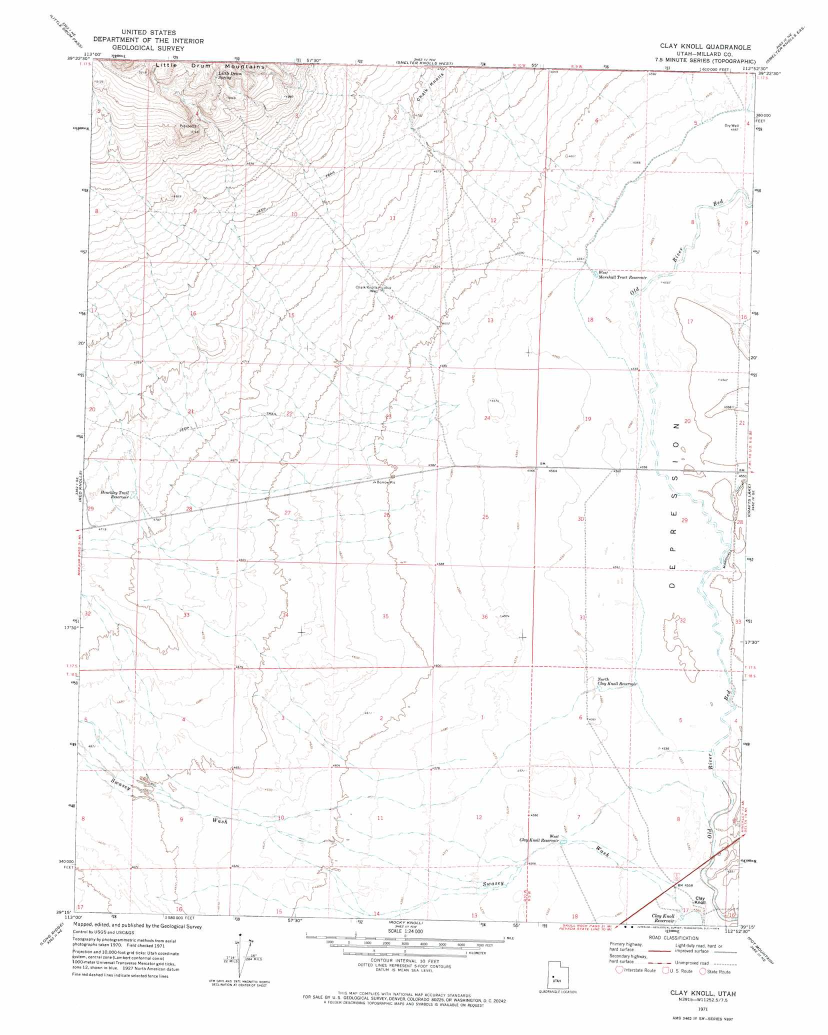
Clay Knoll Topo Map Utah
To zoom in, hover over the map of Clay Knoll
USGS Topo Quad 39112c8 - 1:24,000 scale
| Topo Map Name: | Clay Knoll |
| USGS Topo Quad ID: | 39112c8 |
| Print Size: | ca. 21 1/4" wide x 27" high |
| Southeast Coordinates: | 39.25° N latitude / 112.875° W longitude |
| Map Center Coordinates: | 39.3125° N latitude / 112.9375° W longitude |
| U.S. State: | UT |
| Filename: | o39112c8.jpg |
| Download Map JPG Image: | Clay Knoll topo map 1:24,000 scale |
| Map Type: | Topographic |
| Topo Series: | 7.5´ |
| Map Scale: | 1:24,000 |
| Source of Map Images: | United States Geological Survey (USGS) |
| Alternate Map Versions: |
Clay Knoll UT 1971, updated 1974 Download PDF Buy paper map Clay Knoll UT 2010 Download PDF Buy paper map Clay Knoll UT 2014 Download PDF Buy paper map |
1:24,000 Topo Quads surrounding Clay Knoll
Topaz Mountain Sw |
Lady Laird Peak |
Drum Mountains Well |
Fumarole Butte |
Baker Hot Springs |
Whirlwind Valley Nw |
Little Drum Pass |
Smelter Knolls West |
Smelter Knolls East |
Sutherland |
Whirlwind Valley Sw |
Red Knolls |
Clay Knoll |
Crafts Lake |
Hinckley |
Long Ridge Reservoir |
Long Ridge |
Rocky Knoll |
Pot Mountain |
Sunstone Knoll |
Long Ridge Sw |
Long Ridge Se |
Red Pass |
Neels |
Clear Lake |
> Back to 39112a1 at 1:100,000 scale
> Back to 39112a1 at 1:250,000 scale
> Back to U.S. Topo Maps home
Clay Knoll topo map: Gazetteer
Clay Knoll: Reservoirs
Clay Knoll Reservoir elevation 1389m 4557′Hinckley Trail Reservoir elevation 1439m 4721′
North Clay Knoll Reservoir elevation 1391m 4563′
West Clay Knoll Reservoir elevation 1392m 4566′
West Marshall Tract Reservoir elevation 1390m 4560′
Clay Knoll: Springs
Little Drum Spring elevation 1550m 5085′Clay Knoll: Summits
Chalk Knolls elevation 1449m 4753′Clay Knoll elevation 1395m 4576′
Clay Knoll: Valleys
Swasey Wash elevation 1389m 4557′Clay Knoll: Wells
Chalk Knolls Well elevation 1418m 4652′Clay Knoll digital topo map on disk
Buy this Clay Knoll topo map showing relief, roads, GPS coordinates and other geographical features, as a high-resolution digital map file on DVD: