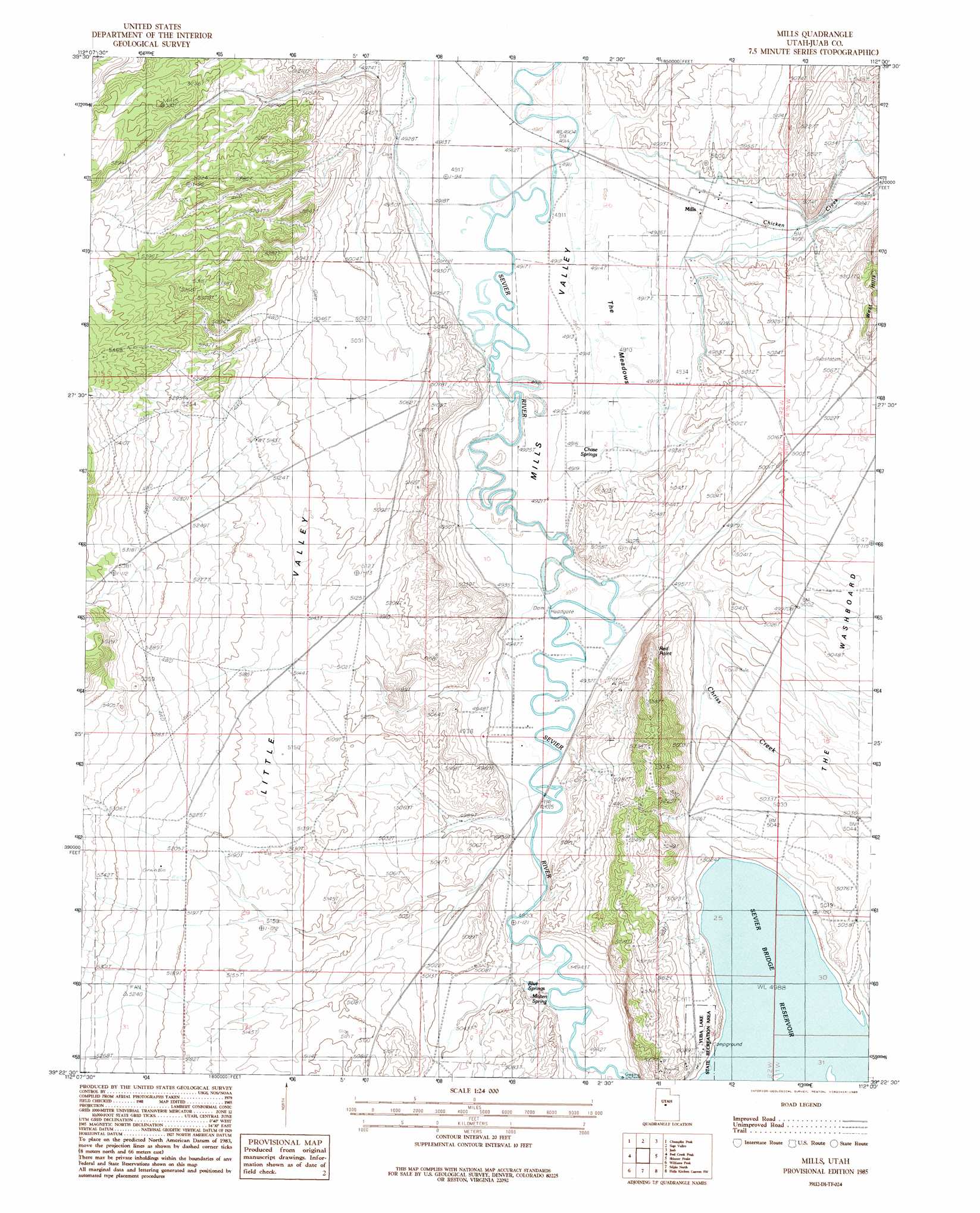
Mills Topo Map Utah
To zoom in, hover over the map of Mills
USGS Topo Quad 39112d1 - 1:24,000 scale
| Topo Map Name: | Mills |
| USGS Topo Quad ID: | 39112d1 |
| Print Size: | ca. 21 1/4" wide x 27" high |
| Southeast Coordinates: | 39.375° N latitude / 112° W longitude |
| Map Center Coordinates: | 39.4375° N latitude / 112.0625° W longitude |
| U.S. State: | UT |
| Filename: | o39112d1.jpg |
| Download Map JPG Image: | Mills topo map 1:24,000 scale |
| Map Type: | Topographic |
| Topo Series: | 7.5´ |
| Map Scale: | 1:24,000 |
| Source of Map Images: | United States Geological Survey (USGS) |
| Alternate Map Versions: |
Mills UT 1985, updated 1985 Download PDF Buy paper map Mills UT 2010 Download PDF Buy paper map Mills UT 2014 Download PDF Buy paper map |
1:24,000 Topo Quads surrounding Mills
Tanner Creek Narrows |
Jericho |
Furner Ridge |
Sugarloaf |
Nephi |
Lynndyl East |
Champlin Peak |
Sage Valley |
Juab |
Levan |
Oak City North |
Fool Creek Peak |
Mills |
Skinner Peaks |
Chriss Canyon |
Oak City South |
Williams Peak |
Scipio North |
Hells Kitchen Canyon Sw |
Hells Kitchen Canyon Se |
Duggins Creek |
Scipio Pass |
Scipio South |
Hayes Canyon |
Gunnison |
> Back to 39112a1 at 1:100,000 scale
> Back to 39112a1 at 1:250,000 scale
> Back to U.S. Topo Maps home
Mills topo map: Gazetteer
Mills: Basins
Little Valley elevation 1567m 5141′Mills Valley elevation 1501m 4924′
Mills: Parks
Mills Meadows Waterfowl Management Area elevation 1497m 4911′Yuba Lake State Recreation Area elevation 1534m 5032′
Mills: Populated Places
Mills elevation 1510m 4954′Red Point elevation 1591m 5219′
Mills: Ridges
Badeau Ridge elevation 1588m 5209′Mills: Springs
Blue Springs elevation 1507m 4944′Chase Springs elevation 1501m 4924′
Molten Spring elevation 1506m 4940′
Mills: Streams
Chicken Creek elevation 1501m 4924′Chriss Creek elevation 1504m 4934′
Mills: Swamps
The Meadows elevation 1498m 4914′Mills digital topo map on disk
Buy this Mills topo map showing relief, roads, GPS coordinates and other geographical features, as a high-resolution digital map file on DVD: