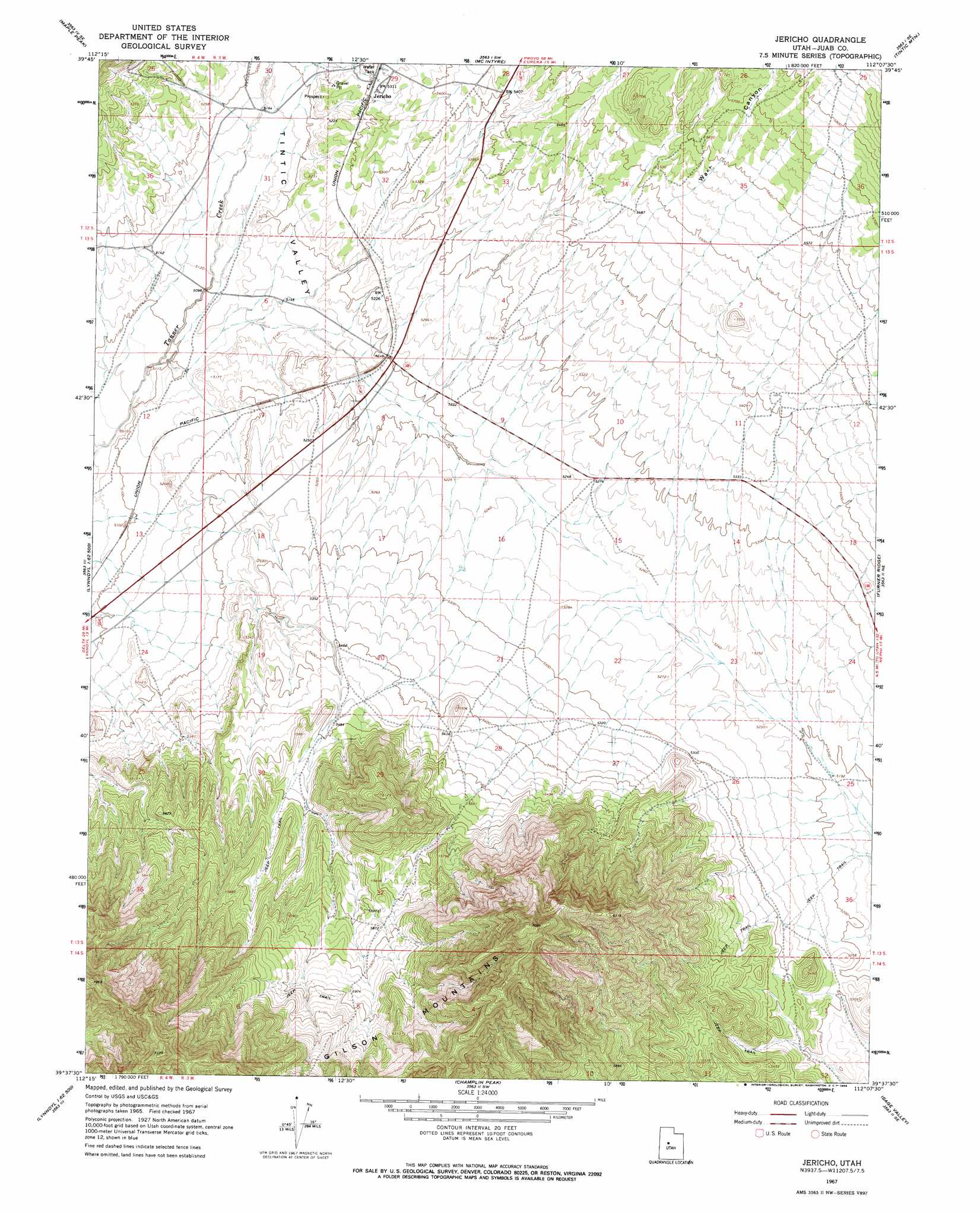
Jericho Topo Map Utah
To zoom in, hover over the map of Jericho
USGS Topo Quad 39112f2 - 1:24,000 scale
| Topo Map Name: | Jericho |
| USGS Topo Quad ID: | 39112f2 |
| Print Size: | ca. 21 1/4" wide x 27" high |
| Southeast Coordinates: | 39.625° N latitude / 112.125° W longitude |
| Map Center Coordinates: | 39.6875° N latitude / 112.1875° W longitude |
| U.S. State: | UT |
| Filename: | o39112f2.jpg |
| Download Map JPG Image: | Jericho topo map 1:24,000 scale |
| Map Type: | Topographic |
| Topo Series: | 7.5´ |
| Map Scale: | 1:24,000 |
| Source of Map Images: | United States Geological Survey (USGS) |
| Alternate Map Versions: |
Jericho UT 1967, updated 1969 Download PDF Buy paper map Jericho UT 2010 Download PDF Buy paper map Jericho UT 2014 Download PDF Buy paper map |
1:24,000 Topo Quads surrounding Jericho
Dutch Peak |
Sabie Mountain |
Tintic Junction |
Eureka |
Goshen |
Cherry Creek |
Maple Peak |
Mcintyre |
Tintic Mountain |
Slate Jack Canyon |
Lynndyl Nw |
Tanner Creek Narrows |
Jericho |
Furner Ridge |
Sugarloaf |
Lynndyl West |
Lynndyl East |
Champlin Peak |
Sage Valley |
Juab |
Strong |
Oak City North |
Fool Creek Peak |
Mills |
Skinner Peaks |
> Back to 39112e1 at 1:100,000 scale
> Back to 39112a1 at 1:250,000 scale
> Back to U.S. Topo Maps home
Jericho topo map: Gazetteer
Jericho: Valleys
Tintic Valley elevation 1581m 5187′Wash Canyon elevation 1688m 5538′
Jericho digital topo map on disk
Buy this Jericho topo map showing relief, roads, GPS coordinates and other geographical features, as a high-resolution digital map file on DVD: