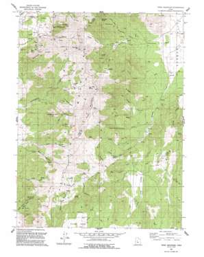
Tintic Mountain Topo Map Utah
To zoom in, hover over the map of Tintic Mountain
USGS Topo Quad 39112g1 - 1:24,000 scale
| Topo Map Name: | Tintic Mountain |
| USGS Topo Quad ID: | 39112g1 |
| Print Size: | ca. 21 1/4" wide x 27" high |
| Southeast Coordinates: | 39.75° N latitude / 112° W longitude |
| Map Center Coordinates: | 39.8125° N latitude / 112.0625° W longitude |
| U.S. State: | UT |
| Filename: | o39112g1.jpg |
| Download Map JPG Image: | Tintic Mountain topo map 1:24,000 scale |
| Map Type: | Topographic |
| Topo Series: | 7.5´ |
| Map Scale: | 1:24,000 |
| Source of Map Images: | United States Geological Survey (USGS) |
| Alternate Map Versions: |
Tintic Mountain UT 1954, updated 1956 Download PDF Buy paper map Tintic Mountain UT 1954, updated 1958 Download PDF Buy paper map Tintic Mountain UT 1954, updated 1984 Download PDF Buy paper map Tintic Mountain UT 1992, updated 1992 Download PDF Buy paper map Tintic Mountain UT 2010 Download PDF Buy paper map Tintic Mountain UT 2014 Download PDF Buy paper map |
1:24,000 Topo Quads surrounding Tintic Mountain
> Back to 39112e1 at 1:100,000 scale
> Back to 39112a1 at 1:250,000 scale
> Back to U.S. Topo Maps home
Tintic Mountain topo map: Gazetteer
Tintic Mountain: Basins
The Headwaters elevation 2064m 6771′Tintic Mountain: Lakes
Andys Pond elevation 1918m 6292′Tintic Mountain: Mines
Buckeye Mine elevation 2084m 6837′Evelyn Mine elevation 2063m 6768′
Old Susan Mine elevation 1927m 6322′
Rising Sun Mine elevation 2255m 7398′
Tintic Chief Mine elevation 1940m 6364′
Tintic Mountain: Populated Places
Dennis elevation 2090m 6856′Tintic Mountain: Ridges
Dry Ridge elevation 2074m 6804′Volcano Ridge elevation 2148m 7047′
Tintic Mountain: Slopes
The Devils Steps elevation 1810m 5938′Tintic Mountain: Springs
Bens Spring elevation 2173m 7129′Bottlegger Spring elevation 1932m 6338′
Horse Spring elevation 1839m 6033′
Jack Spring elevation 1951m 6400′
Jims Spring elevation 2172m 7125′
Jumpoff Spring elevation 1956m 6417′
Kessler Spring elevation 1982m 6502′
Keystone Springs elevation 1958m 6423′
Maple Spring elevation 2097m 6879′
Mud Springs elevation 2143m 7030′
Nettle Spring elevation 2029m 6656′
Riley Springs elevation 1934m 6345′
Young Spring elevation 1904m 6246′
Tintic Mountain: Summits
Buckhorn Mountain elevation 2396m 7860′Horseshoe Hill elevation 1904m 6246′
Rattlesnake Peak elevation 2181m 7155′
Sunrise Peak elevation 2343m 7687′
Tintic Mountain elevation 2495m 8185′
Tintic Mountain: Valleys
Big Dog Canyon elevation 1758m 5767′Birch Canyon elevation 1874m 6148′
Broad Hollow elevation 1885m 6184′
Burnt Hollow elevation 1879m 6164′
Deer Cove elevation 1999m 6558′
Dry Ridge Canyon elevation 1686m 5531′
Furner Canyon elevation 1907m 6256′
Garbett Gulch elevation 1729m 5672′
Government Canyon elevation 1609m 5278′
Left Hand Fork Government Canyon elevation 1685m 5528′
Little Dog Canyon elevation 1794m 5885′
Little Dog Valley elevation 1894m 6213′
Little Valley elevation 1902m 6240′
Little Valley Canyon elevation 1689m 5541′
Right Hand Fork Government Canyon elevation 1677m 5501′
Road Canyon elevation 1873m 6145′
Sunrise Canyon elevation 1939m 6361′
Whitmore Canyon elevation 1910m 6266′
Young Canyon elevation 1659m 5442′
Tintic Mountain: Woods
Paul Bunyans Woodpile elevation 2063m 6768′Tintic Mountain digital topo map on disk
Buy this Tintic Mountain topo map showing relief, roads, GPS coordinates and other geographical features, as a high-resolution digital map file on DVD:


