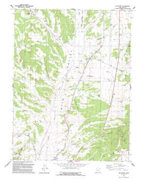
Mcintyre Topo Map Utah
To zoom in, hover over the map of Mcintyre
USGS Topo Quad 39112g2 - 1:24,000 scale
| Topo Map Name: | Mcintyre |
| USGS Topo Quad ID: | 39112g2 |
| Print Size: | ca. 21 1/4" wide x 27" high |
| Southeast Coordinates: | 39.75° N latitude / 112.125° W longitude |
| Map Center Coordinates: | 39.8125° N latitude / 112.1875° W longitude |
| U.S. State: | UT |
| Filename: | o39112g2.jpg |
| Download Map JPG Image: | Mcintyre topo map 1:24,000 scale |
| Map Type: | Topographic |
| Topo Series: | 7.5´ |
| Map Scale: | 1:24,000 |
| Source of Map Images: | United States Geological Survey (USGS) |
| Alternate Map Versions: |
Mc Intyre UT 1954, updated 1955 Download PDF Buy paper map Mc Intyre UT 1954, updated 1955 Download PDF Buy paper map Mc Intyre UT 1954, updated 1980 Download PDF Buy paper map Mc Intyre UT 1992, updated 1992 Download PDF Buy paper map McIntyre UT 2010 Download PDF Buy paper map McIntyre UT 2014 Download PDF Buy paper map |
1:24,000 Topo Quads surrounding Mcintyre
> Back to 39112e1 at 1:100,000 scale
> Back to 39112a1 at 1:250,000 scale
> Back to U.S. Topo Maps home
Mcintyre topo map: Gazetteer
Mcintyre: Populated Places
Jericho elevation 1621m 5318′McIntyre elevation 1700m 5577′
Mcintyre: Springs
Mud Springs elevation 1757m 5764′Railroad Springs elevation 1683m 5521′
Mcintyre: Streams
Chambers Wash elevation 1593m 5226′Copperopolis Creek elevation 1661m 5449′
Death Creek elevation 1659m 5442′
Devil Creek elevation 1744m 5721′
Eureka Creek elevation 1682m 5518′
Hop Creek elevation 1596m 5236′
Mcintyre: Valleys
Diamond Gulch elevation 1681m 5515′Riley Canyon elevation 1868m 6128′
Mcintyre: Wells
No Name Well elevation 1637m 5370′Mcintyre digital topo map on disk
Buy this Mcintyre topo map showing relief, roads, GPS coordinates and other geographical features, as a high-resolution digital map file on DVD:


