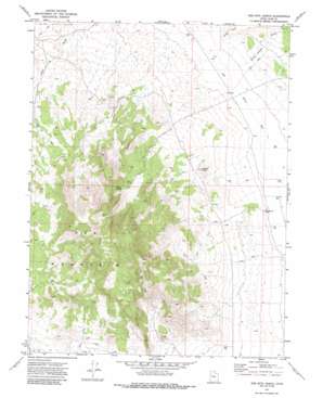
Keg Mountain Ranch Topo Map Utah
To zoom in, hover over the map of Keg Mountain Ranch
USGS Topo Quad 39112g7 - 1:24,000 scale
| Topo Map Name: | Keg Mountain Ranch |
| USGS Topo Quad ID: | 39112g7 |
| Print Size: | ca. 21 1/4" wide x 27" high |
| Southeast Coordinates: | 39.75° N latitude / 112.75° W longitude |
| Map Center Coordinates: | 39.8125° N latitude / 112.8125° W longitude |
| U.S. State: | UT |
| Filename: | o39112g7.jpg |
| Download Map JPG Image: | Keg Mountain Ranch topo map 1:24,000 scale |
| Map Type: | Topographic |
| Topo Series: | 7.5´ |
| Map Scale: | 1:24,000 |
| Source of Map Images: | United States Geological Survey (USGS) |
| Alternate Map Versions: |
Keg Mtn Ranch UT 1971, updated 1974 Download PDF Buy paper map Keg Mtn Ranch UT 1971, updated 1986 Download PDF Buy paper map Keg Mountain Ranch UT 2010 Download PDF Buy paper map Keg Mountain Ranch UT 2014 Download PDF Buy paper map |
1:24,000 Topo Quads surrounding Keg Mountain Ranch
> Back to 39112e1 at 1:100,000 scale
> Back to 39112a1 at 1:250,000 scale
> Back to U.S. Topo Maps home
Keg Mountain Ranch topo map: Gazetteer
Keg Mountain Ranch: Springs
Keg Spring elevation 1825m 5987′Willow Spring elevation 1779m 5836′
Keg Mountain Ranch: Streams
Judd Creek elevation 1402m 4599′Keg Mountain Ranch: Summits
Harvey Knoll elevation 1585m 5200′Keg Mountain elevation 2224m 7296′
Keg Mountain Ranch: Valleys
Death Canyon Wash elevation 1405m 4609′Keg Mountain Ranch digital topo map on disk
Buy this Keg Mountain Ranch topo map showing relief, roads, GPS coordinates and other geographical features, as a high-resolution digital map file on DVD:


