Keg Pass Topo Map Utah
To zoom in, hover over the map of Keg Pass
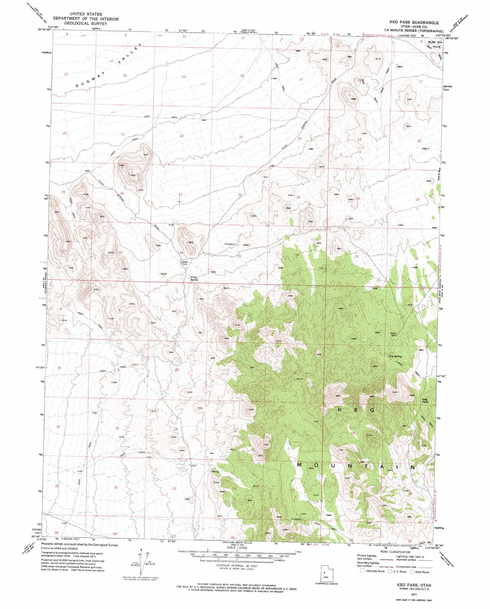
USGS Topo Quad 39112g8 - 1:24,000 scale
| Topo Map Name: | Keg Pass |
| USGS Topo Quad ID: | 39112g8 |
| Print Size: | ca. 21 1/4" wide x 27" high |
| Southeast Coordinates: | 39.75° N latitude / 112.875° W longitude |
| Map Center Coordinates: | 39.8125° N latitude / 112.9375° W longitude |
| U.S. State: | UT |
| Filename: | o39112g8.jpg |
| Download Map JPG Image: | Keg Pass topo map 1:24,000 scale |
| Map Type: | Topographic |
| Topo Series: | 7.5´ |
| Map Scale: | 1:24,000 |
| Source of Map Images: | United States Geological Survey (USGS) |
| Alternate Map Versions: |
Keg Mtn Pass UT 1971, updated 1974 Download PDF Buy paper map Keg Pass UT 2010 Download PDF Buy paper map Keg Pass UT 2014 Download PDF Buy paper map |
1:24,000 Topo Quads surrounding Keg Pass
Dugway Proving Ground Sw |
Dugway Proving Ground Se |
Camels Back Ridge Sw |
Simpson Springs |
Indian Peaks |
Dugway Range Nw |
Dugway Range Ne |
Table Mountain |
Coyote Springs |
Indian Springs |
Dugway Range Sw |
Dugway Pass |
Keg Pass |
Keg Mountain Ranch |
Erickson Wash Sw |
Topaz Mountain West |
Topaz Mountain East |
Picture Rock Hills |
The Hogback |
Crater Bench Reservoir |
Topaz Mountain Sw |
Lady Laird Peak |
Drum Mountains Well |
Fumarole Butte |
Baker Hot Springs |
> Back to 39112e1 at 1:100,000 scale
> Back to 39112a1 at 1:250,000 scale
> Back to U.S. Topo Maps home
Keg Pass topo map: Gazetteer
Keg Pass: Gaps
Keg Pass elevation 1809m 5935′Keg Pass: Springs
Flint Spring elevation 1601m 5252′Keg Spring elevation 1768m 5800′
Keg Pass: Valleys
Slow Elk Wash elevation 1502m 4927′Keg Pass digital topo map on disk
Buy this Keg Pass topo map showing relief, roads, GPS coordinates and other geographical features, as a high-resolution digital map file on DVD: