Table Mountain Topo Map Utah
To zoom in, hover over the map of Table Mountain
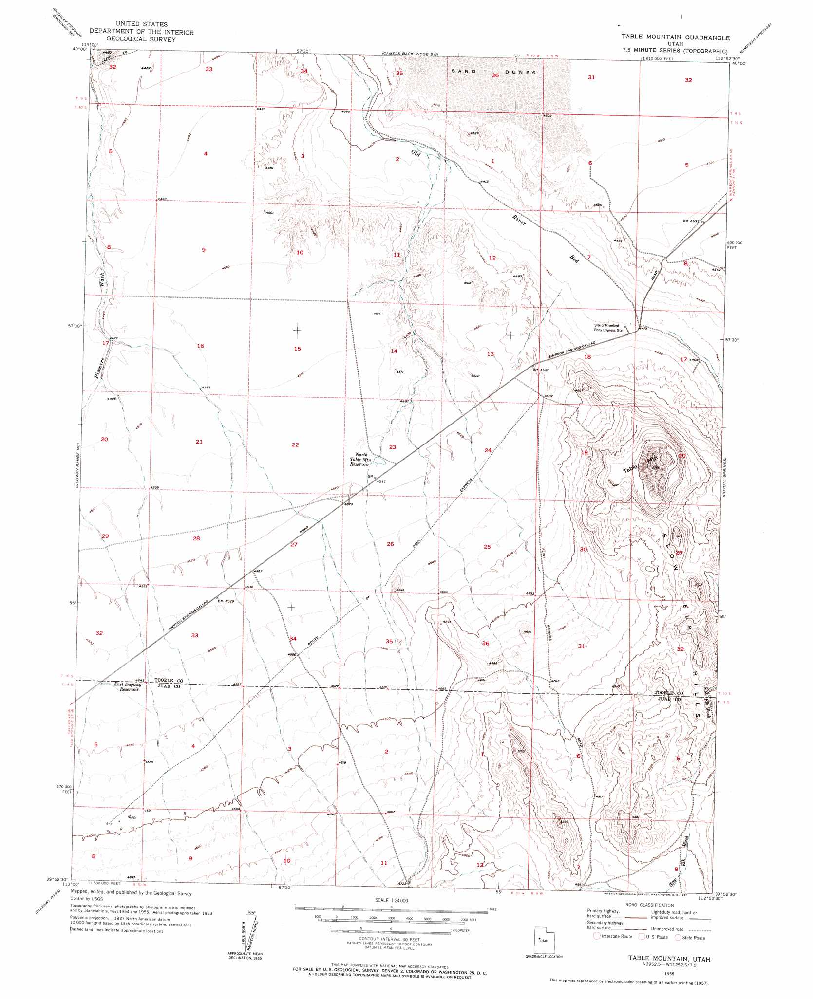
USGS Topo Quad 39112h8 - 1:24,000 scale
| Topo Map Name: | Table Mountain |
| USGS Topo Quad ID: | 39112h8 |
| Print Size: | ca. 21 1/4" wide x 27" high |
| Southeast Coordinates: | 39.875° N latitude / 112.875° W longitude |
| Map Center Coordinates: | 39.9375° N latitude / 112.9375° W longitude |
| U.S. State: | UT |
| Filename: | o39112h8.jpg |
| Download Map JPG Image: | Table Mountain topo map 1:24,000 scale |
| Map Type: | Topographic |
| Topo Series: | 7.5´ |
| Map Scale: | 1:24,000 |
| Source of Map Images: | United States Geological Survey (USGS) |
| Alternate Map Versions: |
Table Mountain UT 1955, updated 1957 Download PDF Buy paper map Table Mountain UT 1955, updated 1957 Download PDF Buy paper map Table Mountain UT 2010 Download PDF Buy paper map Table Mountain UT 2014 Download PDF Buy paper map |
1:24,000 Topo Quads surrounding Table Mountain
Dugway Proving Ground Nw |
Dugway Proving Ground Ne |
Camels Back Ridge Nw |
Camels Back Ridge Ne |
Davis Knolls |
Dugway Proving Ground Sw |
Dugway Proving Ground Se |
Camels Back Ridge Sw |
Simpson Springs |
Indian Peaks |
Dugway Range Nw |
Dugway Range Ne |
Table Mountain |
Coyote Springs |
Indian Springs |
Dugway Range Sw |
Dugway Pass |
Keg Pass |
Keg Mountain Ranch |
Erickson Wash Sw |
Topaz Mountain West |
Topaz Mountain East |
Picture Rock Hills |
The Hogback |
Crater Bench Reservoir |
> Back to 39112e1 at 1:100,000 scale
> Back to 39112a1 at 1:250,000 scale
> Back to U.S. Topo Maps home
Table Mountain topo map: Gazetteer
Table Mountain: Cliffs
White Marl Bluff elevation 1366m 4481′Table Mountain: Reservoirs
East Dugway Reservoir elevation 1385m 4543′North Table Mountain Reservoir elevation 1376m 4514′
Table Mountain: Summits
Table Mountain elevation 1759m 5770′Table Mountain digital topo map on disk
Buy this Table Mountain topo map showing relief, roads, GPS coordinates and other geographical features, as a high-resolution digital map file on DVD: