Skull Rock Pass Topo Map Utah
To zoom in, hover over the map of Skull Rock Pass
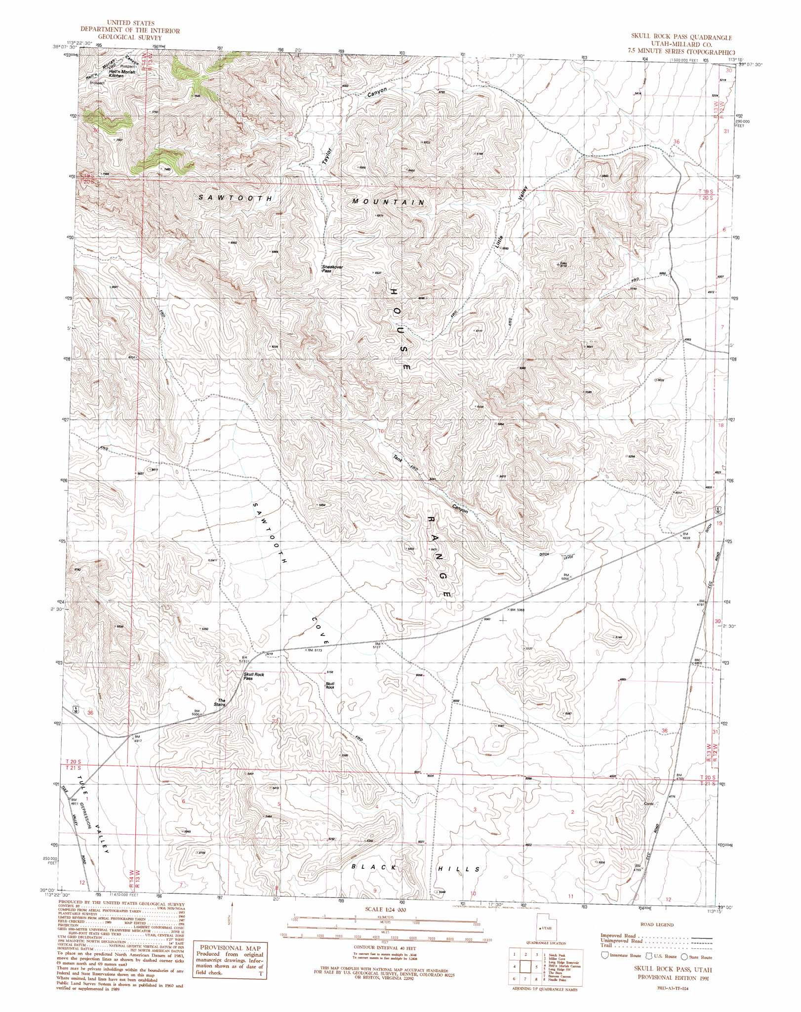
USGS Topo Quad 39113a3 - 1:24,000 scale
| Topo Map Name: | Skull Rock Pass |
| USGS Topo Quad ID: | 39113a3 |
| Print Size: | ca. 21 1/4" wide x 27" high |
| Southeast Coordinates: | 39° N latitude / 113.25° W longitude |
| Map Center Coordinates: | 39.0625° N latitude / 113.3125° W longitude |
| U.S. State: | UT |
| Filename: | o39113a3.jpg |
| Download Map JPG Image: | Skull Rock Pass topo map 1:24,000 scale |
| Map Type: | Topographic |
| Topo Series: | 7.5´ |
| Map Scale: | 1:24,000 |
| Source of Map Images: | United States Geological Survey (USGS) |
| Alternate Map Versions: |
Skull Rock Pass UT 1991, updated 1991 Download PDF Buy paper map Skull Rock Pass UT 2011 Download PDF Buy paper map Skull Rock Pass UT 2014 Download PDF Buy paper map |
1:24,000 Topo Quads surrounding Skull Rock Pass
Chalk Knolls |
Swasey Peak Sw |
Marjum Pass |
Whirlwind Valley Sw |
Red Knolls |
Dowdell Canyon |
Notch Peak |
Miller Cove |
Long Ridge Reservoir |
Long Ridge |
Bullgrass Knoll |
Hell'N Maria Canyon |
Skull Rock Pass |
Long Ridge Sw |
Long Ridge Se |
King Top |
The Barn |
Burnout Canyon |
Needle Point |
Sevier Lake Ne |
Crystal Peak |
Warm Point |
Red Tops |
Sevier Lake Sw |
Headlight Mountain |
> Back to 39113a1 at 1:100,000 scale
> Back to 39112a1 at 1:250,000 scale
> Back to U.S. Topo Maps home
Skull Rock Pass topo map: Gazetteer
Skull Rock Pass: Gaps
Skull Rock Pass elevation 1597m 5239′Sneakover Pass elevation 1925m 6315′
Skull Rock Pass: Pillars
Skull Rock elevation 1576m 5170′Skull Rock Pass: Slopes
The Stairs elevation 1549m 5082′Skull Rock Pass: Valleys
Little Valley elevation 1677m 5501′Sawtooth Cove elevation 1560m 5118′
Tank Canyon elevation 1567m 5141′
Taylor Canyon elevation 1758m 5767′
Skull Rock Pass digital topo map on disk
Buy this Skull Rock Pass topo map showing relief, roads, GPS coordinates and other geographical features, as a high-resolution digital map file on DVD: