Gandy Topo Map Utah
To zoom in, hover over the map of Gandy
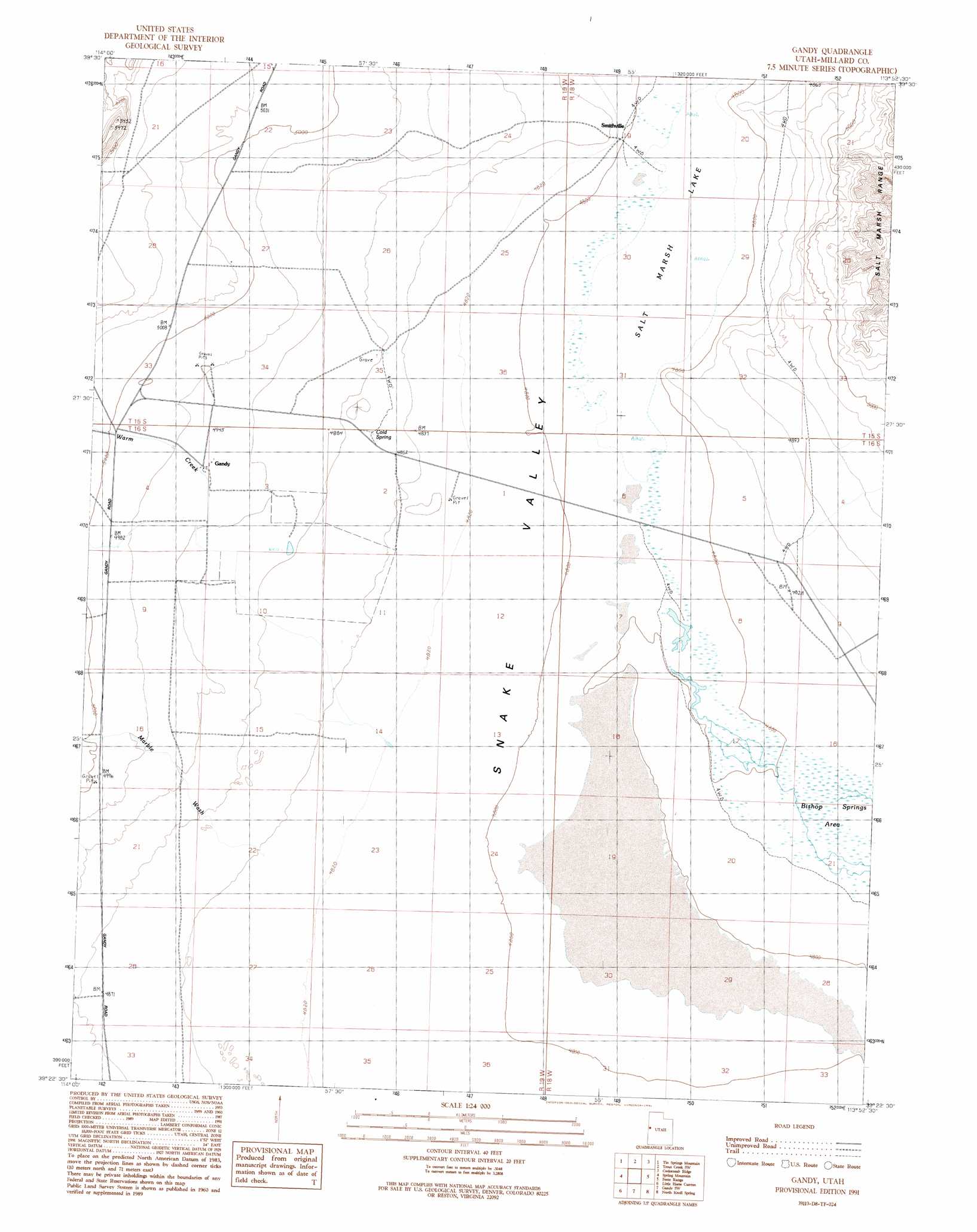
USGS Topo Quad 39113d8 - 1:24,000 scale
| Topo Map Name: | Gandy |
| USGS Topo Quad ID: | 39113d8 |
| Print Size: | ca. 21 1/4" wide x 27" high |
| Southeast Coordinates: | 39.375° N latitude / 113.875° W longitude |
| Map Center Coordinates: | 39.4375° N latitude / 113.9375° W longitude |
| U.S. State: | UT |
| Filename: | o39113d8.jpg |
| Download Map JPG Image: | Gandy topo map 1:24,000 scale |
| Map Type: | Topographic |
| Topo Series: | 7.5´ |
| Map Scale: | 1:24,000 |
| Source of Map Images: | United States Geological Survey (USGS) |
| Alternate Map Versions: |
Gandy UT 1991, updated 1991 Download PDF Buy paper map Gandy UT 2010 Download PDF Buy paper map Gandy UT 2014 Download PDF Buy paper map |
1:24,000 Topo Quads surrounding Gandy
Blue Mass Canyon |
Skinner Canyon |
Partoun |
Trout Creek |
Hole-In-The-Wall Reservoir |
Government Peak |
Tin Springs Mountain |
Trout Creek Sw |
Cockscomb Ridge |
Granite Mountain |
Mormon Jack Pass |
Spring Mountain |
Gandy |
Foote Range |
Big Horseshoe |
Mount Moriah |
Little Horse Canyon |
Gandy Sw |
North Knoll Spring |
Cowboy Pass |
Old Mans Canyon |
The Cove |
Hole In The Ground |
Knoll Hill |
Conger Mountain |
> Back to 39113a1 at 1:100,000 scale
> Back to 39112a1 at 1:250,000 scale
> Back to U.S. Topo Maps home
Gandy topo map: Gazetteer
Gandy: Lakes
Salt Marsh Lake elevation 1461m 4793′Gandy: Populated Places
Gandy elevation 1509m 4950′Gandy: Springs
Cold Spring elevation 1482m 4862′Gandy: Streams
Swan Creek elevation 1511m 4957′Warm Creek elevation 1509m 4950′
Gandy: Valleys
Marble Wash elevation 1476m 4842′Gandy digital topo map on disk
Buy this Gandy topo map showing relief, roads, GPS coordinates and other geographical features, as a high-resolution digital map file on DVD: