Trout Creek Sw Topo Map Utah
To zoom in, hover over the map of Trout Creek Sw
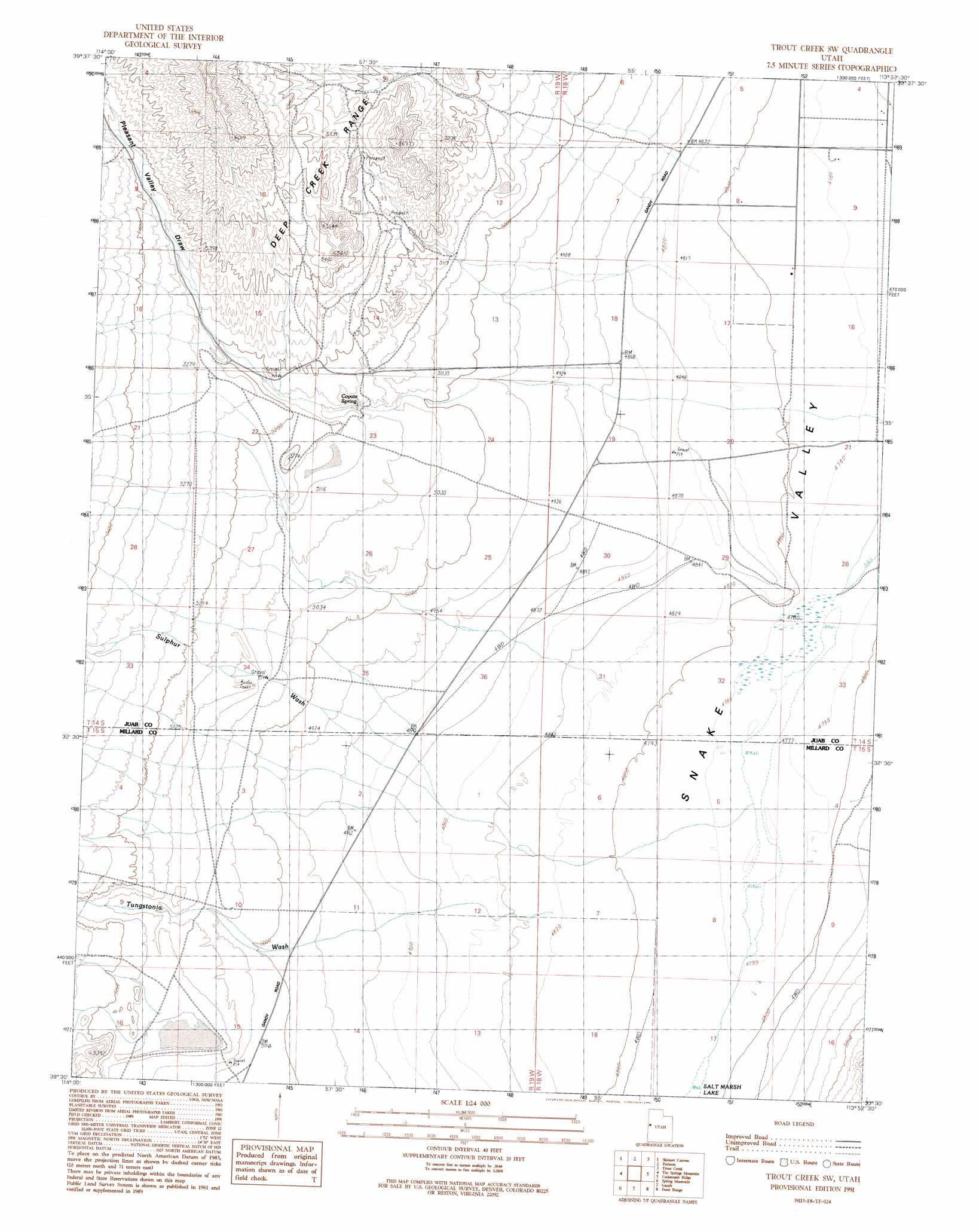
USGS Topo Quad 39113e8 - 1:24,000 scale
| Topo Map Name: | Trout Creek Sw |
| USGS Topo Quad ID: | 39113e8 |
| Print Size: | ca. 21 1/4" wide x 27" high |
| Southeast Coordinates: | 39.5° N latitude / 113.875° W longitude |
| Map Center Coordinates: | 39.5625° N latitude / 113.9375° W longitude |
| U.S. State: | UT |
| Filename: | o39113e8.jpg |
| Download Map JPG Image: | Trout Creek Sw topo map 1:24,000 scale |
| Map Type: | Topographic |
| Topo Series: | 7.5´ |
| Map Scale: | 1:24,000 |
| Source of Map Images: | United States Geological Survey (USGS) |
| Alternate Map Versions: |
Trout Creek SW UT 1991, updated 1991 Download PDF Buy paper map Trout Creek SW UT 2011 Download PDF Buy paper map Trout Creek SW UT 2014 Download PDF Buy paper map |
1:24,000 Topo Quads surrounding Trout Creek Sw
Tippett Canyon |
Weaver Canyon |
Ibapah Peak |
Indian Farm Creek |
Mud Lake Reservoir |
Blue Mass Canyon |
Skinner Canyon |
Partoun |
Trout Creek |
Hole-In-The-Wall Reservoir |
Government Peak |
Tin Springs Mountain |
Trout Creek Sw |
Cockscomb Ridge |
Granite Mountain |
Mormon Jack Pass |
Spring Mountain |
Gandy |
Foote Range |
Big Horseshoe |
Mount Moriah |
Little Horse Canyon |
Gandy Sw |
North Knoll Spring |
Cowboy Pass |
> Back to 39113e1 at 1:100,000 scale
> Back to 39112a1 at 1:250,000 scale
> Back to U.S. Topo Maps home
Trout Creek Sw topo map: Gazetteer
Trout Creek Sw: Springs
Coyote Spring elevation 1551m 5088′Trout Creek Sw: Valleys
Pleasant Valley elevation 1597m 5239′Pleasant Valley Draw elevation 1571m 5154′
Sulphur Wash elevation 1491m 4891′
Tungstonia Wash elevation 1481m 4858′
Trout Creek Sw digital topo map on disk
Buy this Trout Creek Sw topo map showing relief, roads, GPS coordinates and other geographical features, as a high-resolution digital map file on DVD: