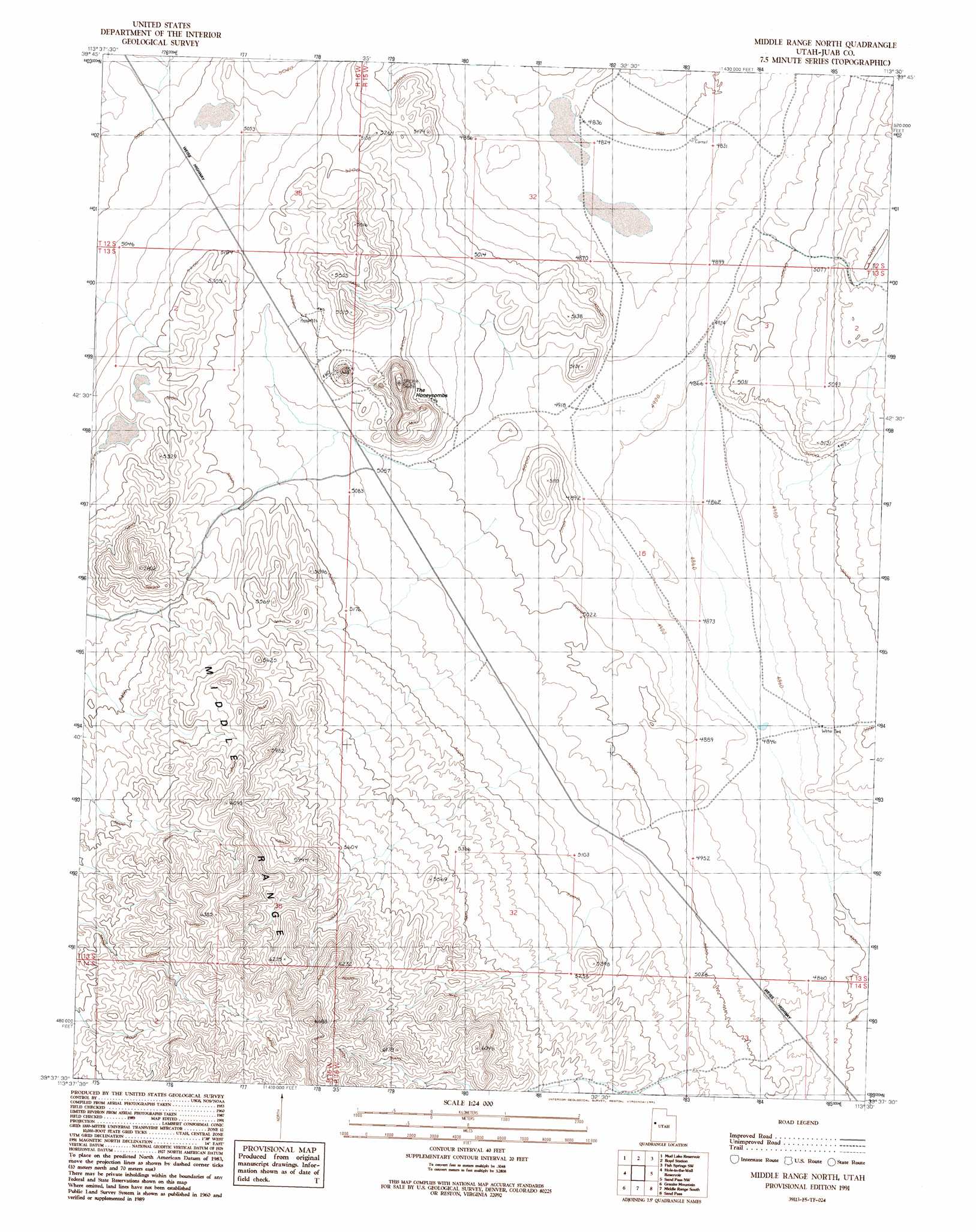
Middle Range North Topo Map Utah
To zoom in, hover over the map of Middle Range North
USGS Topo Quad 39113f5 - 1:24,000 scale
| Topo Map Name: | Middle Range North |
| USGS Topo Quad ID: | 39113f5 |
| Print Size: | ca. 21 1/4" wide x 27" high |
| Southeast Coordinates: | 39.625° N latitude / 113.5° W longitude |
| Map Center Coordinates: | 39.6875° N latitude / 113.5625° W longitude |
| U.S. State: | UT |
| Filename: | o39113f5.jpg |
| Download Map JPG Image: | Middle Range North topo map 1:24,000 scale |
| Map Type: | Topographic |
| Topo Series: | 7.5´ |
| Map Scale: | 1:24,000 |
| Source of Map Images: | United States Geological Survey (USGS) |
| Alternate Map Versions: |
Middle Range North UT 1991, updated 1991 Download PDF Buy paper map Middle Range North UT 2010 Download PDF Buy paper map Middle Range North UT 2014 Download PDF Buy paper map |
1:24,000 Topo Quads surrounding Middle Range North
Goshute Canyon |
Callao |
Callao Ne |
Fish Springs Nw |
Fish Springs Ne |
Indian Farm Creek |
Mud Lake Reservoir |
Boyd Station |
Fish Springs Sw |
Fish Springs Se |
Trout Creek |
Hole-In-The-Wall Reservoir |
Middle Range North |
Sand Pass Nw |
Sand Pass Ne |
Cockscomb Ridge |
Granite Mountain |
Middle Range South |
Sand Pass |
Sand Pass Se |
Foote Range |
Big Horseshoe |
Coyote Knolls |
Swasey Peak Nw |
Swasey Peak |
> Back to 39113e1 at 1:100,000 scale
> Back to 39112a1 at 1:250,000 scale
> Back to U.S. Topo Maps home
Middle Range North topo map: Gazetteer
Middle Range North: Ranges
Middle Range elevation 1917m 6289′Middle Range North: Summits
The Honeycombs elevation 1621m 5318′Middle Range North digital topo map on disk
Buy this Middle Range North topo map showing relief, roads, GPS coordinates and other geographical features, as a high-resolution digital map file on DVD: