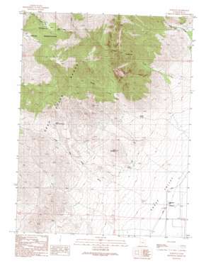
Partoun Topo Map Utah
To zoom in, hover over the map of Partoun
USGS Topo Quad 39113f8 - 1:24,000 scale
| Topo Map Name: | Partoun |
| USGS Topo Quad ID: | 39113f8 |
| Print Size: | ca. 21 1/4" wide x 27" high |
| Southeast Coordinates: | 39.625° N latitude / 113.875° W longitude |
| Map Center Coordinates: | 39.6875° N latitude / 113.9375° W longitude |
| U.S. State: | UT |
| Filename: | o39113f8.jpg |
| Download Map JPG Image: | Partoun topo map 1:24,000 scale |
| Map Type: | Topographic |
| Topo Series: | 7.5´ |
| Map Scale: | 1:24,000 |
| Source of Map Images: | United States Geological Survey (USGS) |
| Alternate Map Versions: |
Partoun UT 1991, updated 1991 Download PDF Buy paper map Partoun UT 2011 Download PDF Buy paper map Partoun UT 2014 Download PDF Buy paper map |
1:24,000 Topo Quads surrounding Partoun
> Back to 39113e1 at 1:100,000 scale
> Back to 39112a1 at 1:250,000 scale
> Back to U.S. Topo Maps home
Partoun topo map: Gazetteer
Partoun: Guts
The Narrows elevation 2169m 7116′Partoun: Populated Places
Partoun elevation 1463m 4799′Partoun: Springs
Blue Spring elevation 2705m 8874′Lime Spring elevation 1602m 5255′
Little Red Cedar Spring elevation 1976m 6482′
Trough Spring elevation 1746m 5728′
Partoun: Streams
North Fork Birch Creek elevation 2536m 8320′South Fork Johnson Creek elevation 2506m 8221′
West Fork Birch Creek elevation 2545m 8349′
Partoun: Summits
Lime Mountain elevation 1829m 6000′Partoun: Valleys
Little Red Cedar Wash elevation 1485m 4872′Little Valley Wash elevation 1939m 6361′
Wood Canyon elevation 1820m 5971′
Partoun digital topo map on disk
Buy this Partoun topo map showing relief, roads, GPS coordinates and other geographical features, as a high-resolution digital map file on DVD:


