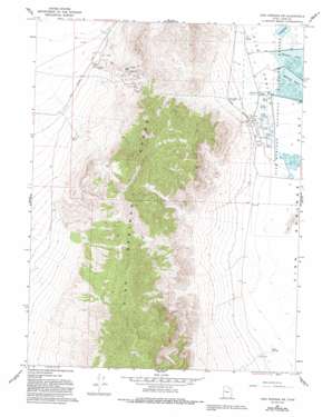
Fish Springs Sw Topo Map Utah
To zoom in, hover over the map of Fish Springs Sw
USGS Topo Quad 39113g4 - 1:24,000 scale
| Topo Map Name: | Fish Springs Sw |
| USGS Topo Quad ID: | 39113g4 |
| Print Size: | ca. 21 1/4" wide x 27" high |
| Southeast Coordinates: | 39.75° N latitude / 113.375° W longitude |
| Map Center Coordinates: | 39.8125° N latitude / 113.4375° W longitude |
| U.S. State: | UT |
| Filename: | o39113g4.jpg |
| Download Map JPG Image: | Fish Springs Sw topo map 1:24,000 scale |
| Map Type: | Topographic |
| Topo Series: | 7.5´ |
| Map Scale: | 1:24,000 |
| Source of Map Images: | United States Geological Survey (USGS) |
| Alternate Map Versions: |
Fish Springs SW UT 1967, updated 1971 Download PDF Buy paper map Fish Springs SW UT 1967, updated 1979 Download PDF Buy paper map Fish Springs SW UT 1967, updated 1993 Download PDF Buy paper map Fish Springs SW UT 2011 Download PDF Buy paper map Fish Springs SW UT 2014 Download PDF Buy paper map |
1:24,000 Topo Quads surrounding Fish Springs Sw
> Back to 39113e1 at 1:100,000 scale
> Back to 39112a1 at 1:250,000 scale
> Back to U.S. Topo Maps home
Fish Springs Sw topo map: Gazetteer
Fish Springs Sw: Mines
Cactus Mine elevation 1396m 4580′Early Harvest Shaft elevation 1397m 4583′
Emma Mine elevation 1515m 4970′
Galena Mine elevation 1560m 5118′
Joseph Adit elevation 1341m 4399′
Utah Mine elevation 1564m 5131′
Vulcan Mine elevation 1530m 5019′
Wilson Mine elevation 1540m 5052′
Fish Springs Sw: Parks
Pony Express Monument elevation 1370m 4494′Fish Springs Sw: Reservoirs
Mallard Pool elevation 1312m 4304′Shoveler Pool elevation 1311m 4301′
Fish Springs Sw: Springs
Cane Springs elevation 1322m 4337′Crater Spring elevation 1312m 4304′
Fish Springs elevation 1313m 4307′
House Springs elevation 1317m 4320′
Lost Spring elevation 1314m 4311′
Middle Spring elevation 1316m 4317′
Mirror Spring elevation 1316m 4317′
Percy Spring elevation 1315m 4314′
South Springs elevation 1313m 4307′
Thomas Springs elevation 1316m 4317′
Walter Spring elevation 1315m 4314′
Fish Springs Sw digital topo map on disk
Buy this Fish Springs Sw topo map showing relief, roads, GPS coordinates and other geographical features, as a high-resolution digital map file on DVD:


