Indian Farm Creek Topo Map Utah
To zoom in, hover over the map of Indian Farm Creek
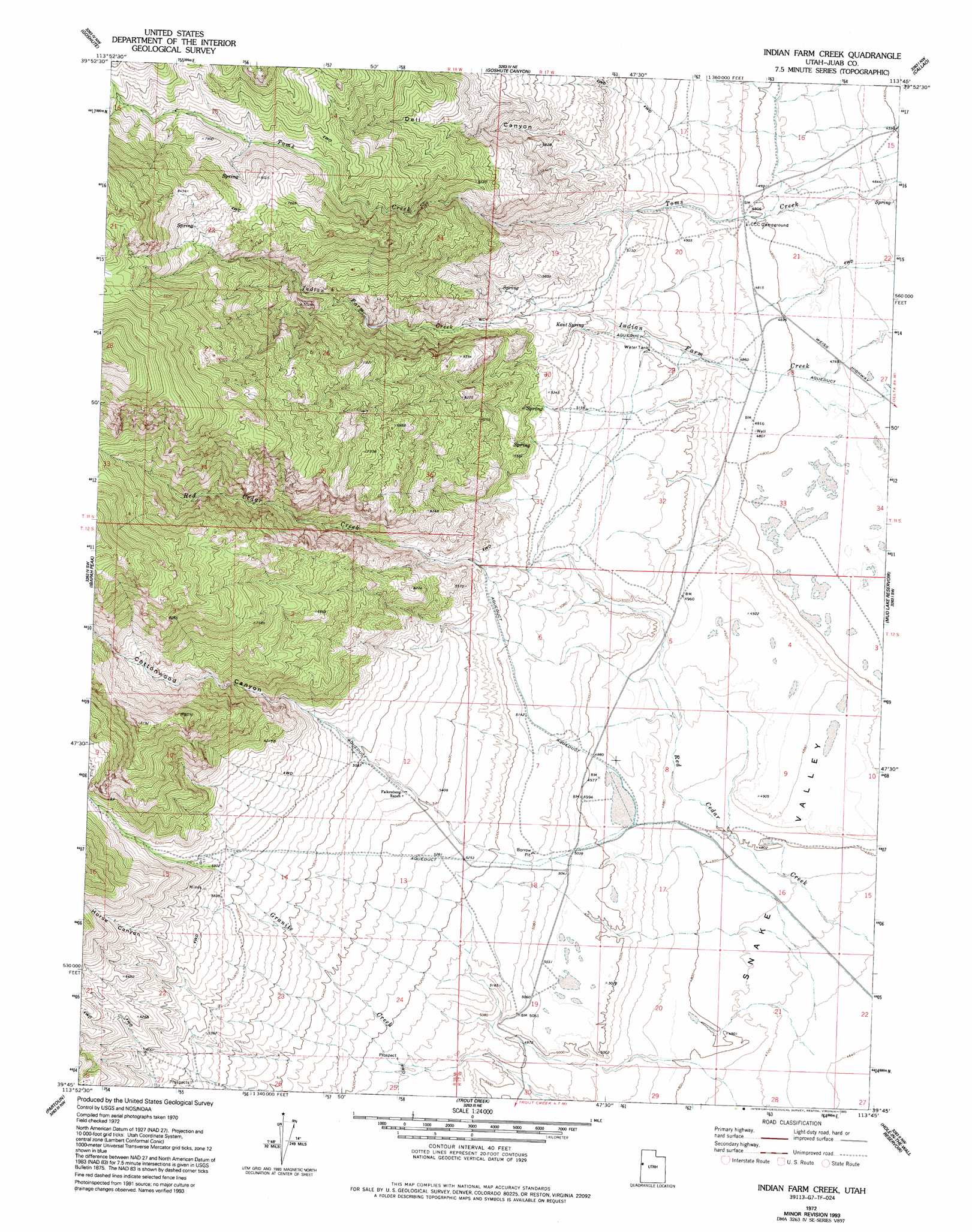
USGS Topo Quad 39113g7 - 1:24,000 scale
| Topo Map Name: | Indian Farm Creek |
| USGS Topo Quad ID: | 39113g7 |
| Print Size: | ca. 21 1/4" wide x 27" high |
| Southeast Coordinates: | 39.75° N latitude / 113.75° W longitude |
| Map Center Coordinates: | 39.8125° N latitude / 113.8125° W longitude |
| U.S. State: | UT |
| Filename: | o39113g7.jpg |
| Download Map JPG Image: | Indian Farm Creek topo map 1:24,000 scale |
| Map Type: | Topographic |
| Topo Series: | 7.5´ |
| Map Scale: | 1:24,000 |
| Source of Map Images: | United States Geological Survey (USGS) |
| Alternate Map Versions: |
Indian Farm Creek UT 1972, updated 1975 Download PDF Buy paper map Indian Farm Creek UT 1972, updated 1985 Download PDF Buy paper map Indian Farm Creek UT 1972, updated 1993 Download PDF Buy paper map Indian Farm Creek UT 2011 Download PDF Buy paper map Indian Farm Creek UT 2014 Download PDF Buy paper map |
1:24,000 Topo Quads surrounding Indian Farm Creek
Ferber Peak Se |
Ibapah |
Clifton |
Gold Hill 4 Sw |
Gold Hill 4 Se |
Georgetta Ranch |
Goshute |
Goshute Canyon |
Callao |
Callao Ne |
Weaver Canyon |
Ibapah Peak |
Indian Farm Creek |
Mud Lake Reservoir |
Boyd Station |
Skinner Canyon |
Partoun |
Trout Creek |
Hole-In-The-Wall Reservoir |
Middle Range North |
Tin Springs Mountain |
Trout Creek Sw |
Cockscomb Ridge |
Granite Mountain |
Middle Range South |
> Back to 39113e1 at 1:100,000 scale
> Back to 39112a1 at 1:250,000 scale
> Back to U.S. Topo Maps home
Indian Farm Creek topo map: Gazetteer
Indian Farm Creek: Basins
Snake Valley elevation 1430m 4691′Indian Farm Creek: Springs
Kent Spring elevation 1565m 5134′Indian Farm Creek: Valleys
Cottonwood Canyon elevation 1581m 5187′Dell Canyon elevation 1617m 5305′
Horse Canyon elevation 1755m 5757′
Snake Valley elevation 1430m 4691′
Indian Farm Creek digital topo map on disk
Buy this Indian Farm Creek topo map showing relief, roads, GPS coordinates and other geographical features, as a high-resolution digital map file on DVD: