Fish Springs Nw Topo Map Utah
To zoom in, hover over the map of Fish Springs Nw
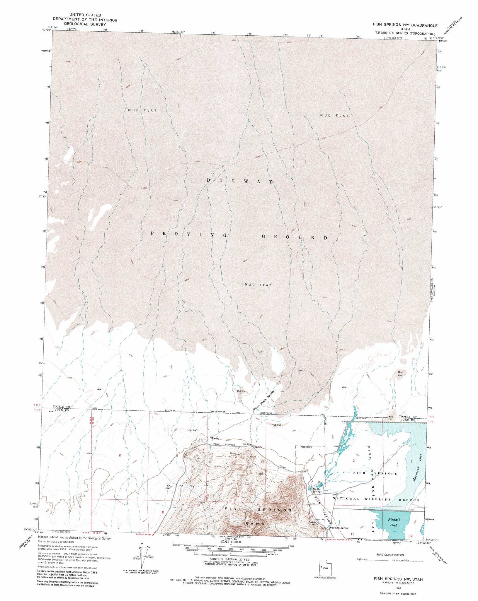
USGS Topo Quad 39113h4 - 1:24,000 scale
| Topo Map Name: | Fish Springs Nw |
| USGS Topo Quad ID: | 39113h4 |
| Print Size: | ca. 21 1/4" wide x 27" high |
| Southeast Coordinates: | 39.875° N latitude / 113.375° W longitude |
| Map Center Coordinates: | 39.9375° N latitude / 113.4375° W longitude |
| U.S. State: | UT |
| Filename: | o39113h4.jpg |
| Download Map JPG Image: | Fish Springs Nw topo map 1:24,000 scale |
| Map Type: | Topographic |
| Topo Series: | 7.5´ |
| Map Scale: | 1:24,000 |
| Source of Map Images: | United States Geological Survey (USGS) |
| Alternate Map Versions: |
Fish Springs NW UT 1967, updated 1971 Download PDF Buy paper map Fish Springs NW UT 1967, updated 1981 Download PDF Buy paper map Fish Springs NW UT 1993, updated 1996 Download PDF Buy paper map Fish Springs NW UT 2011 Download PDF Buy paper map Fish Springs NW UT 2014 Download PDF Buy paper map |
1:24,000 Topo Quads surrounding Fish Springs Nw
Gold Hill 4 Nw |
Gold Hill 4 Ne |
Granite Peak Nw |
Granite Peak |
Dugway Proving Ground Nw |
Gold Hill 4 Sw |
Gold Hill 4 Se |
Granite Peak Sw |
Granite Peak Se |
Dugway Proving Ground Sw |
Callao |
Callao Ne |
Fish Springs Nw |
Fish Springs Ne |
Dugway Range Nw |
Mud Lake Reservoir |
Boyd Station |
Fish Springs Sw |
Fish Springs Se |
Dugway Range Sw |
Hole-In-The-Wall Reservoir |
Middle Range North |
Sand Pass Nw |
Sand Pass Ne |
Topaz Mountain West |
> Back to 39113e1 at 1:100,000 scale
> Back to 39112a1 at 1:250,000 scale
> Back to U.S. Topo Maps home
Fish Springs Nw topo map: Gazetteer
Fish Springs Nw: Reservoirs
Harrison Pool elevation 1306m 4284′Pintail Pool elevation 1308m 4291′
Fish Springs Nw: Springs
Deadman Spring elevation 1316m 4317′North Springs elevation 1312m 4304′
Wilson Health Springs elevation 1311m 4301′
Fish Springs Nw digital topo map on disk
Buy this Fish Springs Nw topo map showing relief, roads, GPS coordinates and other geographical features, as a high-resolution digital map file on DVD: