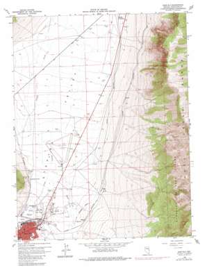
East Ely Topo Map Nevada
To zoom in, hover over the map of East Ely
USGS Topo Quad 39114c7 - 1:24,000 scale
| Topo Map Name: | East Ely |
| USGS Topo Quad ID: | 39114c7 |
| Print Size: | ca. 21 1/4" wide x 27" high |
| Southeast Coordinates: | 39.25° N latitude / 114.75° W longitude |
| Map Center Coordinates: | 39.3125° N latitude / 114.8125° W longitude |
| U.S. State: | NV |
| Filename: | o39114c7.jpg |
| Download Map JPG Image: | East Ely topo map 1:24,000 scale |
| Map Type: | Topographic |
| Topo Series: | 7.5´ |
| Map Scale: | 1:24,000 |
| Source of Map Images: | United States Geological Survey (USGS) |
| Alternate Map Versions: |
East Ely NV 1958, updated 1961 Download PDF Buy paper map East Ely NV 1958, updated 1979 Download PDF Buy paper map East Ely NV 2012 Download PDF Buy paper map East Ely NV 2014 Download PDF Buy paper map |
| FStopo: | US Forest Service topo East Ely is available: Download FStopo PDF Download FStopo TIF |
1:24,000 Topo Quads surrounding East Ely
> Back to 39114a1 at 1:100,000 scale
> Back to 39114a1 at 1:250,000 scale
> Back to U.S. Topo Maps home
East Ely topo map: Gazetteer
East Ely: Airports
Ely Airport-Yelland Field elevation 1904m 6246′Yelland Field elevation 1902m 6240′
East Ely: Mines
Lead King Mine elevation 2090m 6856′East Ely: Populated Places
Baltimore Mill elevation 1948m 6391′East Ely elevation 1961m 6433′
Lavon elevation 1962m 6437′
McGill Junction elevation 1866m 6122′
Mosier elevation 1940m 6364′
East Ely: Post Offices
East Ely Station Post Office elevation 1955m 6414′East Ely: Ranges
Duck Creek Range elevation 2700m 8858′East Ely: Springs
Ely Warm Springs elevation 1939m 6361′Lackawanna Springs elevation 1916m 6286′
Steptoe Spring elevation 2445m 8021′
Warm Spring elevation 1909m 6263′
East Ely: Streams
Murry Creek elevation 1897m 6223′East Ely: Wells
Huesser Winter Well elevation 1884m 6181′East Ely digital topo map on disk
Buy this East Ely topo map showing relief, roads, GPS coordinates and other geographical features, as a high-resolution digital map file on DVD:


