Third Butte West Topo Map Nevada
To zoom in, hover over the map of Third Butte West
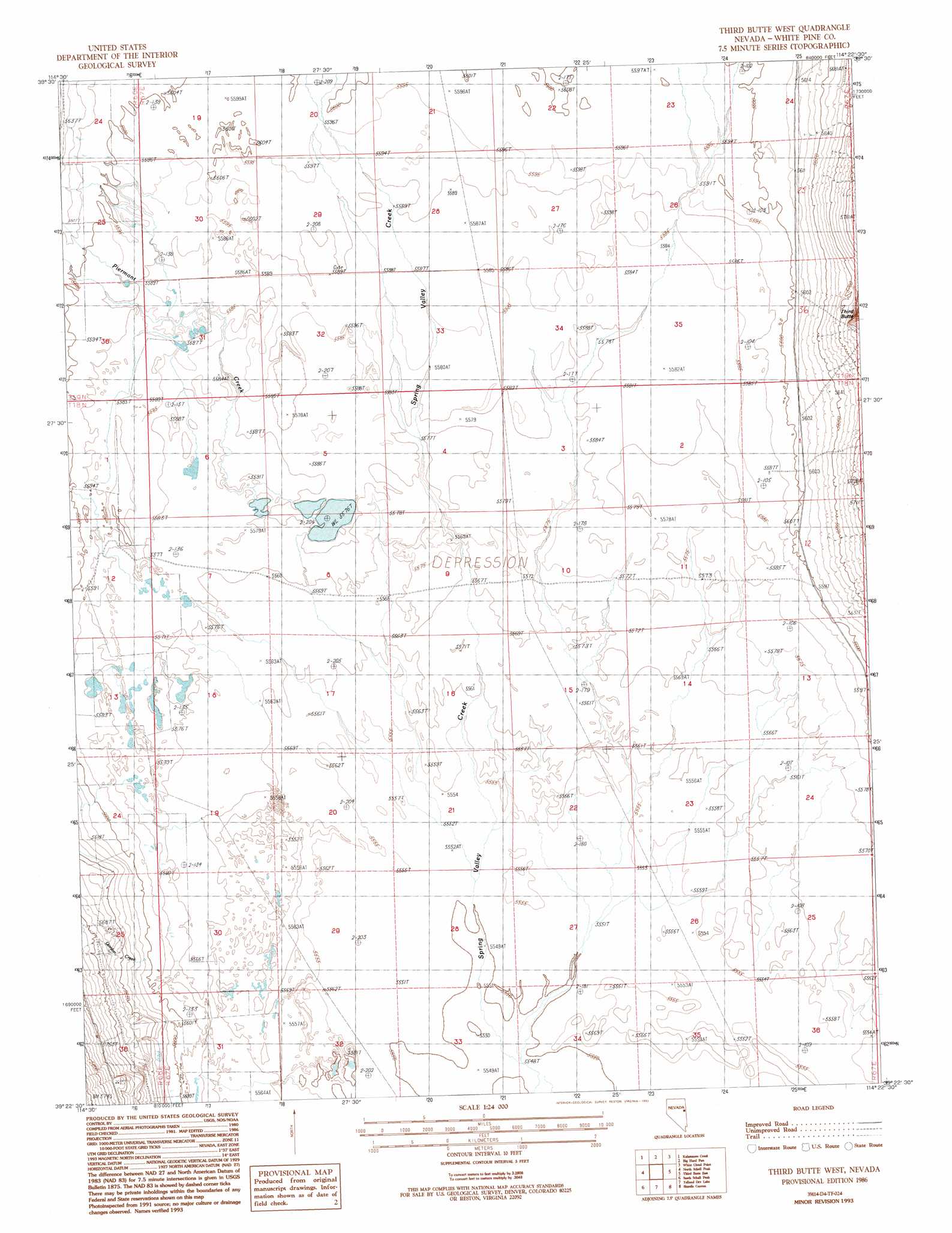
USGS Topo Quad 39114d4 - 1:24,000 scale
| Topo Map Name: | Third Butte West |
| USGS Topo Quad ID: | 39114d4 |
| Print Size: | ca. 21 1/4" wide x 27" high |
| Southeast Coordinates: | 39.375° N latitude / 114.375° W longitude |
| Map Center Coordinates: | 39.4375° N latitude / 114.4375° W longitude |
| U.S. State: | NV |
| Filename: | o39114d4.jpg |
| Download Map JPG Image: | Third Butte West topo map 1:24,000 scale |
| Map Type: | Topographic |
| Topo Series: | 7.5´ |
| Map Scale: | 1:24,000 |
| Source of Map Images: | United States Geological Survey (USGS) |
| Alternate Map Versions: |
Third Butte West NV 1986, updated 1986 Download PDF Buy paper map Third Butte West NV 1993, updated 1993 Download PDF Buy paper map Third Butte West NV 2012 Download PDF Buy paper map Third Butte West NV 2015 Download PDF Buy paper map |
1:24,000 Topo Quads surrounding Third Butte West
Mattier Creek |
Silver Canyon |
Tippett Pass |
Grass Valley Wash |
Blue Mass Canyon |
Kalamazoo Summit |
Kalamazoo Creek |
Big Hard Pan |
White Cloud Point |
Government Peak |
Duck Creek Valley |
North Schell Peak |
Third Butte West |
Third Butte East |
Mormon Jack Pass |
Cleve Creek Baldy |
South Schell Peak |
Yelland Dry Lake |
Sixmile Canyon |
Mount Moriah |
Cave Creek |
Cave Mountain |
South Bastian Spring |
Sacramento Pass |
Old Mans Canyon |
> Back to 39114a1 at 1:100,000 scale
> Back to 39114a1 at 1:250,000 scale
> Back to U.S. Topo Maps home
Third Butte West topo map: Gazetteer
Third Butte West: Streams
Odgers Creek elevation 1703m 5587′Third Butte West: Wells
Eldridge Well elevation 1704m 5590′Third Butte West digital topo map on disk
Buy this Third Butte West topo map showing relief, roads, GPS coordinates and other geographical features, as a high-resolution digital map file on DVD: