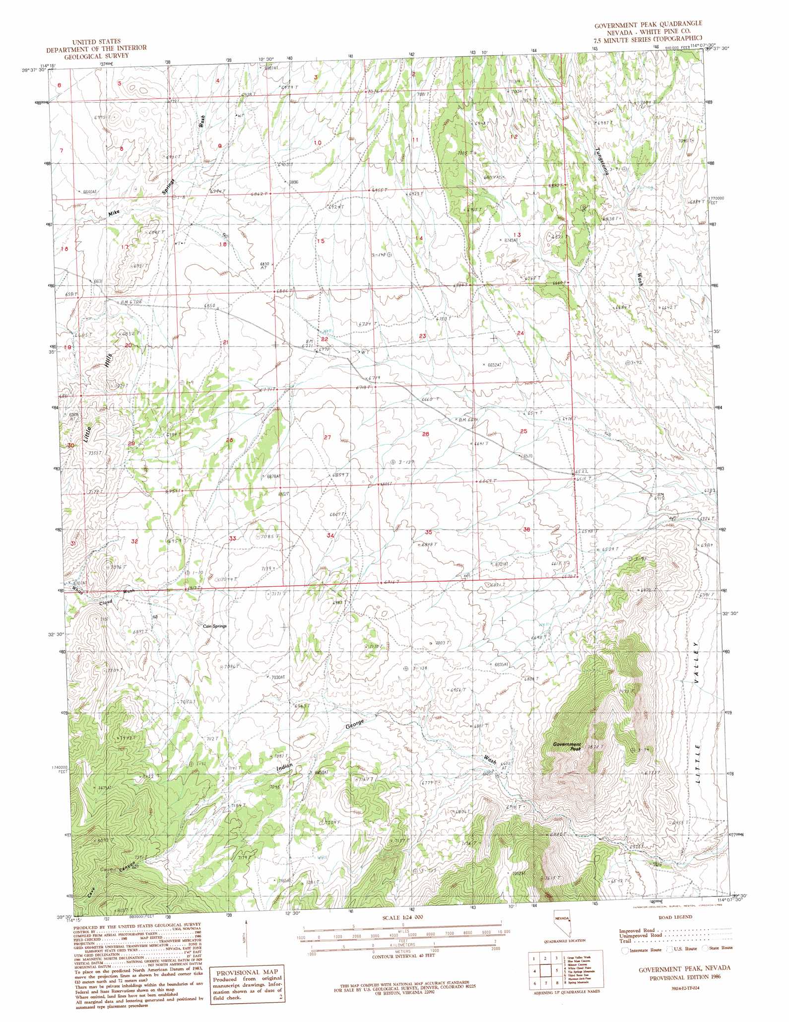
Government Peak Topo Map Nevada
To zoom in, hover over the map of Government Peak
USGS Topo Quad 39114e2 - 1:24,000 scale
| Topo Map Name: | Government Peak |
| USGS Topo Quad ID: | 39114e2 |
| Print Size: | ca. 21 1/4" wide x 27" high |
| Southeast Coordinates: | 39.5° N latitude / 114.125° W longitude |
| Map Center Coordinates: | 39.5625° N latitude / 114.1875° W longitude |
| U.S. State: | NV |
| Filename: | o39114e2.jpg |
| Download Map JPG Image: | Government Peak topo map 1:24,000 scale |
| Map Type: | Topographic |
| Topo Series: | 7.5´ |
| Map Scale: | 1:24,000 |
| Source of Map Images: | United States Geological Survey (USGS) |
| Alternate Map Versions: |
Government Peak NV 1986, updated 1986 Download PDF Buy paper map Government Peak NV 2012 Download PDF Buy paper map Government Peak NV 2014 Download PDF Buy paper map |
1:24,000 Topo Quads surrounding Government Peak
Rock Springs Pass |
Tippett |
Tippett Canyon |
Weaver Canyon |
Ibapah Peak |
Tippett Pass |
Grass Valley Wash |
Blue Mass Canyon |
Skinner Canyon |
Partoun |
Big Hard Pan |
White Cloud Point |
Government Peak |
Tin Springs Mountain |
Trout Creek Sw |
Third Butte West |
Third Butte East |
Mormon Jack Pass |
Spring Mountain |
Gandy |
Yelland Dry Lake |
Sixmile Canyon |
Mount Moriah |
Little Horse Canyon |
Gandy Sw |
> Back to 39114e1 at 1:100,000 scale
> Back to 39114a1 at 1:250,000 scale
> Back to U.S. Topo Maps home
Government Peak topo map: Gazetteer
Government Peak: Springs
Cain Springs elevation 2128m 6981′Government Peak: Summits
Government Peak elevation 2392m 7847′Government Peak: Valleys
Cave Canyon elevation 2190m 7185′Government Peak: Wells
Doutre Well elevation 2057m 6748′Mormon Jack Well elevation 2171m 7122′
Government Peak digital topo map on disk
Buy this Government Peak topo map showing relief, roads, GPS coordinates and other geographical features, as a high-resolution digital map file on DVD: