Steptoe Topo Map Nevada
To zoom in, hover over the map of Steptoe
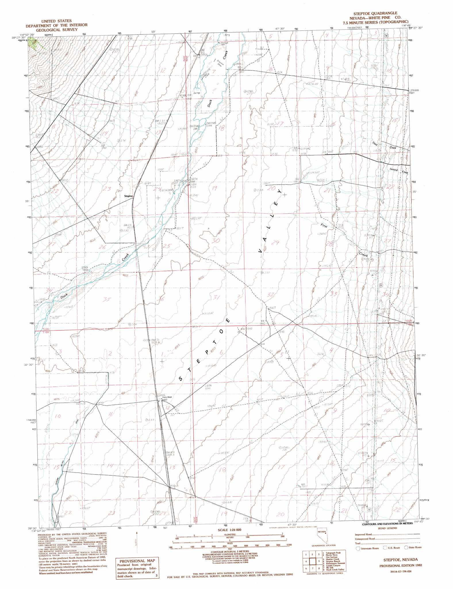
USGS Topo Quad 39114e7 - 1:24,000 scale
| Topo Map Name: | Steptoe |
| USGS Topo Quad ID: | 39114e7 |
| Print Size: | ca. 21 1/4" wide x 27" high |
| Southeast Coordinates: | 39.5° N latitude / 114.75° W longitude |
| Map Center Coordinates: | 39.5625° N latitude / 114.8125° W longitude |
| U.S. State: | NV |
| Filename: | o39114e7.jpg |
| Download Map JPG Image: | Steptoe topo map 1:24,000 scale |
| Map Type: | Topographic |
| Topo Series: | 7.5´ |
| Map Scale: | 1:24,000 |
| Source of Map Images: | United States Geological Survey (USGS) |
| Alternate Map Versions: |
Steptoe NV 1982, updated 1982 Download PDF Buy paper map Steptoe NV 2012 Download PDF Buy paper map Steptoe NV 2014 Download PDF Buy paper map |
1:24,000 Topo Quads surrounding Steptoe
Franks Well |
Egan Canyon |
Borchert Spring |
Schellbourne |
Stonehouse |
Hunter Point |
Telegraph Peak |
Monte Neva Hot Springs |
Mattier Creek |
Silver Canyon |
Combs Creek |
Steptoe Ranch |
Steptoe |
Kalamazoo Summit |
Kalamazoo Creek |
Robinson Summit |
Lusetti Canyon |
Mcgill |
Duck Creek Valley |
North Schell Peak |
Riepetown |
Ruth |
East Ely |
Cleve Creek Baldy |
South Schell Peak |
> Back to 39114e1 at 1:100,000 scale
> Back to 39114a1 at 1:250,000 scale
> Back to U.S. Topo Maps home
Steptoe topo map: Gazetteer
Steptoe: Reservoirs
Steptoe Reservoir Number Two elevation 1828m 5997′Steptoe: Springs
California Canyon Spring elevation 1836m 6023′Steptoe: Streams
First Creek elevation 1828m 5997′Second Creek elevation 1825m 5987′
Third Creek elevation 1824m 5984′
Steptoe: Wells
Fera Thirtyeight elevation 1818m 5964′Fera Thirtynine elevation 1831m 6007′
Fera Well elevation 1838m 6030′
Steptoe digital topo map on disk
Buy this Steptoe topo map showing relief, roads, GPS coordinates and other geographical features, as a high-resolution digital map file on DVD: