Tippett Topo Map Nevada
To zoom in, hover over the map of Tippett
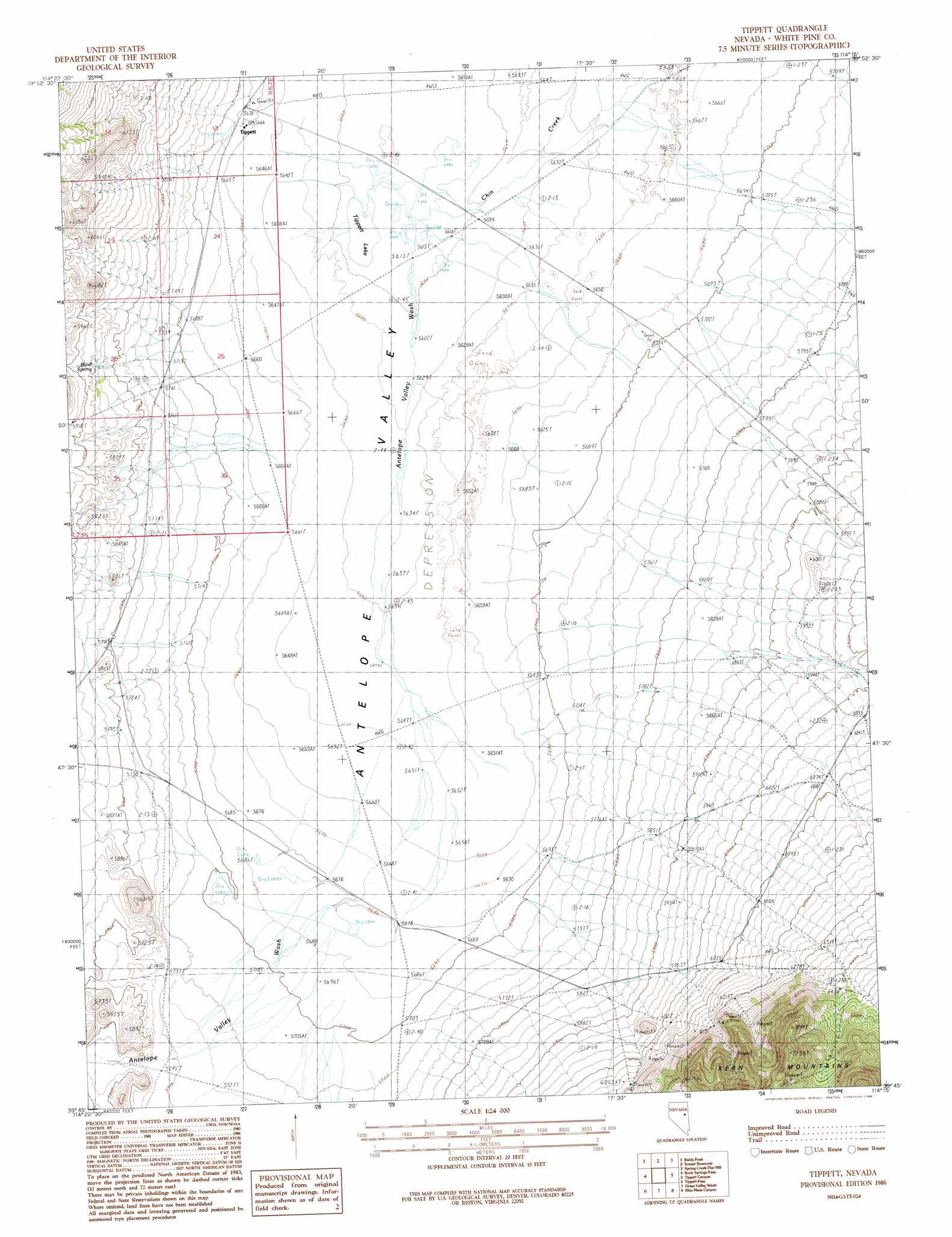
USGS Topo Quad 39114g3 - 1:24,000 scale
| Topo Map Name: | Tippett |
| USGS Topo Quad ID: | 39114g3 |
| Print Size: | ca. 21 1/4" wide x 27" high |
| Southeast Coordinates: | 39.75° N latitude / 114.25° W longitude |
| Map Center Coordinates: | 39.8125° N latitude / 114.3125° W longitude |
| U.S. State: | NV |
| Filename: | o39114g3.jpg |
| Download Map JPG Image: | Tippett topo map 1:24,000 scale |
| Map Type: | Topographic |
| Topo Series: | 7.5´ |
| Map Scale: | 1:24,000 |
| Source of Map Images: | United States Geological Survey (USGS) |
| Alternate Map Versions: |
Tippett NV 1986, updated 1986 Download PDF Buy paper map Tippett NV 2012 Download PDF Buy paper map Tippett NV 2014 Download PDF Buy paper map |
1:24,000 Topo Quads surrounding Tippett
Lages Station |
Chin Creek Spring |
Chin Creek Reservoir |
Ayarbe Spring |
Ferber Peak Se |
Becky Peak |
Baldy Peak |
Sunset Reservoir |
Spring Creek Flat Nw |
Georgetta Ranch |
Stonehouse |
Rock Springs Pass |
Tippett |
Tippett Canyon |
Weaver Canyon |
Silver Canyon |
Tippett Pass |
Grass Valley Wash |
Blue Mass Canyon |
Skinner Canyon |
Kalamazoo Creek |
Big Hard Pan |
White Cloud Point |
Government Peak |
Tin Springs Mountain |
> Back to 39114e1 at 1:100,000 scale
> Back to 39114a1 at 1:250,000 scale
> Back to U.S. Topo Maps home
Tippett topo map: Gazetteer
Tippett: Flats
Tippett Lake elevation 1712m 5616′Tippett: Mines
Antelope Mine elevation 1853m 6079′Rees Mine elevation 1863m 6112′
Tippett: Populated Places
Tippett elevation 1735m 5692′Tippett: Post Offices
Tippett Post Office (historical) elevation 1735m 5692′Tippett: Springs
Blind Spring elevation 1785m 5856′Tippett: Streams
Antelope Valley Wash elevation 1712m 5616′Chin Creek elevation 1713m 5620′
Tippett digital topo map on disk
Buy this Tippett topo map showing relief, roads, GPS coordinates and other geographical features, as a high-resolution digital map file on DVD: