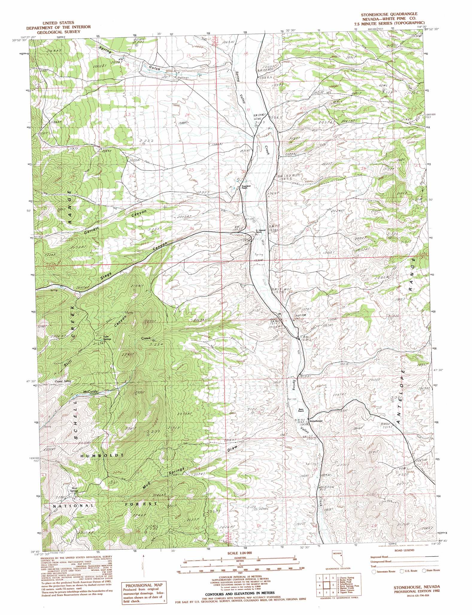
Stonehouse Topo Map Nevada
To zoom in, hover over the map of Stonehouse
USGS Topo Quad 39114g5 - 1:24,000 scale
| Topo Map Name: | Stonehouse |
| USGS Topo Quad ID: | 39114g5 |
| Print Size: | ca. 21 1/4" wide x 27" high |
| Southeast Coordinates: | 39.75° N latitude / 114.5° W longitude |
| Map Center Coordinates: | 39.8125° N latitude / 114.5625° W longitude |
| U.S. State: | NV |
| Filename: | o39114g5.jpg |
| Download Map JPG Image: | Stonehouse topo map 1:24,000 scale |
| Map Type: | Topographic |
| Topo Series: | 7.5´ |
| Map Scale: | 1:24,000 |
| Source of Map Images: | United States Geological Survey (USGS) |
| Alternate Map Versions: |
Stonehouse NV 1982, updated 1982 Download PDF Buy paper map Stonehouse NV 2012 Download PDF Buy paper map Stonehouse NV 2014 Download PDF Buy paper map |
| FStopo: | US Forest Service topo Stonehouse is available: Download FStopo PDF Download FStopo TIF |
1:24,000 Topo Quads surrounding Stonehouse
Goshute Creek |
Goshute Lake South |
Lages Station |
Chin Creek Spring |
Chin Creek Reservoir |
Cherry Creek Station |
Cherry Spring |
Becky Peak |
Baldy Peak |
Sunset Reservoir |
Borchert Spring |
Schellbourne |
Stonehouse |
Rock Springs Pass |
Tippett |
Monte Neva Hot Springs |
Mattier Creek |
Silver Canyon |
Tippett Pass |
Grass Valley Wash |
Steptoe |
Kalamazoo Summit |
Kalamazoo Creek |
Big Hard Pan |
White Cloud Point |
> Back to 39114e1 at 1:100,000 scale
> Back to 39114a1 at 1:250,000 scale
> Back to U.S. Topo Maps home
Stonehouse topo map: Gazetteer
Stonehouse: Populated Places
Stonehouse elevation 1913m 6276′Stonehouse: Springs
Crystal Spring elevation 2267m 7437′Garden Springs elevation 2066m 6778′
Golden Springs elevation 2020m 6627′
Mud Springs elevation 2263m 7424′
Twin Springs elevation 2165m 7103′
Stonehouse: Streams
McCurdy Creek elevation 1918m 6292′Stonehouse: Valleys
Garrett Canyon elevation 1946m 6384′Mud Springs Draw elevation 1918m 6292′
Spring Gulch elevation 1964m 6443′
Stage Canyon elevation 1950m 6397′
Still Canyon elevation 1998m 6555′
Stonehouse digital topo map on disk
Buy this Stonehouse topo map showing relief, roads, GPS coordinates and other geographical features, as a high-resolution digital map file on DVD: