Railroad Crossing Dam Topo Map Nevada
To zoom in, hover over the map of Railroad Crossing Dam
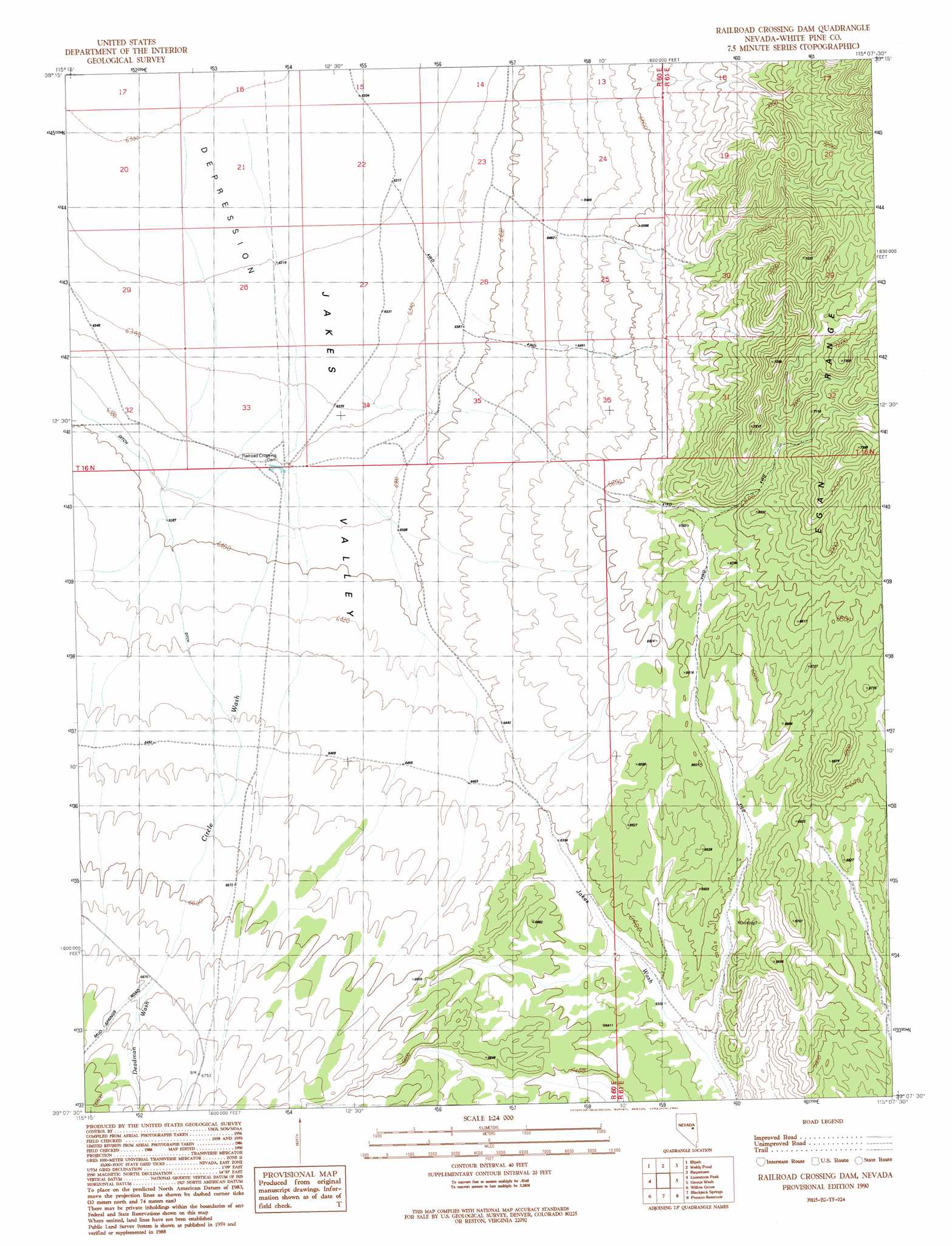
USGS Topo Quad 39115b2 - 1:24,000 scale
| Topo Map Name: | Railroad Crossing Dam |
| USGS Topo Quad ID: | 39115b2 |
| Print Size: | ca. 21 1/4" wide x 27" high |
| Southeast Coordinates: | 39.125° N latitude / 115.125° W longitude |
| Map Center Coordinates: | 39.1875° N latitude / 115.1875° W longitude |
| U.S. State: | NV |
| Filename: | o39115b2.jpg |
| Download Map JPG Image: | Railroad Crossing Dam topo map 1:24,000 scale |
| Map Type: | Topographic |
| Topo Series: | 7.5´ |
| Map Scale: | 1:24,000 |
| Source of Map Images: | United States Geological Survey (USGS) |
| Alternate Map Versions: |
Railroad Crossing Dam NV 1990, updated 1991 Download PDF Buy paper map Railroad Crossing Dam NV 2012 Download PDF Buy paper map Railroad Crossing Dam NV 2014 Download PDF Buy paper map |
1:24,000 Topo Quads surrounding Railroad Crossing Dam
Antelope Mountain |
Sammys Springs |
Marking Corral Summit |
Robinson Summit |
Lusetti Canyon |
Hamilton |
Illipah |
Waldy Pond |
Riepetown |
Ruth |
Treasure Hill |
Limestone Peak |
Railroad Crossing Dam |
Giroux Wash |
Ely |
Indian Garden Mountain |
Easter Springs |
Blackjack Springs |
Preston Reservoir |
Ward Mountain |
Currant Mountain |
Horse Track Spring |
Badger Hole Spring |
Preston |
Sawmill Canyon |
> Back to 39115a1 at 1:100,000 scale
> Back to 39114a1 at 1:250,000 scale
> Back to U.S. Topo Maps home
Railroad Crossing Dam topo map: Gazetteer
Railroad Crossing Dam: Dams
Railroad Crossing Dam elevation 1940m 6364′Railroad Crossing Dam: Streams
Circle Wash elevation 1923m 6309′Deadman Wash elevation 2035m 6676′
Hayden Creek elevation 1922m 6305′
Railroad Crossing Dam digital topo map on disk
Buy this Railroad Crossing Dam topo map showing relief, roads, GPS coordinates and other geographical features, as a high-resolution digital map file on DVD: