Sammys Springs Topo Map Nevada
To zoom in, hover over the map of Sammys Springs
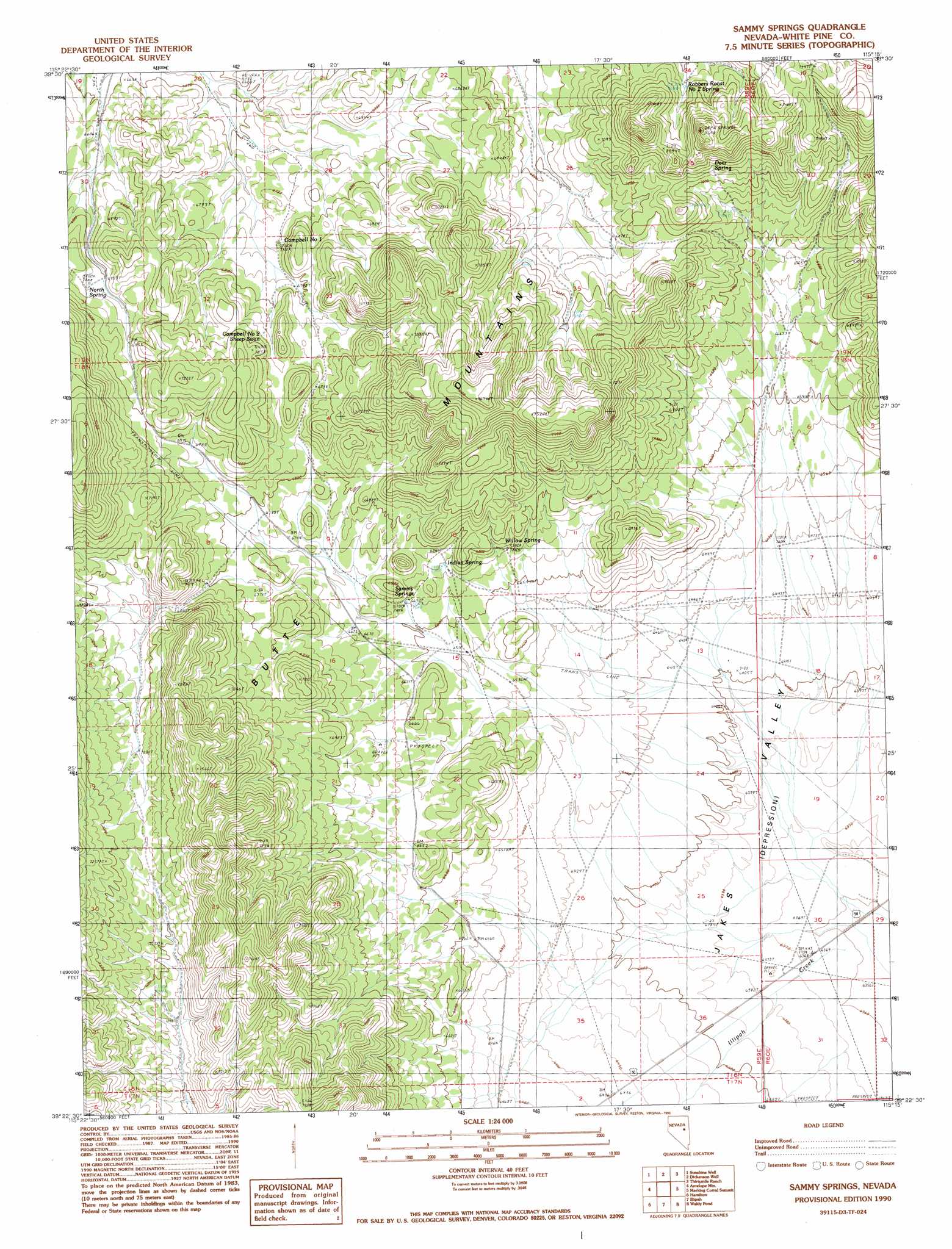
USGS Topo Quad 39115d3 - 1:24,000 scale
| Topo Map Name: | Sammys Springs |
| USGS Topo Quad ID: | 39115d3 |
| Print Size: | ca. 21 1/4" wide x 27" high |
| Southeast Coordinates: | 39.375° N latitude / 115.25° W longitude |
| Map Center Coordinates: | 39.4375° N latitude / 115.3125° W longitude |
| U.S. State: | NV |
| Filename: | o39115d3.jpg |
| Download Map JPG Image: | Sammys Springs topo map 1:24,000 scale |
| Map Type: | Topographic |
| Topo Series: | 7.5´ |
| Map Scale: | 1:24,000 |
| Source of Map Images: | United States Geological Survey (USGS) |
| Alternate Map Versions: |
Sammy Springs NV 1990, updated 1990 Download PDF Buy paper map Sammy Springs NV 2012 Download PDF Buy paper map Sammy Springs NV 2014 Download PDF Buy paper map |
1:24,000 Topo Quads surrounding Sammys Springs
Buck Mountain East |
Sunshine Well Nw |
Mcbrides Sheep Well |
White Sage Well |
Hunter Point |
Beck Pass |
Sunshine Well |
Dickenson Well |
Thirtymile Ranch |
Combs Creek |
East Of Pancake Summit |
Antelope Mountain |
Sammys Springs |
Marking Corral Summit |
Robinson Summit |
Seligman Canyon |
Hamilton |
Illipah |
Waldy Pond |
Riepetown |
Mount Hamilton |
Treasure Hill |
Limestone Peak |
Railroad Crossing Dam |
Giroux Wash |
> Back to 39115a1 at 1:100,000 scale
> Back to 39114a1 at 1:250,000 scale
> Back to U.S. Topo Maps home
Sammys Springs topo map: Gazetteer
Sammys Springs: Springs
Campbell Number One Sheep Swan elevation 2046m 6712′Campbell Number Two Sheep Swan elevation 2119m 6952′
Deer Spring elevation 2142m 7027′
Indian Spring elevation 2054m 6738′
Robbers Roost Number Two Spring elevation 2162m 7093′
Sammy Springs elevation 2032m 6666′
Willow Spring elevation 2042m 6699′
Sammys Springs digital topo map on disk
Buy this Sammys Springs topo map showing relief, roads, GPS coordinates and other geographical features, as a high-resolution digital map file on DVD: