Cow Camp Topo Map Nevada
To zoom in, hover over the map of Cow Camp
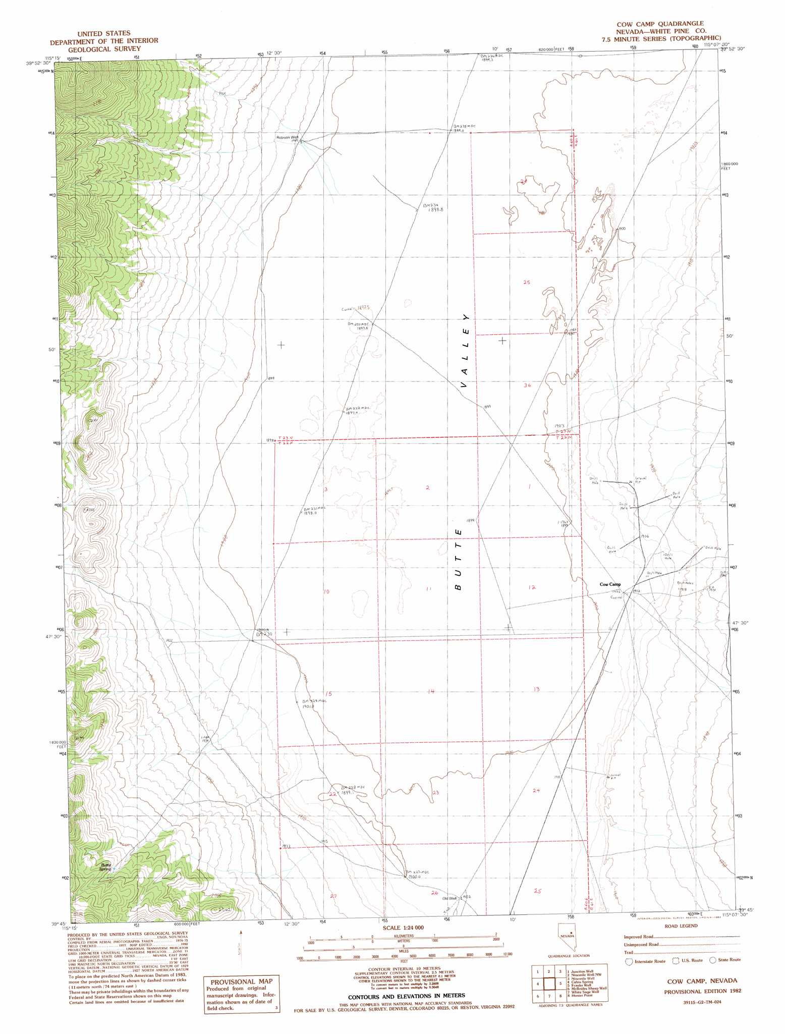
USGS Topo Quad 39115g2 - 1:24,000 scale
| Topo Map Name: | Cow Camp |
| USGS Topo Quad ID: | 39115g2 |
| Print Size: | ca. 21 1/4" wide x 27" high |
| Southeast Coordinates: | 39.75° N latitude / 115.125° W longitude |
| Map Center Coordinates: | 39.8125° N latitude / 115.1875° W longitude |
| U.S. State: | NV |
| Filename: | o39115g2.jpg |
| Download Map JPG Image: | Cow Camp topo map 1:24,000 scale |
| Map Type: | Topographic |
| Topo Series: | 7.5´ |
| Map Scale: | 1:24,000 |
| Source of Map Images: | United States Geological Survey (USGS) |
| Alternate Map Versions: |
Cow Camp NV 1982, updated 1982 Download PDF Buy paper map Cow Camp NV 2012 Download PDF Buy paper map Cow Camp NV 2014 Download PDF Buy paper map |
1:24,000 Topo Quads surrounding Cow Camp
Station Butte |
Ruby Lake Se |
Pot Spring |
High Bald Peaks Se |
Paris Creek |
Tognini Spring |
Junction Well |
Ninemile Well Nw |
Ninemile Well |
Cherry Creek |
Long Valley Slough |
Cabin Spring |
Cow Camp |
Franks Well |
Egan Canyon |
Sunshine Well Nw |
Mcbrides Sheep Well |
White Sage Well |
Hunter Point |
Telegraph Peak |
Sunshine Well |
Dickenson Well |
Thirtymile Ranch |
Combs Creek |
Steptoe Ranch |
> Back to 39115e1 at 1:100,000 scale
> Back to 39114a1 at 1:250,000 scale
> Back to U.S. Topo Maps home
Cow Camp topo map: Gazetteer
Cow Camp: Basins
Butte Valley elevation 1901m 6236′Cow Camp: Springs
Butte Spring elevation 2089m 6853′Cow Camp: Wells
Robison Well elevation 1909m 6263′Rye Grass Well elevation 1905m 6250′
Uhalde Well elevation 1904m 6246′
Cow Camp digital topo map on disk
Buy this Cow Camp topo map showing relief, roads, GPS coordinates and other geographical features, as a high-resolution digital map file on DVD: