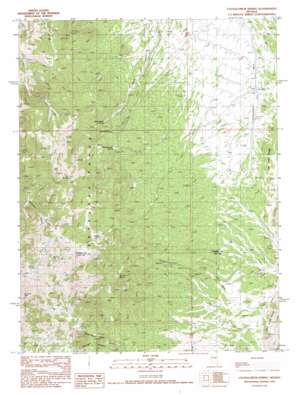
Cockalorum Spring Topo Map Nevada
To zoom in, hover over the map of Cockalorum Spring
USGS Topo Quad 39116b2 - 1:24,000 scale
| Topo Map Name: | Cockalorum Spring |
| USGS Topo Quad ID: | 39116b2 |
| Print Size: | ca. 21 1/4" wide x 27" high |
| Southeast Coordinates: | 39.125° N latitude / 116.125° W longitude |
| Map Center Coordinates: | 39.1875° N latitude / 116.1875° W longitude |
| U.S. State: | NV |
| Filename: | o39116b2.jpg |
| Download Map JPG Image: | Cockalorum Spring topo map 1:24,000 scale |
| Map Type: | Topographic |
| Topo Series: | 7.5´ |
| Map Scale: | 1:24,000 |
| Source of Map Images: | United States Geological Survey (USGS) |
| Alternate Map Versions: |
Cockalorum Spring NV 1990, updated 1990 Download PDF Buy paper map Cockalorum Spring NV 2012 Download PDF Buy paper map Cockalorum Spring NV 2014 Download PDF Buy paper map |
1:24,000 Topo Quads surrounding Cockalorum Spring
> Back to 39116a1 at 1:100,000 scale
> Back to 39116a1 at 1:250,000 scale
> Back to U.S. Topo Maps home
Cockalorum Spring topo map: Gazetteer
Cockalorum Spring: Springs
Cockalorum Spring elevation 2372m 7782′Double Spring elevation 2579m 8461′
Kinkead Spring elevation 2299m 7542′
Middle Spring elevation 2454m 8051′
North Cottonwood Spring elevation 2532m 8307′
Number Four Spring elevation 2318m 7604′
Peak Spring elevation 2715m 8907′
Pine Spring elevation 2600m 8530′
Rock Spring elevation 2682m 8799′
Sheep Spring elevation 2591m 8500′
South Cottonwood Spring elevation 2558m 8392′
Twin Spring elevation 2522m 8274′
Upper Davis Spring elevation 2305m 7562′
Wild Horse Spring elevation 2441m 8008′
Cockalorum Spring: Valleys
Cockalorum Draw elevation 2143m 7030′Mulligan Canyon elevation 2301m 7549′
Cockalorum Spring digital topo map on disk
Buy this Cockalorum Spring topo map showing relief, roads, GPS coordinates and other geographical features, as a high-resolution digital map file on DVD:


