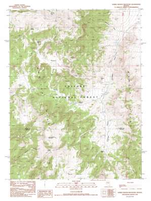
Horse Heaven Mountain Topo Map Nevada
To zoom in, hover over the map of Horse Heaven Mountain
USGS Topo Quad 39116b4 - 1:24,000 scale
| Topo Map Name: | Horse Heaven Mountain |
| USGS Topo Quad ID: | 39116b4 |
| Print Size: | ca. 21 1/4" wide x 27" high |
| Southeast Coordinates: | 39.125° N latitude / 116.375° W longitude |
| Map Center Coordinates: | 39.1875° N latitude / 116.4375° W longitude |
| U.S. State: | NV |
| Filename: | o39116b4.jpg |
| Download Map JPG Image: | Horse Heaven Mountain topo map 1:24,000 scale |
| Map Type: | Topographic |
| Topo Series: | 7.5´ |
| Map Scale: | 1:24,000 |
| Source of Map Images: | United States Geological Survey (USGS) |
| Alternate Map Versions: |
Horse Heaven Mountain NV 1990, updated 1990 Download PDF Buy paper map Horse Heaven Mountain NV 2012 Download PDF Buy paper map Horse Heaven Mountain NV 2014 Download PDF Buy paper map |
| FStopo: | US Forest Service topo Horse Heaven Mountain is available: Download FStopo PDF Download FStopo TIF |
1:24,000 Topo Quads surrounding Horse Heaven Mountain
> Back to 39116a1 at 1:100,000 scale
> Back to 39116a1 at 1:250,000 scale
> Back to U.S. Topo Maps home
Horse Heaven Mountain topo map: Gazetteer
Horse Heaven Mountain: Flats
Horse Heaven elevation 2549m 8362′Horse Heaven Mountain: Ridges
Martin Ridge elevation 2337m 7667′Horse Heaven Mountain: Springs
Laxague Spring elevation 2636m 8648′Ryegrass Spring elevation 2192m 7191′
Seep Spring elevation 2510m 8234′
Sheep Spring elevation 2459m 8067′
Whiterock Spring elevation 2362m 7749′
Horse Heaven Mountain: Streams
Sweeney Wash elevation 2039m 6689′Horse Heaven Mountain: Summits
Horse Heaven Mountain elevation 2795m 9169′Rabbit Hill elevation 2193m 7194′
Horse Heaven Mountain: Valleys
Copenhagen Canyon elevation 2022m 6633′Ryegrass Canyon elevation 2135m 7004′
Whiterock Canyon elevation 2123m 6965′
Horse Heaven Mountain digital topo map on disk
Buy this Horse Heaven Mountain topo map showing relief, roads, GPS coordinates and other geographical features, as a high-resolution digital map file on DVD:


