Well Canyon Topo Map Nevada
To zoom in, hover over the map of Well Canyon
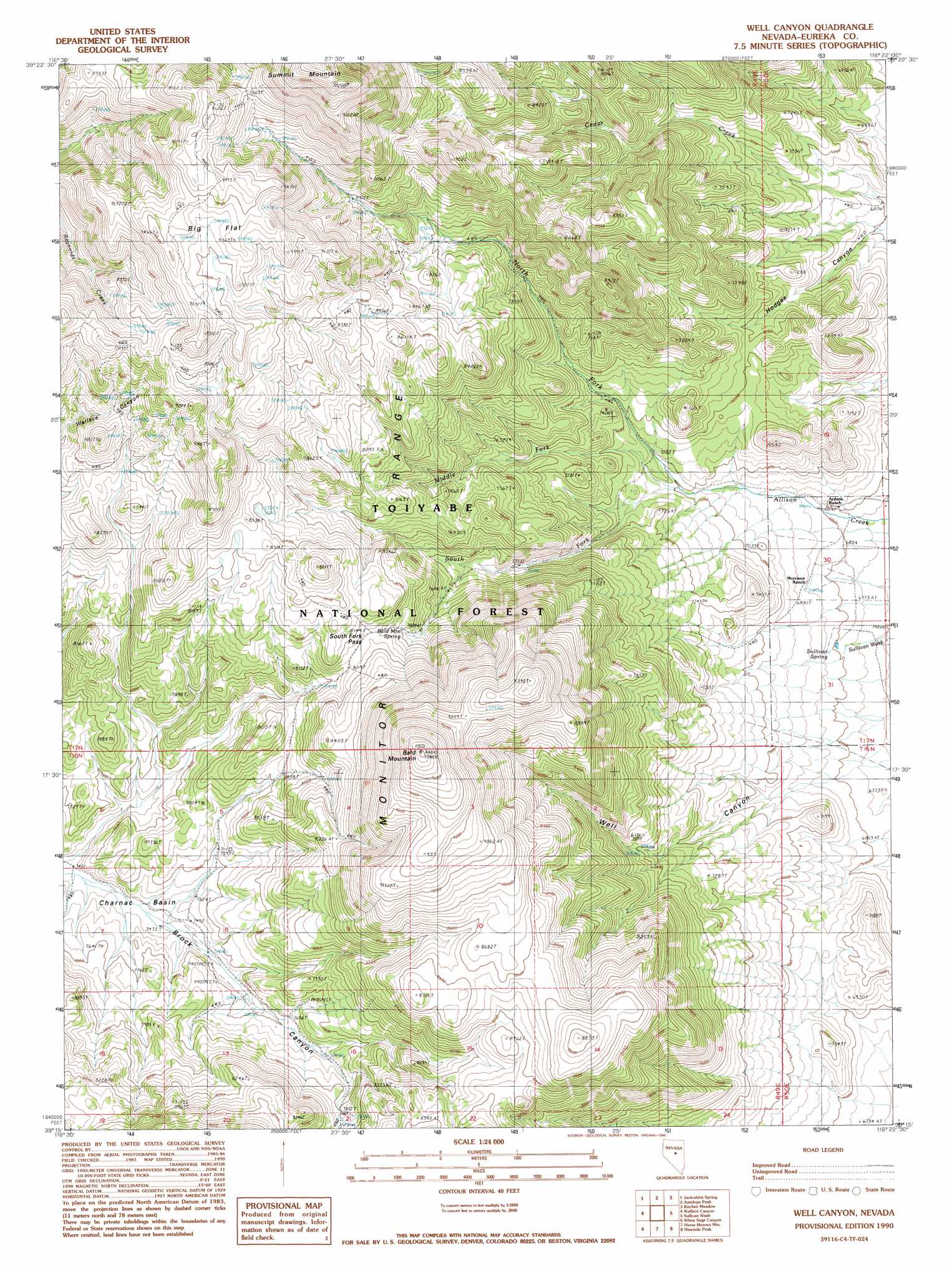
USGS Topo Quad 39116c4 - 1:24,000 scale
| Topo Map Name: | Well Canyon |
| USGS Topo Quad ID: | 39116c4 |
| Print Size: | ca. 21 1/4" wide x 27" high |
| Southeast Coordinates: | 39.25° N latitude / 116.375° W longitude |
| Map Center Coordinates: | 39.3125° N latitude / 116.4375° W longitude |
| U.S. State: | NV |
| Filename: | o39116c4.jpg |
| Download Map JPG Image: | Well Canyon topo map 1:24,000 scale |
| Map Type: | Topographic |
| Topo Series: | 7.5´ |
| Map Scale: | 1:24,000 |
| Source of Map Images: | United States Geological Survey (USGS) |
| Alternate Map Versions: |
Well Canyon NV 1990, updated 1990 Download PDF Buy paper map Well Canyon NV 2012 Download PDF Buy paper map Well Canyon NV 2014 Download PDF Buy paper map |
| FStopo: | US Forest Service topo Well Canyon is available: Download FStopo PDF Download FStopo TIF |
1:24,000 Topo Quads surrounding Well Canyon
Ackerman Canyon |
Bean Flat West |
Bean Flat East |
Bartine Ranch |
Hay Ranch |
Hickison Summit |
Jackrabbit Spring |
Antelope Peak |
Antelope Meadow |
Combs Peak |
Potts Well |
Wallace Canyon |
Well Canyon |
Sullivan Wash |
West Of Bellevue Peak |
The Monitor |
White Sage Canyon |
Horse Heaven Mountain |
Ninemile Peak |
Cockalorum Spring |
Dianas Punch Bowl |
Butler Ranch |
Savory Mountain |
Segura Ranch |
Snowball Ranch |
> Back to 39116a1 at 1:100,000 scale
> Back to 39116a1 at 1:250,000 scale
> Back to U.S. Topo Maps home
Well Canyon topo map: Gazetteer
Well Canyon: Basins
Charnac Basin elevation 2281m 7483′Well Canyon: Flats
Big Flat elevation 2827m 9274′Well Canyon: Gaps
South Fork Pass elevation 2487m 8159′Well Canyon: Springs
Bald Mountain Spring elevation 2436m 7992′Sullivan Spring elevation 2078m 6817′
Well Canyon: Streams
Middle Fork Allison Creek elevation 2135m 7004′North Fork Allison Creek elevation 2139m 7017′
South Fork Allison Creek elevation 2135m 7004′
Well Canyon: Summits
Bald Mountain elevation 2992m 9816′Well Canyon: Valleys
Hodges Canyon elevation 2071m 6794′Well Canyon elevation 2075m 6807′
Well Canyon digital topo map on disk
Buy this Well Canyon topo map showing relief, roads, GPS coordinates and other geographical features, as a high-resolution digital map file on DVD: