Antelope Meadow Topo Map Nevada
To zoom in, hover over the map of Antelope Meadow
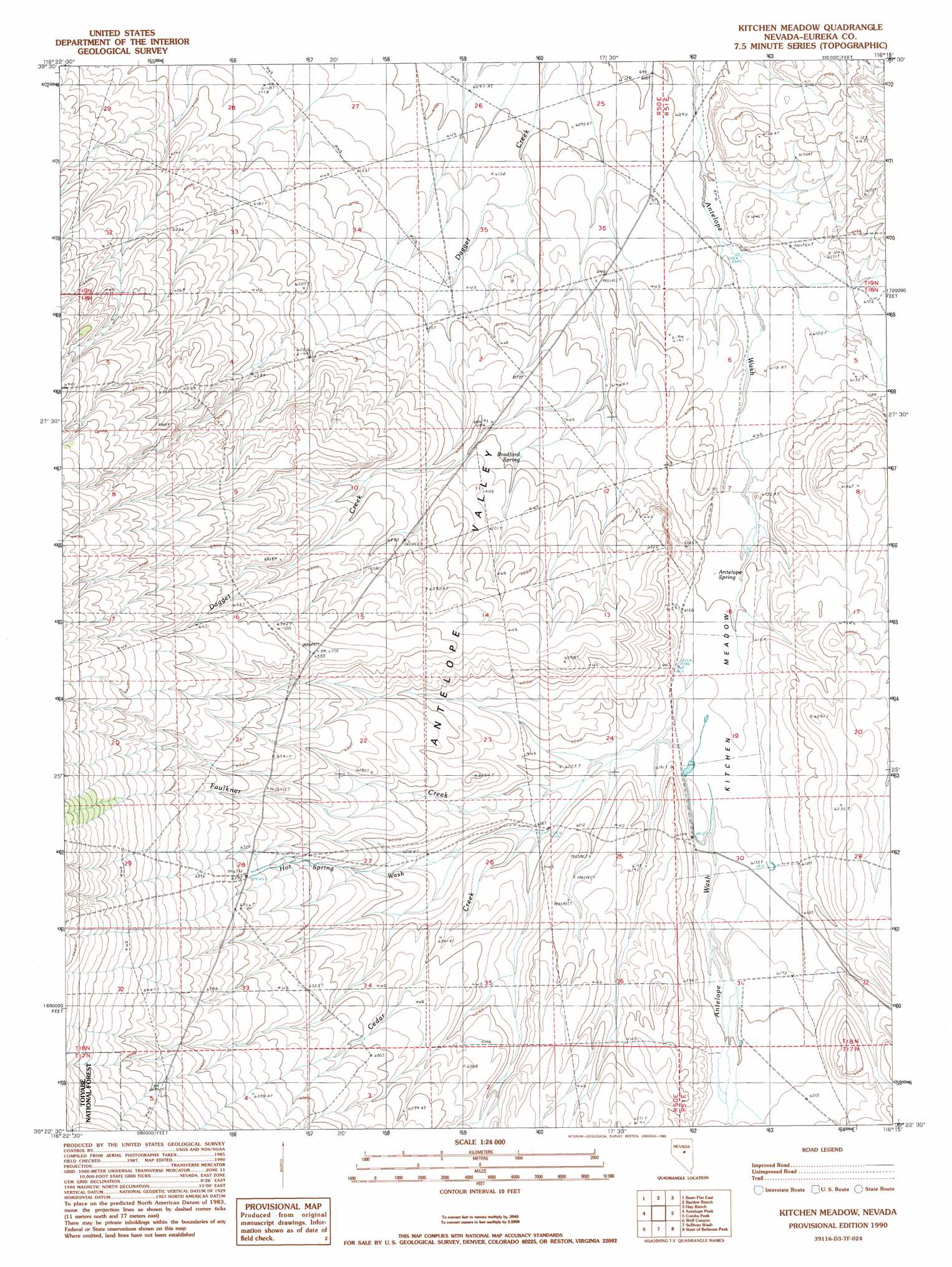
USGS Topo Quad 39116d3 - 1:24,000 scale
| Topo Map Name: | Antelope Meadow |
| USGS Topo Quad ID: | 39116d3 |
| Print Size: | ca. 21 1/4" wide x 27" high |
| Southeast Coordinates: | 39.375° N latitude / 116.25° W longitude |
| Map Center Coordinates: | 39.4375° N latitude / 116.3125° W longitude |
| U.S. State: | NV |
| Filename: | o39116d3.jpg |
| Download Map JPG Image: | Antelope Meadow topo map 1:24,000 scale |
| Map Type: | Topographic |
| Topo Series: | 7.5´ |
| Map Scale: | 1:24,000 |
| Source of Map Images: | United States Geological Survey (USGS) |
| Alternate Map Versions: |
Kitchen Meadow NV 1990, updated 1990 Download PDF Buy paper map Kitchen Meadow NV 2012 Download PDF Buy paper map Kitchen Meadow NV 2015 Download PDF Buy paper map |
| FStopo: | US Forest Service topo Kitchen Meadow is available: Download FStopo PDF Download FStopo TIF |
1:24,000 Topo Quads surrounding Antelope Meadow
Shagnasty |
Bartine Ranch Nw |
Bartine Ranch Ne |
West Of Whistler Mountain |
Whistler Mountain |
Bean Flat West |
Bean Flat East |
Bartine Ranch |
Hay Ranch |
Devon Peak |
Jackrabbit Spring |
Antelope Peak |
Antelope Meadow |
Combs Peak |
Spring Valley Summit |
Wallace Canyon |
Well Canyon |
Sullivan Wash |
West Of Bellevue Peak |
Bellevue Peak |
White Sage Canyon |
Horse Heaven Mountain |
Ninemile Peak |
Cockalorum Spring |
Eightmile Well |
> Back to 39116a1 at 1:100,000 scale
> Back to 39116a1 at 1:250,000 scale
> Back to U.S. Topo Maps home
Antelope Meadow topo map: Gazetteer
Antelope Meadow: Basins
Antelope Valley elevation 1903m 6243′Antelope Meadow: Flats
Antelope Meadow elevation 1882m 6174′Kitchen Meadow elevation 1881m 6171′
Antelope Meadow: Springs
Antelope Spring elevation 1875m 6151′Bradford Spring elevation 1885m 6184′
Klobe Hot Springs elevation 1933m 6341′
Warm Spring elevation 1910m 6266′
Antelope Meadow: Streams
Cedar Creek elevation 1881m 6171′Faulkner Creek elevation 1882m 6174′
Hot Spring Wash elevation 1888m 6194′
Antelope Meadow digital topo map on disk
Buy this Antelope Meadow topo map showing relief, roads, GPS coordinates and other geographical features, as a high-resolution digital map file on DVD: