Bean Flat East Topo Map Nevada
To zoom in, hover over the map of Bean Flat East
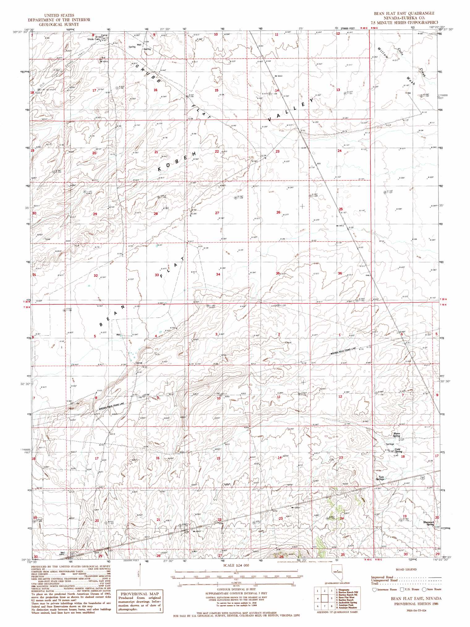
USGS Topo Quad 39116e4 - 1:24,000 scale
| Topo Map Name: | Bean Flat East |
| USGS Topo Quad ID: | 39116e4 |
| Print Size: | ca. 21 1/4" wide x 27" high |
| Southeast Coordinates: | 39.5° N latitude / 116.375° W longitude |
| Map Center Coordinates: | 39.5625° N latitude / 116.4375° W longitude |
| U.S. State: | NV |
| Filename: | o39116e4.jpg |
| Download Map JPG Image: | Bean Flat East topo map 1:24,000 scale |
| Map Type: | Topographic |
| Topo Series: | 7.5´ |
| Map Scale: | 1:24,000 |
| Source of Map Images: | United States Geological Survey (USGS) |
| Alternate Map Versions: |
Bean Flat East NV 1986, updated 1986 Download PDF Buy paper map Bean Flat East NV 2012 Download PDF Buy paper map Bean Flat East NV 2014 Download PDF Buy paper map |
1:24,000 Topo Quads surrounding Bean Flat East
West Of Fagin Mountain |
Fagin Mountain |
Three Bar Ranch |
Roberts Creek Mountain |
Garden Pass |
Salt Marsh Canyon |
Shagnasty |
Bartine Ranch Nw |
Bartine Ranch Ne |
West Of Whistler Mountain |
Ackerman Canyon |
Bean Flat West |
Bean Flat East |
Bartine Ranch |
Hay Ranch |
Hickison Summit |
Jackrabbit Spring |
Antelope Peak |
Antelope Meadow |
Combs Peak |
Potts Well |
Wallace Canyon |
Well Canyon |
Sullivan Wash |
West Of Bellevue Peak |
> Back to 39116e1 at 1:100,000 scale
> Back to 39116a1 at 1:250,000 scale
> Back to U.S. Topo Maps home
Bean Flat East topo map: Gazetteer
Bean Flat East: Flats
Bean Flat elevation 1875m 6151′Grubb Flat elevation 1874m 6148′
Bean Flat East: Springs
Cold Spring elevation 1872m 6141′Shamrock Spring elevation 1875m 6151′
Twin Springs elevation 1874m 6148′
Warm Spring elevation 1872m 6141′
Woods Spring One elevation 1875m 6151′
Woods Spring Three elevation 1882m 6174′
Woods Spring Two elevation 1874m 6148′
Bean Flat East: Streams
Willow Creek elevation 1901m 6236′Bean Flat East: Wells
Grub Flat Well elevation 1871m 6138′Bean Flat East digital topo map on disk
Buy this Bean Flat East topo map showing relief, roads, GPS coordinates and other geographical features, as a high-resolution digital map file on DVD: