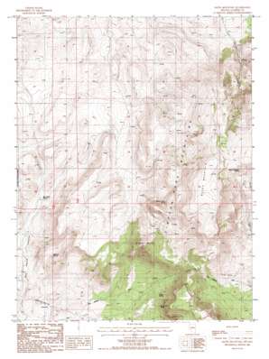
Bates Mountain Topo Map Nevada
To zoom in, hover over the map of Bates Mountain
USGS Topo Quad 39116e7 - 1:24,000 scale
| Topo Map Name: | Bates Mountain |
| USGS Topo Quad ID: | 39116e7 |
| Print Size: | ca. 21 1/4" wide x 27" high |
| Southeast Coordinates: | 39.5° N latitude / 116.75° W longitude |
| Map Center Coordinates: | 39.5625° N latitude / 116.8125° W longitude |
| U.S. State: | NV |
| Filename: | o39116e7.jpg |
| Download Map JPG Image: | Bates Mountain topo map 1:24,000 scale |
| Map Type: | Topographic |
| Topo Series: | 7.5´ |
| Map Scale: | 1:24,000 |
| Source of Map Images: | United States Geological Survey (USGS) |
| Alternate Map Versions: |
Bates Mountain NV 1986, updated 1986 Download PDF Buy paper map Bates Mountain NV 2012 Download PDF Buy paper map Bates Mountain NV 2014 Download PDF Buy paper map |
| FStopo: | US Forest Service topo Bates Mountain is available: Download FStopo PDF Download FStopo TIF |
1:24,000 Topo Quads surrounding Bates Mountain
> Back to 39116e1 at 1:100,000 scale
> Back to 39116a1 at 1:250,000 scale
> Back to U.S. Topo Maps home
Bates Mountain topo map: Gazetteer
Bates Mountain: Springs
Bates Mountain Spring elevation 2576m 8451′Bullrush Spring elevation 2011m 6597′
Dry Creek Spring elevation 2106m 6909′
Indian Ranch Spring elevation 2253m 7391′
Long Spring elevation 2051m 6729′
Rye Patch Spring elevation 1922m 6305′
Bates Mountain: Streams
Indian Creek elevation 2076m 6811′North Fork Steiner Creek elevation 2149m 7050′
Bates Mountain: Summits
Bates Mountain elevation 2724m 8937′Eagle Butte elevation 2555m 8382′
Bates Mountain digital topo map on disk
Buy this Bates Mountain topo map showing relief, roads, GPS coordinates and other geographical features, as a high-resolution digital map file on DVD:


