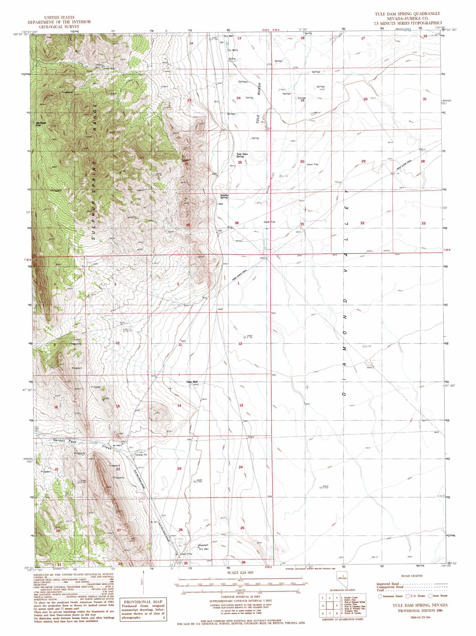
Tule Dam Spring Topo Map Nevada
To zoom in, hover over the map of Tule Dam Spring
USGS Topo Quad 39116g1 - 1:24,000 scale
| Topo Map Name: | Tule Dam Spring |
| USGS Topo Quad ID: | 39116g1 |
| Print Size: | ca. 21 1/4" wide x 27" high |
| Southeast Coordinates: | 39.75° N latitude / 116° W longitude |
| Map Center Coordinates: | 39.8125° N latitude / 116.0625° W longitude |
| U.S. State: | NV |
| Filename: | o39116g1.jpg |
| Download Map JPG Image: | Tule Dam Spring topo map 1:24,000 scale |
| Map Type: | Topographic |
| Topo Series: | 7.5´ |
| Map Scale: | 1:24,000 |
| Source of Map Images: | United States Geological Survey (USGS) |
| Alternate Map Versions: |
Tule Dam Spring NV 1986, updated 1987 Download PDF Buy paper map Tule Dam Spring NV 2012 Download PDF Buy paper map Tule Dam Spring NV 2014 Download PDF Buy paper map |
1:24,000 Topo Quads surrounding Tule Dam Spring
Pete Hanson Creek |
Mineral Hill Sw |
Telegraph Canyon |
West Of Railroad Pass |
Railroad Pass |
Cooper Peak |
Frazier Creek |
Bailey Pass |
West Of Diamond Springs |
Diamond Springs |
Roberts Creek Mountain |
Garden Pass |
Tule Dam Spring |
West Of Christina Peak |
Christina Peak |
Bartine Ranch Ne |
West Of Whistler Mountain |
Whistler Mountain |
North Of Eureka |
Rattlesnake Mountain |
Bartine Ranch |
Hay Ranch |
Devon Peak |
Eureka |
Diamond Peak |
> Back to 39116e1 at 1:100,000 scale
> Back to 39116a1 at 1:250,000 scale
> Back to U.S. Topo Maps home
Tule Dam Spring topo map: Gazetteer
Tule Dam Spring: Gaps
Mulligan Gap elevation 2125m 6971′Tyrone Gap elevation 1836m 6023′
Tule Dam Spring: Springs
Sulphur Spring elevation 1774m 5820′Tule Dam Spring elevation 1774m 5820′
Tule Dam Spring: Streams
Barren Wash elevation 1771m 5810′Garden Pass Creek elevation 1774m 5820′
Tule Dam Spring: Swamps
Tule Marsh elevation 1769m 5803′Tule Dam Spring: Wells
View Well elevation 1787m 5862′Tule Dam Spring digital topo map on disk
Buy this Tule Dam Spring topo map showing relief, roads, GPS coordinates and other geographical features, as a high-resolution digital map file on DVD: