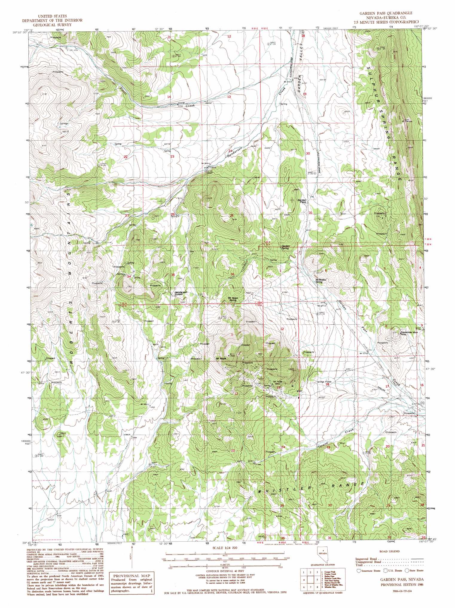
Garden Pass Topo Map Nevada
To zoom in, hover over the map of Garden Pass
USGS Topo Quad 39116g2 - 1:24,000 scale
| Topo Map Name: | Garden Pass |
| USGS Topo Quad ID: | 39116g2 |
| Print Size: | ca. 21 1/4" wide x 27" high |
| Southeast Coordinates: | 39.75° N latitude / 116.125° W longitude |
| Map Center Coordinates: | 39.8125° N latitude / 116.1875° W longitude |
| U.S. State: | NV |
| Filename: | o39116g2.jpg |
| Download Map JPG Image: | Garden Pass topo map 1:24,000 scale |
| Map Type: | Topographic |
| Topo Series: | 7.5´ |
| Map Scale: | 1:24,000 |
| Source of Map Images: | United States Geological Survey (USGS) |
| Alternate Map Versions: |
Garden Pass NV 1986, updated 1986 Download PDF Buy paper map Garden Pass NV 2012 Download PDF Buy paper map Garden Pass NV 2014 Download PDF Buy paper map |
1:24,000 Topo Quads surrounding Garden Pass
Rocky Hills |
Pete Hanson Creek |
Mineral Hill Sw |
Telegraph Canyon |
West Of Railroad Pass |
Tonkin Summit |
Cooper Peak |
Frazier Creek |
Bailey Pass |
West Of Diamond Springs |
Three Bar Ranch |
Roberts Creek Mountain |
Garden Pass |
Tule Dam Spring |
West Of Christina Peak |
Bartine Ranch Nw |
Bartine Ranch Ne |
West Of Whistler Mountain |
Whistler Mountain |
North Of Eureka |
Bean Flat East |
Bartine Ranch |
Hay Ranch |
Devon Peak |
Eureka |
> Back to 39116e1 at 1:100,000 scale
> Back to 39116a1 at 1:250,000 scale
> Back to U.S. Topo Maps home
Garden Pass topo map: Gazetteer
Garden Pass: Mines
Mount Hope Mine elevation 2055m 6742′September Morn Mine elevation 2015m 6610′
Garden Pass: Springs
Garden Spring elevation 2028m 6653′McBrides Spring elevation 1979m 6492′
Mount Hope Spring elevation 2183m 7162′
Garden Pass: Streams
Tyrone Creek elevation 1863m 6112′Vinini Creek elevation 1958m 6423′
Garden Pass: Summits
Henderson Summit elevation 2184m 7165′Mount Hope elevation 2553m 8375′
Garden Pass digital topo map on disk
Buy this Garden Pass topo map showing relief, roads, GPS coordinates and other geographical features, as a high-resolution digital map file on DVD: