North Shoshone Peak Topo Map Nevada
To zoom in, hover over the map of North Shoshone Peak
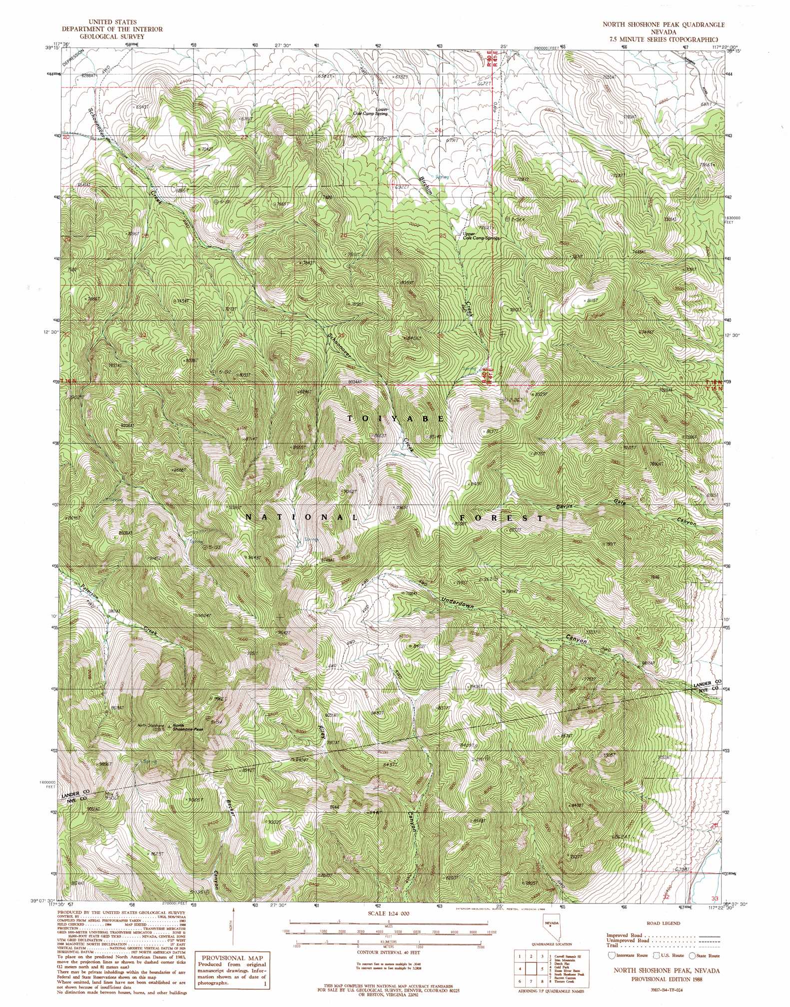
USGS Topo Quad 39117b4 - 1:24,000 scale
| Topo Map Name: | North Shoshone Peak |
| USGS Topo Quad ID: | 39117b4 |
| Print Size: | ca. 21 1/4" wide x 27" high |
| Southeast Coordinates: | 39.125° N latitude / 117.375° W longitude |
| Map Center Coordinates: | 39.1875° N latitude / 117.4375° W longitude |
| U.S. State: | NV |
| Filename: | o39117b4.jpg |
| Download Map JPG Image: | North Shoshone Peak topo map 1:24,000 scale |
| Map Type: | Topographic |
| Topo Series: | 7.5´ |
| Map Scale: | 1:24,000 |
| Source of Map Images: | United States Geological Survey (USGS) |
| Alternate Map Versions: |
North Shoshone Peak NV 1988, updated 1988 Download PDF Buy paper map North Shoshone Peak NV 2012 Download PDF Buy paper map North Shoshone Peak NV 2015 Download PDF Buy paper map |
| FStopo: | US Forest Service topo North Shoshone Peak is available: Download FStopo PDF Download FStopo TIF |
1:24,000 Topo Quads surrounding North Shoshone Peak
Basque Summit |
Carroll Summit Ne |
Emigrant Peak |
Gandolfo Canyon |
West Of Austin |
Carroll Summit |
Carroll Summit Se |
Iron Mountain |
Dutch Flat |
Bunker Hill |
Campbell Creek Ranch |
Gold Park |
North Shoshone Peak |
Reese River Butte |
Brewer Canyon |
Midas Spring |
South Shoshone Peak |
Barrett Canyon |
Tierney Creek |
Millett Ranch |
Ione Nw |
Ione |
Corral Wash |
South Toiyabe Peak |
Carvers Nw |
> Back to 39117a1 at 1:100,000 scale
> Back to 39116a1 at 1:250,000 scale
> Back to U.S. Topo Maps home
North Shoshone Peak topo map: Gazetteer
North Shoshone Peak: Gaps
Elkhorn Pass elevation 2098m 6883′North Shoshone Peak: Springs
Lower Cole Camp Spring elevation 2024m 6640′Upper Cole Camp Springs elevation 2123m 6965′
North Shoshone Peak: Summits
North Shoshone Peak elevation 3118m 10229′North Shoshone Peak digital topo map on disk
Buy this North Shoshone Peak topo map showing relief, roads, GPS coordinates and other geographical features, as a high-resolution digital map file on DVD: