Campbell Creek Ranch Topo Map Nevada
To zoom in, hover over the map of Campbell Creek Ranch
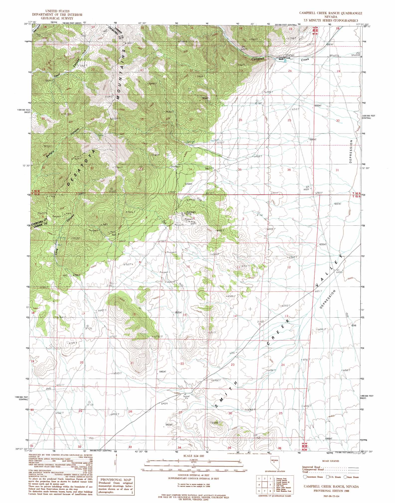
USGS Topo Quad 39117b6 - 1:24,000 scale
| Topo Map Name: | Campbell Creek Ranch |
| USGS Topo Quad ID: | 39117b6 |
| Print Size: | ca. 21 1/4" wide x 27" high |
| Southeast Coordinates: | 39.125° N latitude / 117.625° W longitude |
| Map Center Coordinates: | 39.1875° N latitude / 117.6875° W longitude |
| U.S. State: | NV |
| Filename: | o39117b6.jpg |
| Download Map JPG Image: | Campbell Creek Ranch topo map 1:24,000 scale |
| Map Type: | Topographic |
| Topo Series: | 7.5´ |
| Map Scale: | 1:24,000 |
| Source of Map Images: | United States Geological Survey (USGS) |
| Alternate Map Versions: |
Campbell Creek Ranch NV 1988, updated 1988 Download PDF Buy paper map Campbell Creek Ranch NV 2011 Download PDF Buy paper map Campbell Creek Ranch NV 2015 Download PDF Buy paper map |
1:24,000 Topo Quads surrounding Campbell Creek Ranch
Camp Creek Canyon |
Cold Springs |
Basque Summit |
Carroll Summit Ne |
Emigrant Peak |
Eastgate |
Desatoya Peak |
Carroll Summit |
Carroll Summit Se |
Iron Mountain |
Quartz Mountain Nw |
Buffalo Summit |
Campbell Creek Ranch |
Gold Park |
North Shoshone Peak |
Quartz Mountain |
Burnt Cabin Summit |
Midas Spring |
South Shoshone Peak |
Barrett Canyon |
Downeyville |
Ellsworth |
Ione Nw |
Ione |
Corral Wash |
> Back to 39117a1 at 1:100,000 scale
> Back to 39116a1 at 1:250,000 scale
> Back to U.S. Topo Maps home
Campbell Creek Ranch topo map: Gazetteer
Campbell Creek Ranch: Valleys
Long Canyon elevation 1941m 6368′Campbell Creek Ranch digital topo map on disk
Buy this Campbell Creek Ranch topo map showing relief, roads, GPS coordinates and other geographical features, as a high-resolution digital map file on DVD: