Bunker Hill Topo Map Nevada
To zoom in, hover over the map of Bunker Hill
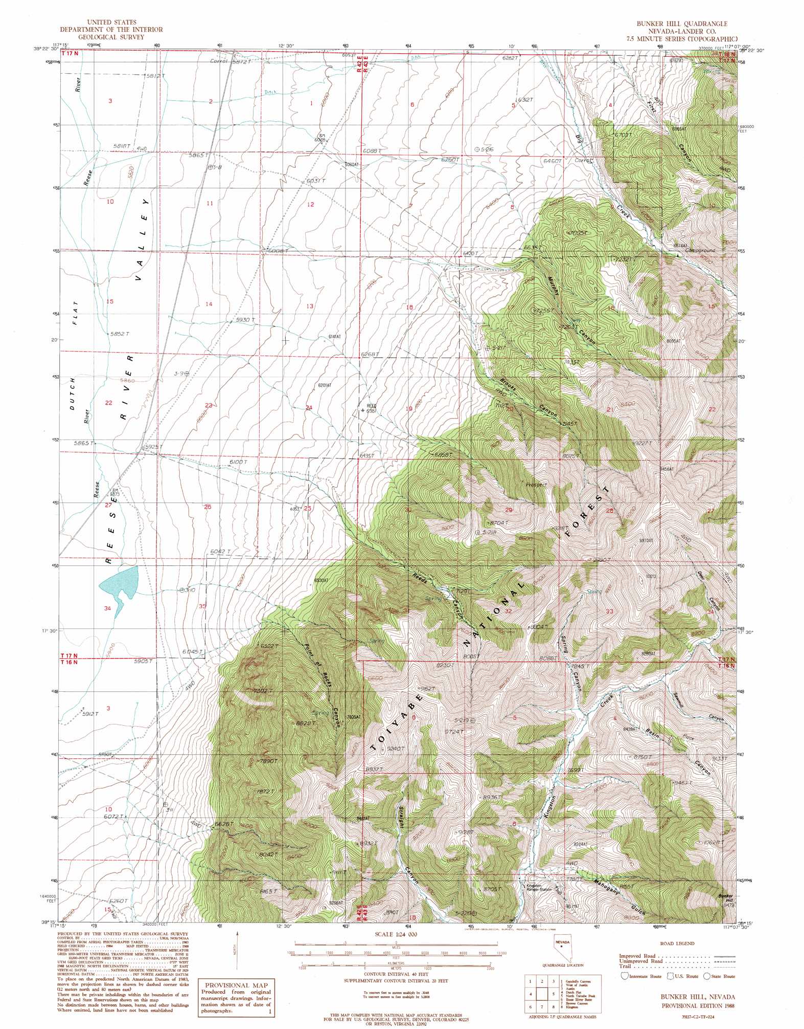
USGS Topo Quad 39117c2 - 1:24,000 scale
| Topo Map Name: | Bunker Hill |
| USGS Topo Quad ID: | 39117c2 |
| Print Size: | ca. 21 1/4" wide x 27" high |
| Southeast Coordinates: | 39.25° N latitude / 117.125° W longitude |
| Map Center Coordinates: | 39.3125° N latitude / 117.1875° W longitude |
| U.S. State: | NV |
| Filename: | o39117c2.jpg |
| Download Map JPG Image: | Bunker Hill topo map 1:24,000 scale |
| Map Type: | Topographic |
| Topo Series: | 7.5´ |
| Map Scale: | 1:24,000 |
| Source of Map Images: | United States Geological Survey (USGS) |
| Alternate Map Versions: |
Bunker Hill NV 1988, updated 1988 Download PDF Buy paper map Bunker Hill NV 2012 Download PDF Buy paper map Bunker Hill NV 2014 Download PDF Buy paper map |
| FStopo: | US Forest Service topo Bunker Hill is available: Download FStopo PDF Download FStopo TIF |
1:24,000 Topo Quads surrounding Bunker Hill
Mount Airy |
Mount Airy Mesa |
Vigus Butte |
Yankee Blade |
Barton Spring |
Emigrant Peak |
Gandolfo Canyon |
West Of Austin |
Austin |
Simpson Park Canyon |
Iron Mountain |
Dutch Flat |
Bunker Hill |
North Toiyabe Peak |
Birch Creek Ranch |
North Shoshone Peak |
Reese River Butte |
Brewer Canyon |
Kingston |
Wildcat Peak Nw |
Barrett Canyon |
Tierney Creek |
Millett Ranch |
East Of Millett Ranch |
Wildcat Canyon |
> Back to 39117a1 at 1:100,000 scale
> Back to 39116a1 at 1:250,000 scale
> Back to U.S. Topo Maps home
Bunker Hill topo map: Gazetteer
Bunker Hill: Cliffs
Point of Rocks elevation 2184m 7165′Bunker Hill: Populated Places
Canyon City (historical) elevation 2035m 6676′Watertown (historical) elevation 2073m 6801′
Bunker Hill: Post Offices
Canyon City Post Office (historical) elevation 2035m 6676′Bunker Hill: Summits
Big Creek Peak elevation 3053m 10016′Bunker Hill: Valleys
Basin Canyon elevation 2364m 7755′Big Creek Canyon elevation 1926m 6318′
Brooks Canyon elevation 1924m 6312′
Deer Canyon elevation 2434m 7985′
Mahogany Gulch elevation 2320m 7611′
Murphy Canyon elevation 1892m 6207′
Point of Rocks Canyon elevation 1978m 6489′
Reeds Canyon elevation 1902m 6240′
Sawmill Canyon elevation 2387m 7831′
Spring Canyon elevation 2548m 8359′
Bunker Hill digital topo map on disk
Buy this Bunker Hill topo map showing relief, roads, GPS coordinates and other geographical features, as a high-resolution digital map file on DVD: