Desatoya Peak Topo Map Nevada
To zoom in, hover over the map of Desatoya Peak
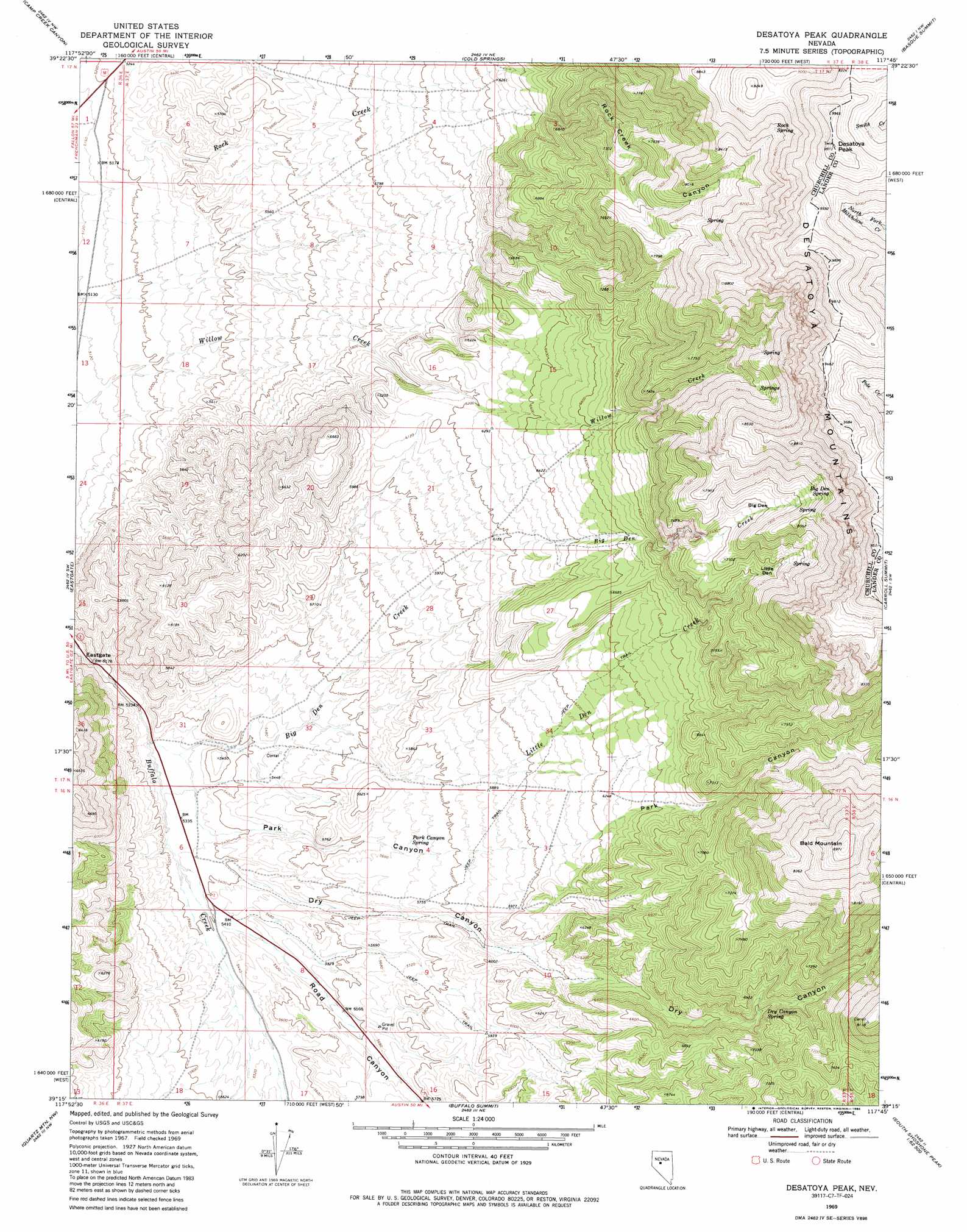
USGS Topo Quad 39117c7 - 1:24,000 scale
| Topo Map Name: | Desatoya Peak |
| USGS Topo Quad ID: | 39117c7 |
| Print Size: | ca. 21 1/4" wide x 27" high |
| Southeast Coordinates: | 39.25° N latitude / 117.75° W longitude |
| Map Center Coordinates: | 39.3125° N latitude / 117.8125° W longitude |
| U.S. State: | NV |
| Filename: | o39117c7.jpg |
| Download Map JPG Image: | Desatoya Peak topo map 1:24,000 scale |
| Map Type: | Topographic |
| Topo Series: | 7.5´ |
| Map Scale: | 1:24,000 |
| Source of Map Images: | United States Geological Survey (USGS) |
| Alternate Map Versions: |
Desatoya Peak NV 1969, updated 1972 Download PDF Buy paper map Desatoya Peak NV 1969, updated 1986 Download PDF Buy paper map Desatoya Peak NV 2012 Download PDF Buy paper map Desatoya Peak NV 2014 Download PDF Buy paper map |
1:24,000 Topo Quads surrounding Desatoya Peak
Dixie Valley Se |
Mount Augusta |
Clan Alpine Ranch |
Byers Ranch |
New Pass |
Wonder Mountain |
Camp Creek Canyon |
Cold Springs |
Basque Summit |
Carroll Summit Ne |
West Gate |
Eastgate |
Desatoya Peak |
Carroll Summit |
Carroll Summit Se |
Bell Mountain |
Quartz Mountain Nw |
Buffalo Summit |
Campbell Creek Ranch |
Gold Park |
Broken Hills |
Quartz Mountain |
Burnt Cabin Summit |
Midas Spring |
South Shoshone Peak |
> Back to 39117a1 at 1:100,000 scale
> Back to 39116a1 at 1:250,000 scale
> Back to U.S. Topo Maps home
Desatoya Peak topo map: Gazetteer
Desatoya Peak: Basins
Big Den elevation 2281m 7483′Little Den elevation 2195m 7201′
Desatoya Peak: Gaps
Eastgate elevation 1567m 5141′Desatoya Peak: Springs
Big Den Spring elevation 2455m 8054′Dry Canyon Spring elevation 2017m 6617′
Park Canyon Spring elevation 1736m 5695′
Rock Spring elevation 2631m 8631′
Desatoya Peak: Streams
Big Den Creek elevation 1613m 5291′Buffalo Creek elevation 1609m 5278′
Little Den Creek elevation 1672m 5485′
North Ford Big Dew Creek elevation 1639m 5377′
Road Canyon Creek elevation 1636m 5367′
Desatoya Peak: Summits
Bald Mountain elevation 2711m 8894′Desatoya North Twin elevation 3027m 9931′
Desatoya Peak elevation 2995m 9826′
Desatoya Peak: Valleys
Dry Canyon elevation 1643m 5390′Park Canyon elevation 1628m 5341′
Road Canyon elevation 1648m 5406′
Rock Creek Canyon elevation 1924m 6312′
Desatoya Peak digital topo map on disk
Buy this Desatoya Peak topo map showing relief, roads, GPS coordinates and other geographical features, as a high-resolution digital map file on DVD: