Carroll Summit Ne Topo Map Nevada
To zoom in, hover over the map of Carroll Summit Ne
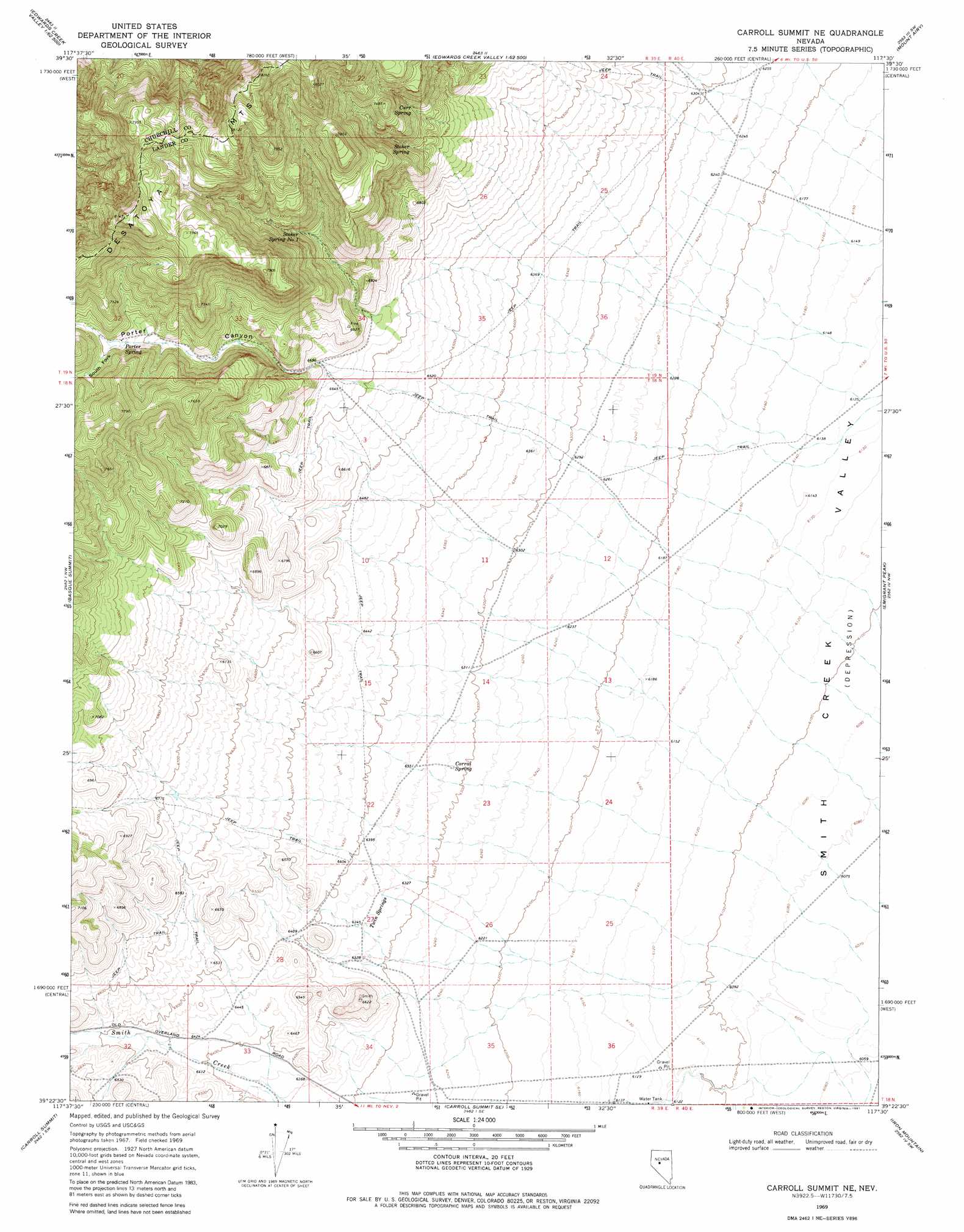
USGS Topo Quad 39117d5 - 1:24,000 scale
| Topo Map Name: | Carroll Summit Ne |
| USGS Topo Quad ID: | 39117d5 |
| Print Size: | ca. 21 1/4" wide x 27" high |
| Southeast Coordinates: | 39.375° N latitude / 117.5° W longitude |
| Map Center Coordinates: | 39.4375° N latitude / 117.5625° W longitude |
| U.S. State: | NV |
| Filename: | o39117d5.jpg |
| Download Map JPG Image: | Carroll Summit Ne topo map 1:24,000 scale |
| Map Type: | Topographic |
| Topo Series: | 7.5´ |
| Map Scale: | 1:24,000 |
| Source of Map Images: | United States Geological Survey (USGS) |
| Alternate Map Versions: |
Carroll Summit NE NV 1969, updated 1972 Download PDF Buy paper map Carroll Summit NE NV 1969, updated 1981 Download PDF Buy paper map Carroll Summit NE NV 2011 Download PDF Buy paper map Carroll Summit NE NV 2015 Download PDF Buy paper map |
1:24,000 Topo Quads surrounding Carroll Summit Ne
Byers Canyon |
Tungsten Mountain |
New Pass Well |
New Pass Peak |
Mount Airy Ne |
Clan Alpine Ranch |
Byers Ranch |
New Pass |
Mount Airy |
Mount Airy Mesa |
Cold Springs |
Basque Summit |
Carroll Summit Ne |
Emigrant Peak |
Gandolfo Canyon |
Desatoya Peak |
Carroll Summit |
Carroll Summit Se |
Iron Mountain |
Dutch Flat |
Buffalo Summit |
Campbell Creek Ranch |
Gold Park |
North Shoshone Peak |
Reese River Butte |
> Back to 39117a1 at 1:100,000 scale
> Back to 39116a1 at 1:250,000 scale
> Back to U.S. Topo Maps home
Carroll Summit Ne topo map: Gazetteer
Carroll Summit Ne: Springs
Carr Spring elevation 2167m 7109′Corral Spring elevation 1928m 6325′
Porter Spring elevation 2181m 7155′
Stoker Spring elevation 2129m 6984′
Stoker Spring Number One elevation 2144m 7034′
Twin Springs elevation 1935m 6348′
Carroll Summit Ne: Streams
Porter Creek elevation 1922m 6305′Carroll Summit Ne: Valleys
Porter Canyon elevation 2032m 6666′South Fork Porter Canyon elevation 2188m 7178′
Carroll Summit Ne digital topo map on disk
Buy this Carroll Summit Ne topo map showing relief, roads, GPS coordinates and other geographical features, as a high-resolution digital map file on DVD: