Mount Airy Ne Topo Map Nevada
To zoom in, hover over the map of Mount Airy Ne
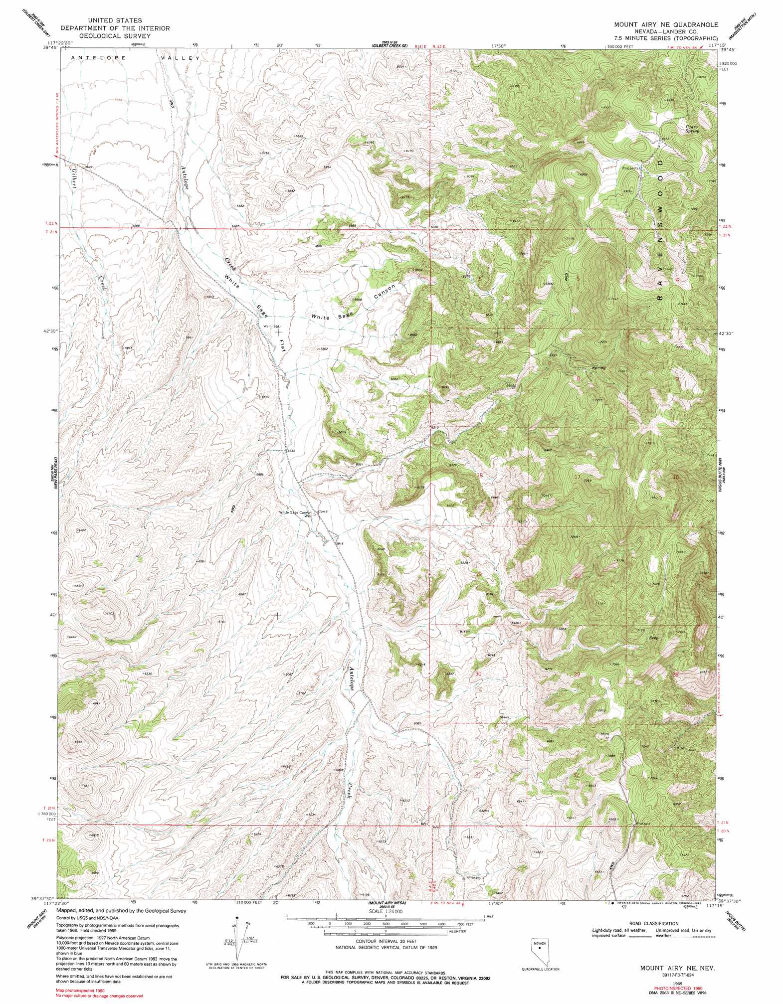
USGS Topo Quad 39117f3 - 1:24,000 scale
| Topo Map Name: | Mount Airy Ne |
| USGS Topo Quad ID: | 39117f3 |
| Print Size: | ca. 21 1/4" wide x 27" high |
| Southeast Coordinates: | 39.625° N latitude / 117.25° W longitude |
| Map Center Coordinates: | 39.6875° N latitude / 117.3125° W longitude |
| U.S. State: | NV |
| Filename: | o39117f3.jpg |
| Download Map JPG Image: | Mount Airy Ne topo map 1:24,000 scale |
| Map Type: | Topographic |
| Topo Series: | 7.5´ |
| Map Scale: | 1:24,000 |
| Source of Map Images: | United States Geological Survey (USGS) |
| Alternate Map Versions: |
Mount Airy NE NV 1969, updated 1971 Download PDF Buy paper map Mount Airy NE NV 1969, updated 1991 Download PDF Buy paper map Mount Airy NE NV 2011 Download PDF Buy paper map Mount Airy NE NV 2014 Download PDF Buy paper map |
1:24,000 Topo Quads surrounding Mount Airy Ne
Shoshone Meadows Ne |
Gilbert Creek Nw |
Gilbert Creek Ne |
Manhattan Mountain Nw |
Manhattan Mountain Ne |
Shoshone Meadows Se |
Gilbert Creek Sw |
Gilbert Creek Se |
Manhattan Mountain |
Joe Eason Mountain |
New Pass Well |
New Pass Peak |
Mount Airy Ne |
Vigus Butte Nw |
Vigus Butte Ne |
New Pass |
Mount Airy |
Mount Airy Mesa |
Vigus Butte |
Yankee Blade |
Carroll Summit Ne |
Emigrant Peak |
Gandolfo Canyon |
West Of Austin |
Austin |
> Back to 39117e1 at 1:100,000 scale
> Back to 39116a1 at 1:250,000 scale
> Back to U.S. Topo Maps home
Mount Airy Ne topo map: Gazetteer
Mount Airy Ne: Flats
White Sage Flat elevation 1727m 5666′Mount Airy Ne: Ranges
Ravenswood elevation 2059m 6755′Mount Airy Ne: Springs
Cadro Spring elevation 2101m 6893′Mount Airy Ne: Valleys
White Sage Canyon elevation 1734m 5688′Mount Airy Ne: Wells
Laborde Well Number Six elevation 1733m 5685′White Sage Canyon Well elevation 1768m 5800′
Mount Airy Ne digital topo map on disk
Buy this Mount Airy Ne topo map showing relief, roads, GPS coordinates and other geographical features, as a high-resolution digital map file on DVD: