New Pass Well Topo Map Nevada
To zoom in, hover over the map of New Pass Well
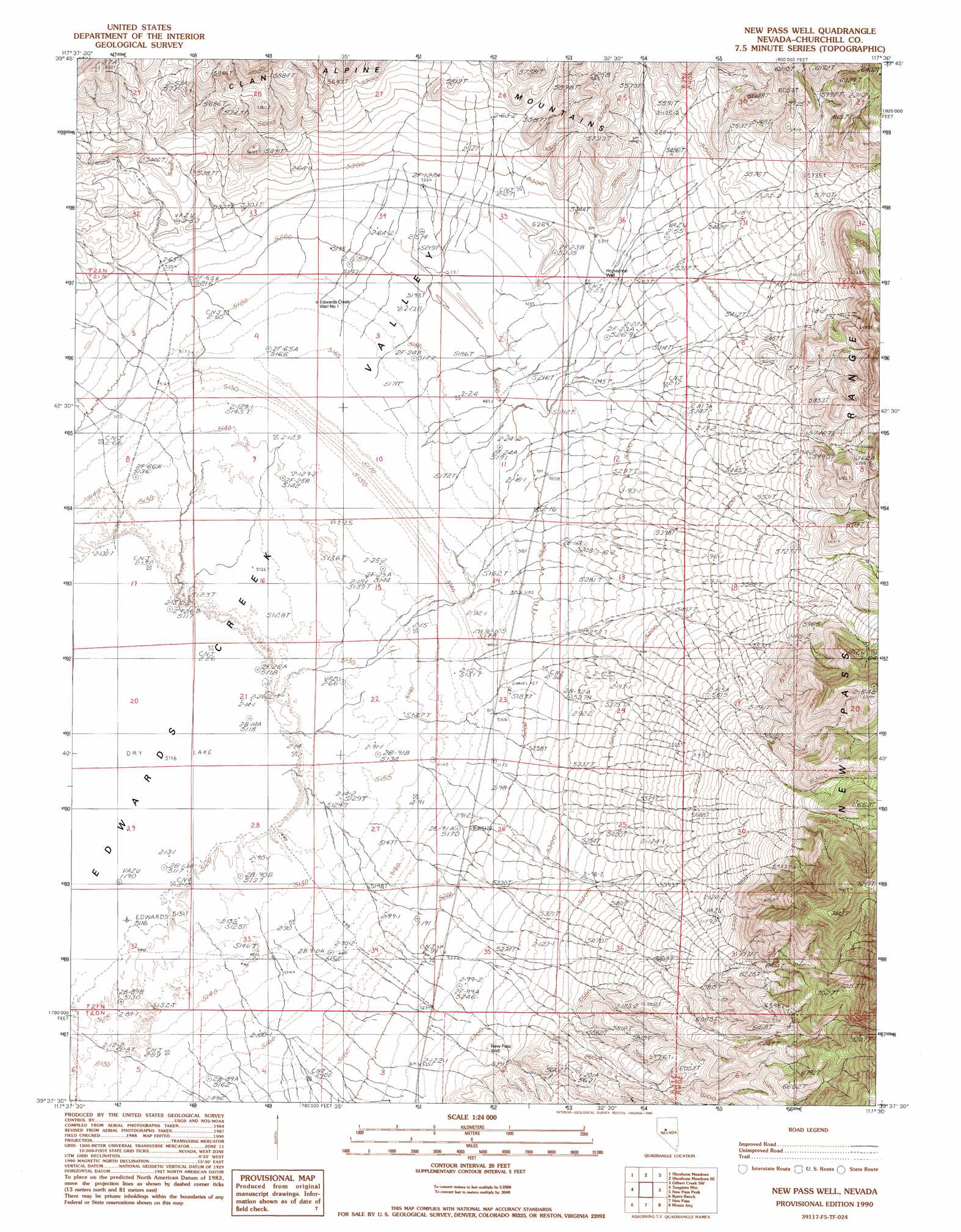
USGS Topo Quad 39117f5 - 1:24,000 scale
| Topo Map Name: | New Pass Well |
| USGS Topo Quad ID: | 39117f5 |
| Print Size: | ca. 21 1/4" wide x 27" high |
| Southeast Coordinates: | 39.625° N latitude / 117.5° W longitude |
| Map Center Coordinates: | 39.6875° N latitude / 117.5625° W longitude |
| U.S. State: | NV |
| Filename: | o39117f5.jpg |
| Download Map JPG Image: | New Pass Well topo map 1:24,000 scale |
| Map Type: | Topographic |
| Topo Series: | 7.5´ |
| Map Scale: | 1:24,000 |
| Source of Map Images: | United States Geological Survey (USGS) |
| Alternate Map Versions: |
New Pass Well NV 1990, updated 1990 Download PDF Buy paper map New Pass Well NV 2011 Download PDF Buy paper map New Pass Well NV 2014 Download PDF Buy paper map |
1:24,000 Topo Quads surrounding New Pass Well
Boyer Ranch |
Hole In The Wall |
Shoshone Meadows Ne |
Gilbert Creek Nw |
Gilbert Creek Ne |
Bernice Canyon |
Shoshone Meadows |
Shoshone Meadows Se |
Gilbert Creek Sw |
Gilbert Creek Se |
Byers Canyon |
Tungsten Mountain |
New Pass Well |
New Pass Peak |
Mount Airy Ne |
Clan Alpine Ranch |
Byers Ranch |
New Pass |
Mount Airy |
Mount Airy Mesa |
Cold Springs |
Basque Summit |
Carroll Summit Ne |
Emigrant Peak |
Gandolfo Canyon |
> Back to 39117e1 at 1:100,000 scale
> Back to 39116a1 at 1:250,000 scale
> Back to U.S. Topo Maps home
New Pass Well topo map: Gazetteer
New Pass Well: Wells
Edwards Creek Well Number One elevation 1578m 5177′Horseshoe Well elevation 1615m 5298′
New Pass Well elevation 1626m 5334′
New Pass Well digital topo map on disk
Buy this New Pass Well topo map showing relief, roads, GPS coordinates and other geographical features, as a high-resolution digital map file on DVD: