Gilbert Creek Sw Topo Map Nevada
To zoom in, hover over the map of Gilbert Creek Sw
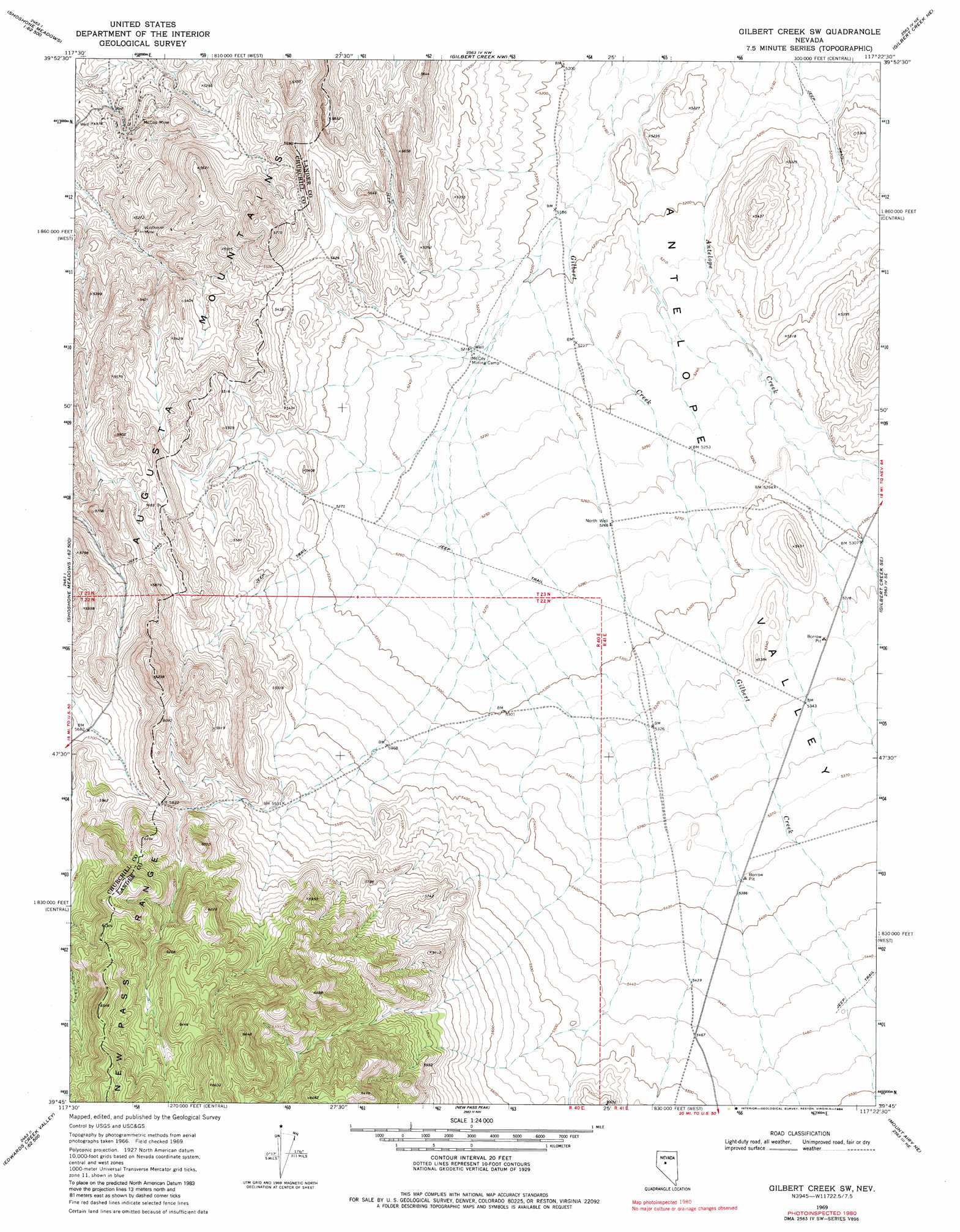
USGS Topo Quad 39117g4 - 1:24,000 scale
| Topo Map Name: | Gilbert Creek Sw |
| USGS Topo Quad ID: | 39117g4 |
| Print Size: | ca. 21 1/4" wide x 27" high |
| Southeast Coordinates: | 39.75° N latitude / 117.375° W longitude |
| Map Center Coordinates: | 39.8125° N latitude / 117.4375° W longitude |
| U.S. State: | NV |
| Filename: | o39117g4.jpg |
| Download Map JPG Image: | Gilbert Creek Sw topo map 1:24,000 scale |
| Map Type: | Topographic |
| Topo Series: | 7.5´ |
| Map Scale: | 1:24,000 |
| Source of Map Images: | United States Geological Survey (USGS) |
| Alternate Map Versions: |
Gilbert Creek SW NV 1969, updated 1971 Download PDF Buy paper map Gilbert Creek SW NV 1969, updated 1984 Download PDF Buy paper map Gilbert Creek SW NV 2011 Download PDF Buy paper map Gilbert Creek SW NV 2014 Download PDF Buy paper map |
1:24,000 Topo Quads surrounding Gilbert Creek Sw
Sou Hot Springs |
Cain Mountain |
Home Station Gap |
Mount Moses Se |
The Cedars Sw |
Hole In The Wall |
Shoshone Meadows Ne |
Gilbert Creek Nw |
Gilbert Creek Ne |
Manhattan Mountain Nw |
Shoshone Meadows |
Shoshone Meadows Se |
Gilbert Creek Sw |
Gilbert Creek Se |
Manhattan Mountain |
Tungsten Mountain |
New Pass Well |
New Pass Peak |
Mount Airy Ne |
Vigus Butte Nw |
Byers Ranch |
New Pass |
Mount Airy |
Mount Airy Mesa |
Vigus Butte |
> Back to 39117e1 at 1:100,000 scale
> Back to 39116a1 at 1:250,000 scale
> Back to U.S. Topo Maps home
Gilbert Creek Sw topo map: Gazetteer
Gilbert Creek Sw: Gaps
Soldiers Spring Pass elevation 1694m 5557′Gilbert Creek Sw: Mines
Black Devil Mine elevation 1664m 5459′McCoy Mine elevation 1581m 5187′
Wildhorse Mine elevation 1576m 5170′
Gilbert Creek Sw: Wells
North Well elevation 1606m 5269′Gilbert Creek Sw digital topo map on disk
Buy this Gilbert Creek Sw topo map showing relief, roads, GPS coordinates and other geographical features, as a high-resolution digital map file on DVD: