Bell Mountain Topo Map Nevada
To zoom in, hover over the map of Bell Mountain
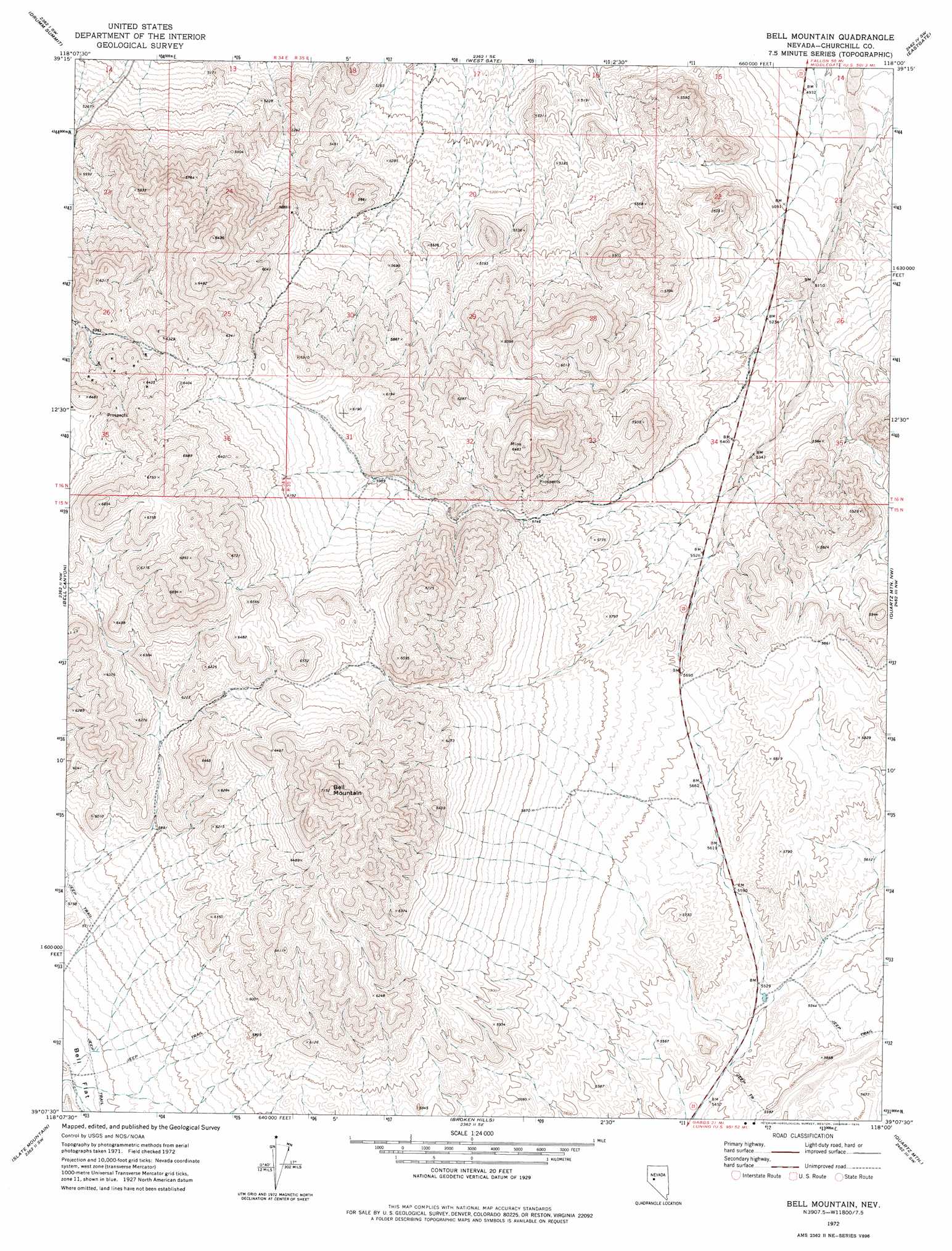
USGS Topo Quad 39118b1 - 1:24,000 scale
| Topo Map Name: | Bell Mountain |
| USGS Topo Quad ID: | 39118b1 |
| Print Size: | ca. 21 1/4" wide x 27" high |
| Southeast Coordinates: | 39.125° N latitude / 118° W longitude |
| Map Center Coordinates: | 39.1875° N latitude / 118.0625° W longitude |
| U.S. State: | NV |
| Filename: | o39118b1.jpg |
| Download Map JPG Image: | Bell Mountain topo map 1:24,000 scale |
| Map Type: | Topographic |
| Topo Series: | 7.5´ |
| Map Scale: | 1:24,000 |
| Source of Map Images: | United States Geological Survey (USGS) |
| Alternate Map Versions: |
Bell Mountain NV 1972, updated 1975 Download PDF Buy paper map Bell Mountain NV 2011 Download PDF Buy paper map Bell Mountain NV 2014 Download PDF Buy paper map |
1:24,000 Topo Quads surrounding Bell Mountain
La Plata Canyon |
Pirouette Mountain |
Wonder Mountain |
Camp Creek Canyon |
Cold Springs |
Frenchman |
Drumm Summit |
West Gate |
Eastgate |
Desatoya Peak |
Chukar Canyon |
Bell Canyon |
Bell Mountain |
Quartz Mountain Nw |
Buffalo Summit |
Big Kasock Mountain |
Slate Mountain |
Broken Hills |
Quartz Mountain |
Burnt Cabin Summit |
Murphys Well |
Mount Annie |
Mount Annie Ne |
Downeyville |
Ellsworth |
> Back to 39118a1 at 1:100,000 scale
> Back to 39118a1 at 1:250,000 scale
> Back to U.S. Topo Maps home
Bell Mountain topo map: Gazetteer
Bell Mountain: Mines
Gold Basin Mine elevation 1904m 6246′Bell Mountain: Ranges
West Gate Range elevation 1868m 6128′Bell Mountain: Summits
Bell Mountain elevation 2167m 7109′Bell Mountain digital topo map on disk
Buy this Bell Mountain topo map showing relief, roads, GPS coordinates and other geographical features, as a high-resolution digital map file on DVD: