Bunejug Mountains Topo Map Nevada
To zoom in, hover over the map of Bunejug Mountains
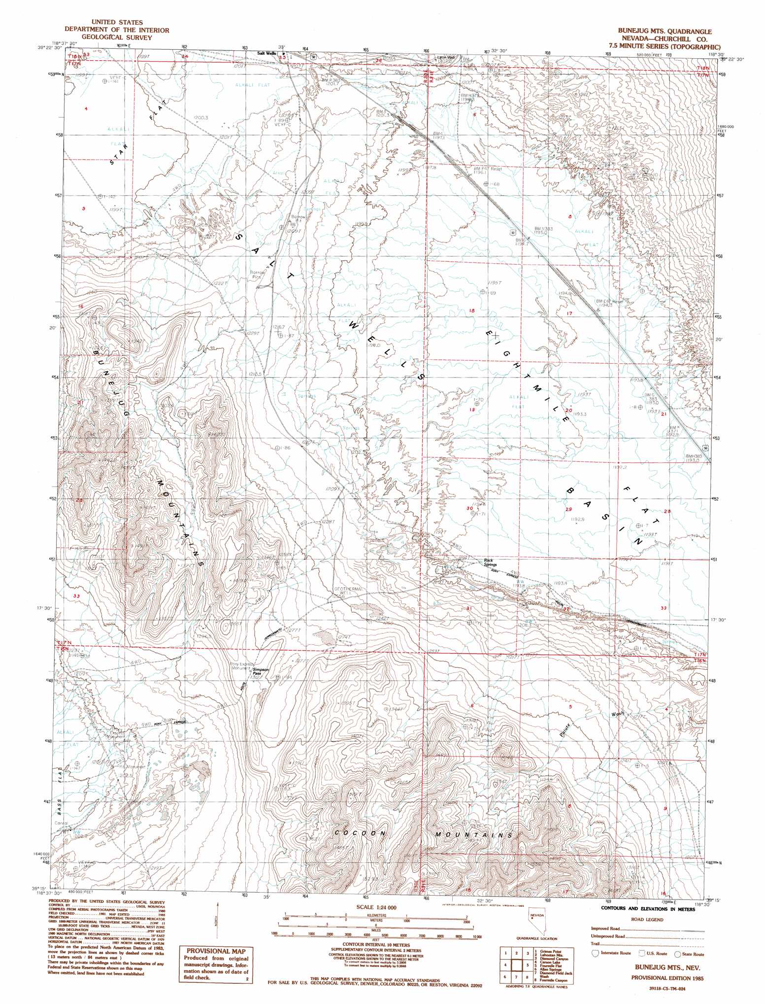
USGS Topo Quad 39118c5 - 1:24,000 scale
| Topo Map Name: | Bunejug Mountains |
| USGS Topo Quad ID: | 39118c5 |
| Print Size: | ca. 21 1/4" wide x 27" high |
| Southeast Coordinates: | 39.25° N latitude / 118.5° W longitude |
| Map Center Coordinates: | 39.3125° N latitude / 118.5625° W longitude |
| U.S. State: | NV |
| Filename: | o39118c5.jpg |
| Download Map JPG Image: | Bunejug Mountains topo map 1:24,000 scale |
| Map Type: | Topographic |
| Topo Series: | 7.5´ |
| Map Scale: | 1:24,000 |
| Source of Map Images: | United States Geological Survey (USGS) |
| Alternate Map Versions: |
Bunejug Mts. NV 1985, updated 1985 Download PDF Buy paper map Bunejug Mountains NV 2011 Download PDF Buy paper map Bunejug Mountains NV 2014 Download PDF Buy paper map |
1:24,000 Topo Quads surrounding Bunejug Mountains
Soda Lake East |
Indian Lakes |
Stillwater |
Foxtail Lake |
Table Mountain |
Fallon |
Grimes Point |
Lahontan Mountains |
Diamond Canyon |
La Plata Canyon |
South Of Fallon |
Carson Lake |
Bunejug Mountains |
Fourmile Flat |
Frenchman |
Russell Spit |
Allen Springs |
Diamond Field Jack Wash |
Fourmile Canyon |
Chukar Canyon |
Weber Dam |
Terrill Mountains |
Red Ridge |
Rawhide |
Big Kasock Mountain |
> Back to 39118a1 at 1:100,000 scale
> Back to 39118a1 at 1:250,000 scale
> Back to U.S. Topo Maps home
Bunejug Mountains topo map: Gazetteer
Bunejug Mountains: Flats
Eightmile Flat elevation 1195m 3920′Star Flat elevation 1199m 3933′
Bunejug Mountains: Gaps
Simpson Pass elevation 1313m 4307′Bunejug Mountains: Parks
Pony Express Monument elevation 1207m 3959′Pony Express Monument elevation 1313m 4307′
Pony Express Monument elevation 1203m 3946′
Bunejug Mountains: Ranges
Bunejug Mountains elevation 1492m 4895′Bunejug Mountains: Springs
Borax Spring elevation 1205m 3953′Rock Springs elevation 1195m 3920′
Bunejug Mountains: Streams
Diamond Creek elevation 1213m 3979′Paiute Wash elevation 1202m 3943′
Bunejug Mountains: Wells
Lattin Well elevation 1208m 3963′Lattin Well elevation 1195m 3920′
Bunejug Mountains digital topo map on disk
Buy this Bunejug Mountains topo map showing relief, roads, GPS coordinates and other geographical features, as a high-resolution digital map file on DVD: