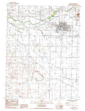
Fallon Topo Map Nevada
To zoom in, hover over the map of Fallon
USGS Topo Quad 39118d7 - 1:24,000 scale
| Topo Map Name: | Fallon |
| USGS Topo Quad ID: | 39118d7 |
| Print Size: | ca. 21 1/4" wide x 27" high |
| Southeast Coordinates: | 39.375° N latitude / 118.75° W longitude |
| Map Center Coordinates: | 39.4375° N latitude / 118.8125° W longitude |
| U.S. State: | NV |
| Filename: | o39118d7.jpg |
| Download Map JPG Image: | Fallon topo map 1:24,000 scale |
| Map Type: | Topographic |
| Topo Series: | 7.5´ |
| Map Scale: | 1:24,000 |
| Source of Map Images: | United States Geological Survey (USGS) |
| Alternate Map Versions: |
Fallon NV 1985, updated 1985 Download PDF Buy paper map Fallon NV 1985, updated 1992 Download PDF Buy paper map Fallon NV 2011 Download PDF Buy paper map Fallon NV 2014 Download PDF Buy paper map |
1:24,000 Topo Quads surrounding Fallon
> Back to 39118a1 at 1:100,000 scale
> Back to 39118a1 at 1:250,000 scale
> Back to U.S. Topo Maps home
Fallon topo map: Gazetteer
Fallon: Airports
Fallon Municipal Airport elevation 1206m 3956′Fallon: Canals
A Line Canal elevation 1205m 3953′E Line Canal elevation 1211m 3973′
Gummow Drain elevation 1203m 3946′
L D Drain elevation 1205m 3953′
L Line Canal elevation 1205m 3953′
L2 Drain elevation 1204m 3950′
Mills Drain elevation 1211m 3973′
New River Extension Branch Drain elevation 1213m 3979′
Sheckler 1 Drain elevation 1215m 3986′
Sheckler Drain elevation 1213m 3979′
South Upper Soda Lake Drain elevation 1212m 3976′
Thoma Drain elevation 1209m 3966′
Upper Soda Lake 1 Drain elevation 1215m 3986′
Upper Soda Lake Drain elevation 1214m 3982′
Westside Drain elevation 1209m 3966′
Fallon: Dams
Coleman Diversion Dam elevation 1213m 3979′Fallon: Parks
Churchill County Regional Park elevation 1208m 3963′Oats Park elevation 1207m 3959′
Fallon: Populated Places
Fallon elevation 1207m 3959′Island City (historical) elevation 1203m 3946′
Saint Clair elevation 1209m 3966′
Saint Clair Station (historical) elevation 1213m 3979′
Fallon: Post Offices
Fallon Post Office elevation 1208m 3963′Island City Post Office (historical) elevation 1203m 3946′
Saint Clair Post Office (historical) elevation 1209m 3966′
Saint Clair Station Post Office (historical) elevation 1213m 3979′
Fallon: Summits
Rattlesnake Hill elevation 1269m 4163′Fallon digital topo map on disk
Buy this Fallon topo map showing relief, roads, GPS coordinates and other geographical features, as a high-resolution digital map file on DVD:


