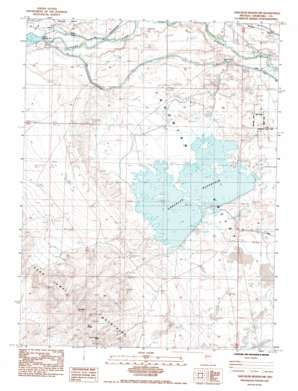
Sheckler Reservoir Topo Map Nevada
To zoom in, hover over the map of Sheckler Reservoir
USGS Topo Quad 39118d8 - 1:24,000 scale
| Topo Map Name: | Sheckler Reservoir |
| USGS Topo Quad ID: | 39118d8 |
| Print Size: | ca. 21 1/4" wide x 27" high |
| Southeast Coordinates: | 39.375° N latitude / 118.875° W longitude |
| Map Center Coordinates: | 39.4375° N latitude / 118.9375° W longitude |
| U.S. State: | NV |
| Filename: | o39118d8.jpg |
| Download Map JPG Image: | Sheckler Reservoir topo map 1:24,000 scale |
| Map Type: | Topographic |
| Topo Series: | 7.5´ |
| Map Scale: | 1:24,000 |
| Source of Map Images: | United States Geological Survey (USGS) |
| Alternate Map Versions: |
Sheckler Reservoir NV 1985, updated 1985 Download PDF Buy paper map Sheckler Reservoir NV 2011 Download PDF Buy paper map Sheckler Reservoir NV 2014 Download PDF Buy paper map |
1:24,000 Topo Quads surrounding Sheckler Reservoir
> Back to 39118a1 at 1:100,000 scale
> Back to 39118a1 at 1:250,000 scale
> Back to U.S. Topo Maps home
Sheckler Reservoir topo map: Gazetteer
Sheckler Reservoir: Basins
Lahontan Valley elevation 1221m 4005′Sheckler Reservoir: Canals
N Line Canal elevation 1224m 4015′Upper West Side Drain elevation 1217m 3992′
V Line Canal elevation 1233m 4045′
Sheckler Reservoir: Dams
Carson Diversion Dam elevation 1229m 4032′Sheckler Dam elevation 1217m 3992′
Sheckler Reservoir: Falls
Twenty Six Foot Drop elevation 1225m 4019′Sheckler Reservoir: Mines
Camp Gregory Mine elevation 1419m 4655′Sheckler Reservoir: Populated Places
Gregory (historical) elevation 1346m 4416′Willowtown (historical) elevation 1227m 4025′
Sheckler Reservoir: Reservoirs
Sheckler Reservoir elevation 1217m 3992′Sheckler Reservoir: Summits
Red Mountain elevation 1622m 5321′The Nipple elevation 1559m 5114′
Sheckler Reservoir digital topo map on disk
Buy this Sheckler Reservoir topo map showing relief, roads, GPS coordinates and other geographical features, as a high-resolution digital map file on DVD:


