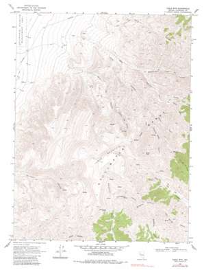
Table Mountain Topo Map Nevada
To zoom in, hover over the map of Table Mountain
USGS Topo Quad 39118e3 - 1:24,000 scale
| Topo Map Name: | Table Mountain |
| USGS Topo Quad ID: | 39118e3 |
| Print Size: | ca. 21 1/4" wide x 27" high |
| Southeast Coordinates: | 39.5° N latitude / 118.25° W longitude |
| Map Center Coordinates: | 39.5625° N latitude / 118.3125° W longitude |
| U.S. State: | NV |
| Filename: | o39118e3.jpg |
| Download Map JPG Image: | Table Mountain topo map 1:24,000 scale |
| Map Type: | Topographic |
| Topo Series: | 7.5´ |
| Map Scale: | 1:24,000 |
| Source of Map Images: | United States Geological Survey (USGS) |
| Alternate Map Versions: |
Table Mtn NV 1969, updated 1971 Download PDF Buy paper map Table Mtn NV 1969, updated 1982 Download PDF Buy paper map Table Mtn NV 1969, updated 1982 Download PDF Buy paper map Table Mountain NV 2011 Download PDF Buy paper map Table Mountain NV 2014 Download PDF Buy paper map |
1:24,000 Topo Quads surrounding Table Mountain
> Back to 39118e1 at 1:100,000 scale
> Back to 39118a1 at 1:250,000 scale
> Back to U.S. Topo Maps home
Table Mountain topo map: Gazetteer
Table Mountain: Springs
East Lee Spring elevation 2026m 6646′Elevenmile Springs elevation 2108m 6916′
Hard Time Spring elevation 2201m 7221′
Long Canyon Spring elevation 2023m 6637′
Long Canyon Spring elevation 1810m 5938′
Sheep Canyon Spring elevation 1893m 6210′
Side Spring elevation 1648m 5406′
Stone House Spring elevation 2081m 6827′
Trap Corral Spring elevation 1992m 6535′
Table Mountain: Summits
Carson Table Summit elevation 2527m 8290′Mount Lincoln elevation 2611m 8566′
Shaly Peak elevation 2464m 8083′
Slaughter Peaks elevation 2474m 8116′
Table Mountain elevation 2521m 8270′
Table Mountain: Valleys
Government Trail Canyon elevation 1581m 5187′Huckleberry Canyon elevation 2085m 6840′
Long Canyon elevation 1352m 4435′
Middle Fork Pete Canyon elevation 1809m 5935′
North Fork Long Canyon elevation 1769m 5803′
North Lee Canyon elevation 1726m 5662′
Pete Canyon elevation 1323m 4340′
Quaking Aspen Canyon elevation 1898m 6227′
South Fork Long Canyon elevation 1769m 5803′
South Fork Pete Canyon elevation 1809m 5935′
West Lee Canyon elevation 1339m 4393′
Table Mountain: Wells
Long Canyon Well elevation 1202m 3943′West Lee Well elevation 1196m 3923′
Table Mountain digital topo map on disk
Buy this Table Mountain topo map showing relief, roads, GPS coordinates and other geographical features, as a high-resolution digital map file on DVD:


