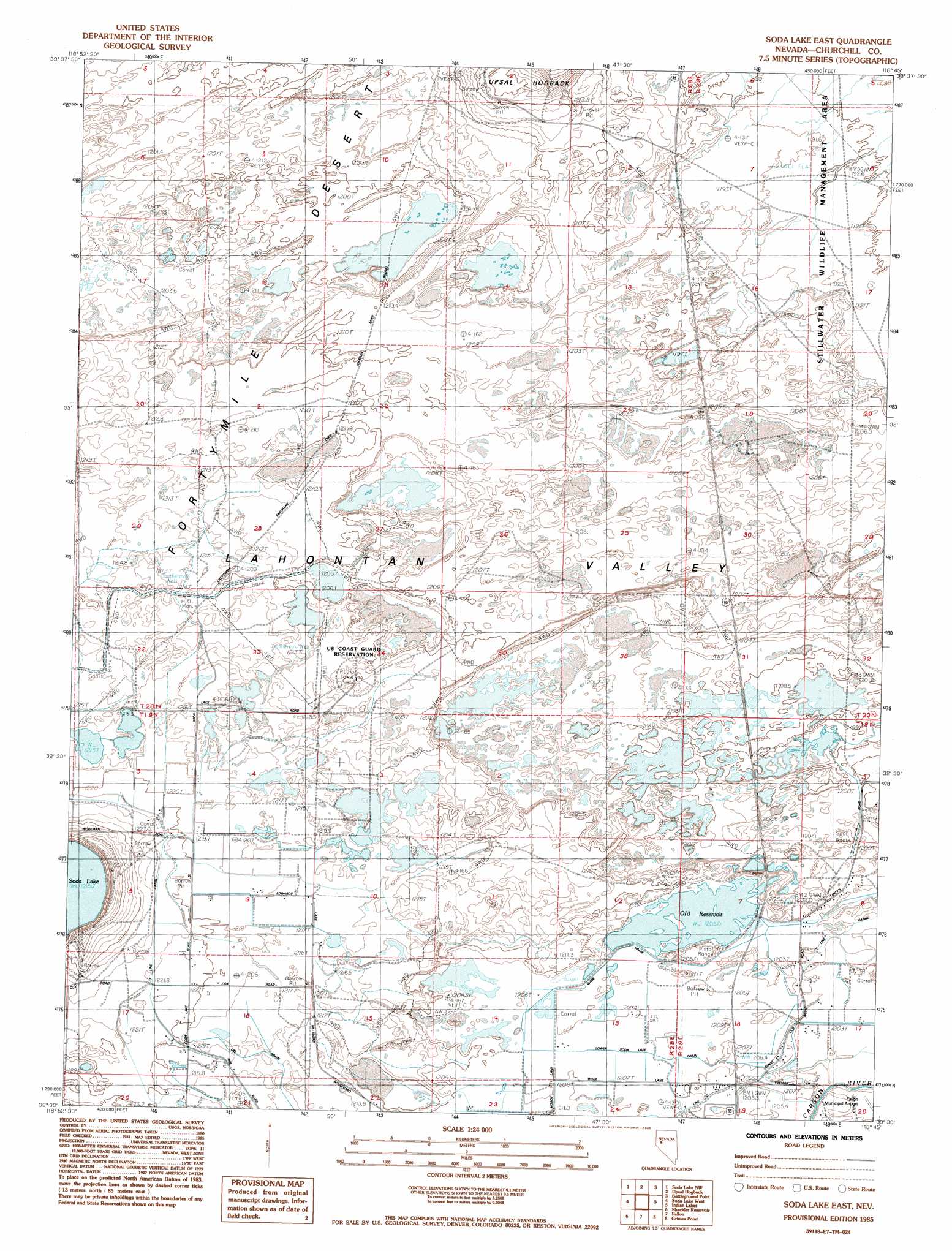
Soda Lake East Topo Map Nevada
To zoom in, hover over the map of Soda Lake East
USGS Topo Quad 39118e7 - 1:24,000 scale
| Topo Map Name: | Soda Lake East |
| USGS Topo Quad ID: | 39118e7 |
| Print Size: | ca. 21 1/4" wide x 27" high |
| Southeast Coordinates: | 39.5° N latitude / 118.75° W longitude |
| Map Center Coordinates: | 39.5625° N latitude / 118.8125° W longitude |
| U.S. State: | NV |
| Filename: | o39118e7.jpg |
| Download Map JPG Image: | Soda Lake East topo map 1:24,000 scale |
| Map Type: | Topographic |
| Topo Series: | 7.5´ |
| Map Scale: | 1:24,000 |
| Source of Map Images: | United States Geological Survey (USGS) |
| Alternate Map Versions: |
Soda Lake East NV 1985, updated 1985 Download PDF Buy paper map Soda Lake East NV 2011 Download PDF Buy paper map Soda Lake East NV 2014 Download PDF Buy paper map |
1:24,000 Topo Quads surrounding Soda Lake East
Hot Springs Flat |
Desert Peak |
Parran |
Carson Sink Sw |
Carson Sink Se |
Eagle Rock |
Soda Lake Nw |
Upsal Hogback |
Battleground Point |
Stillwater Ne |
Hazen |
Soda Lake West |
Soda Lake East |
Indian Lakes |
Stillwater |
Lahontan Dam |
Sheckler Reservoir |
Fallon |
Grimes Point |
Lahontan Mountains |
Hooten Well |
Salt Cave |
South Of Fallon |
Carson Lake |
Bunejug Mountains |
> Back to 39118e1 at 1:100,000 scale
> Back to 39118a1 at 1:250,000 scale
> Back to U.S. Topo Maps home
Soda Lake East topo map: Gazetteer
Soda Lake East: Canals
Erb Drain elevation 1203m 3946′Lower Soda Lake Drain elevation 1208m 3963′
Ponte Drain elevation 1205m 3953′
R Drain elevation 1217m 3992′
Soda Lake Drain elevation 1205m 3953′
T Line Canal elevation 1219m 3999′
UID Drain elevation 1216m 3989′
Wade Drain elevation 1206m 3956′
Soda Lake East: Reservoirs
Old Reservoir elevation 1207m 3959′Soda Lake East: Trails
Old California Trail elevation 1211m 3973′Soda Lake East digital topo map on disk
Buy this Soda Lake East topo map showing relief, roads, GPS coordinates and other geographical features, as a high-resolution digital map file on DVD: