Soda Lake West Topo Map Nevada
To zoom in, hover over the map of Soda Lake West
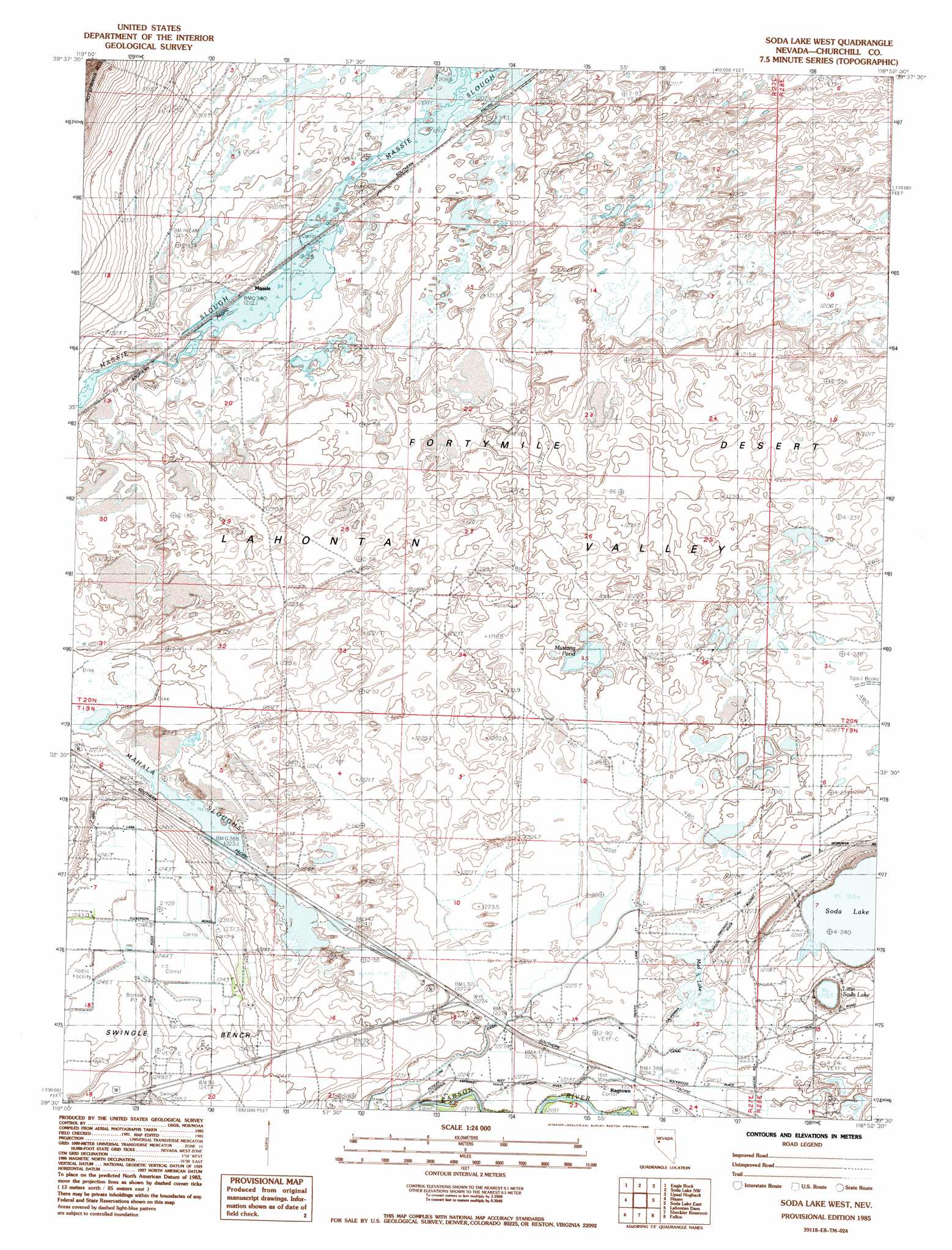
USGS Topo Quad 39118e8 - 1:24,000 scale
| Topo Map Name: | Soda Lake West |
| USGS Topo Quad ID: | 39118e8 |
| Print Size: | ca. 21 1/4" wide x 27" high |
| Southeast Coordinates: | 39.5° N latitude / 118.875° W longitude |
| Map Center Coordinates: | 39.5625° N latitude / 118.9375° W longitude |
| U.S. State: | NV |
| Filename: | o39118e8.jpg |
| Download Map JPG Image: | Soda Lake West topo map 1:24,000 scale |
| Map Type: | Topographic |
| Topo Series: | 7.5´ |
| Map Scale: | 1:24,000 |
| Source of Map Images: | United States Geological Survey (USGS) |
| Alternate Map Versions: |
Soda Lake West NV 1985, updated 1985 Download PDF Buy paper map Soda Lake West NV 2011 Download PDF Buy paper map Soda Lake West NV 2014 Download PDF Buy paper map |
1:24,000 Topo Quads surrounding Soda Lake West
Juniper Peak |
Hot Springs Flat |
Desert Peak |
Parran |
Carson Sink Sw |
Two Tips |
Eagle Rock |
Soda Lake Nw |
Upsal Hogback |
Battleground Point |
Fernley East |
Hazen |
Soda Lake West |
Soda Lake East |
Indian Lakes |
Silver Springs North |
Lahontan Dam |
Sheckler Reservoir |
Fallon |
Grimes Point |
Silver Springs South |
Hooten Well |
Salt Cave |
South Of Fallon |
Carson Lake |
> Back to 39118e1 at 1:100,000 scale
> Back to 39118a1 at 1:250,000 scale
> Back to U.S. Topo Maps home
Soda Lake West topo map: Gazetteer
Soda Lake West: Benches
Swingle Bench elevation 1246m 4087′Soda Lake West: Lakes
Little Soda Lake elevation 1216m 3989′Mud Lake elevation 1223m 4012′
Mustang Pond elevation 1221m 4005′
Soda Lake elevation 1216m 3989′
Soda Lake West: Populated Places
Leeteville (historical) elevation 1228m 4028′Massie elevation 1212m 3976′
Ragtown (historical) elevation 1223m 4012′
Soda Lake West: Post Offices
Leeteville Post Office (historical) elevation 1228m 4028′Ragtown Post Office elevation 1223m 4012′
Soda Lake West: Swamps
Mahala Sloughs elevation 1223m 4012′Massie Slough elevation 1208m 3963′
Soda Lake West digital topo map on disk
Buy this Soda Lake West topo map showing relief, roads, GPS coordinates and other geographical features, as a high-resolution digital map file on DVD: