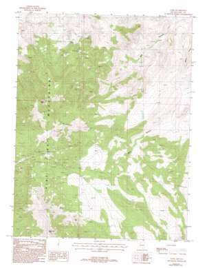
Como Topo Map Nevada
To zoom in, hover over the map of Como
USGS Topo Quad 39119b4 - 1:24,000 scale
| Topo Map Name: | Como |
| USGS Topo Quad ID: | 39119b4 |
| Print Size: | ca. 21 1/4" wide x 27" high |
| Southeast Coordinates: | 39.125° N latitude / 119.375° W longitude |
| Map Center Coordinates: | 39.1875° N latitude / 119.4375° W longitude |
| U.S. State: | NV |
| Filename: | o39119b4.jpg |
| Download Map JPG Image: | Como topo map 1:24,000 scale |
| Map Type: | Topographic |
| Topo Series: | 7.5´ |
| Map Scale: | 1:24,000 |
| Source of Map Images: | United States Geological Survey (USGS) |
| Alternate Map Versions: |
Como NV 1987, updated 1988 Download PDF Buy paper map Como NV 1987, updated 1993 Download PDF Buy paper map Como NV 2011 Download PDF Buy paper map Como NV 2014 Download PDF Buy paper map |
1:24,000 Topo Quads surrounding Como
> Back to 39119a1 at 1:100,000 scale
> Back to 39118a1 at 1:250,000 scale
> Back to U.S. Topo Maps home
Como topo map: Gazetteer
Como: Mines
Como Mines elevation 2172m 7125′Hercules Mine elevation 1873m 6145′
May Day Mine elevation 2186m 7171′
Mohawk Mine elevation 2094m 6870′
Pony Meadows Mine elevation 1972m 6469′
Stone Cabin Mine elevation 2015m 6610′
Whitman Coal Mines (historical) elevation 1596m 5236′
Como: Populated Places
Como elevation 2169m 7116′Palmyra (historical) elevation 2171m 7122′
Stone Cabin (historical) elevation 1934m 6345′
Como: Post Offices
Como Post Office elevation 2174m 7132′Palmyra Post Office (historical) elevation 2171m 7122′
Como: Springs
Barton Springs elevation 1804m 5918′Bull Spring elevation 1873m 6145′
Cottonwood Spring elevation 1706m 5597′
Hazlett Spring elevation 1595m 5232′
Rattlesnake Spring elevation 1534m 5032′
Stone Spring elevation 2221m 7286′
Whitman Spring elevation 2046m 6712′
Como: Summits
Lyon Peak elevation 2627m 8618′Rawe Peak elevation 2511m 8238′
Como: Tunnels
Boyle Tunnel elevation 2011m 6597′Como digital topo map on disk
Buy this Como topo map showing relief, roads, GPS coordinates and other geographical features, as a high-resolution digital map file on DVD:


